Mount Blanchard Topo Map Ohio
To zoom in, hover over the map of Mount Blanchard
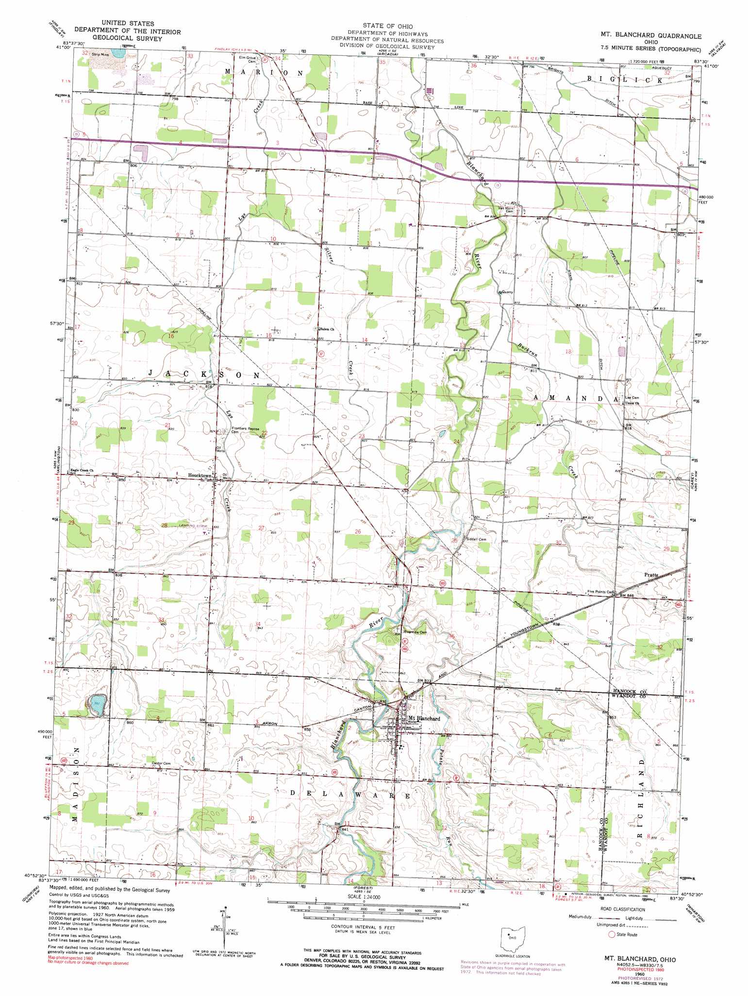
USGS Topo Quad 40083h5 - 1:24,000 scale
| Topo Map Name: | Mount Blanchard |
| USGS Topo Quad ID: | 40083h5 |
| Print Size: | ca. 21 1/4" wide x 27" high |
| Southeast Coordinates: | 40.875° N latitude / 83.5° W longitude |
| Map Center Coordinates: | 40.9375° N latitude / 83.5625° W longitude |
| U.S. State: | OH |
| Filename: | o40083h5.jpg |
| Download Map JPG Image: | Mount Blanchard topo map 1:24,000 scale |
| Map Type: | Topographic |
| Topo Series: | 7.5´ |
| Map Scale: | 1:24,000 |
| Source of Map Images: | United States Geological Survey (USGS) |
| Alternate Map Versions: |
Mt Blanchard OH 1960, updated 1962 Download PDF Buy paper map Mt Blanchard OH 1960, updated 1973 Download PDF Buy paper map Mt Blanchard OH 1960, updated 1990 Download PDF Buy paper map Mount Blanchard OH 2010 Download PDF Buy paper map Mount Blanchard OH 2013 Download PDF Buy paper map Mount Blanchard OH 2016 Download PDF Buy paper map |
1:24,000 Topo Quads surrounding Mount Blanchard
Hoytville |
North Baltimore |
Bloomdale |
Fostoria |
Bascom |
Mccomb |
Findlay |
Arcadia |
Alvada |
New Riegel |
Rawson |
Arlington |
Mount Blanchard |
Carey |
Mccutchenville |
Ada |
Dunkirk |
Forest |
Wharton |
Upper Sandusky |
Alger |
Foraker |
Kenton |
Marseilles |
Meeker |
> Back to 40083e1 at 1:100,000 scale
> Back to 40082a1 at 1:250,000 scale
> Back to U.S. Topo Maps home
Mount Blanchard topo map: Gazetteer
Mount Blanchard: Airports
Hagerty Airport elevation 245m 803′Lutz Airport elevation 246m 807′
Mount Blanchard: Canals
Brights Ditch elevation 241m 790′Stahl Ditch elevation 247m 810′
Mount Blanchard: Parks
Island Park elevation 253m 830′Mount Blanchard: Populated Places
Houcktown elevation 253m 830′Mount Blanchard elevation 258m 846′
Pratts elevation 259m 849′
Mount Blanchard: Post Offices
Houcktown Post Office (historical) elevation 253m 830′Mount Blanchard Post Office elevation 258m 846′
Mount Blanchard: Streams
Buckrun Creek elevation 244m 800′Potato Run elevation 250m 820′
Silver Creek elevation 243m 797′
Mount Blanchard digital topo map on disk
Buy this Mount Blanchard topo map showing relief, roads, GPS coordinates and other geographical features, as a high-resolution digital map file on DVD:
 map DVD")