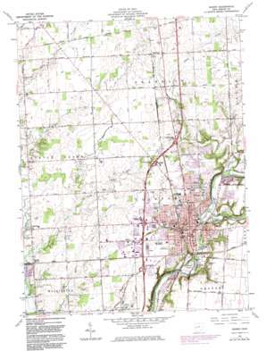
Sidney Topo Map Ohio
To zoom in, hover over the map of Sidney
USGS Topo Quad 40084c2 - 1:24,000 scale
| Topo Map Name: | Sidney |
| USGS Topo Quad ID: | 40084c2 |
| Print Size: | ca. 21 1/4" wide x 27" high |
| Southeast Coordinates: | 40.25° N latitude / 84.125° W longitude |
| Map Center Coordinates: | 40.3125° N latitude / 84.1875° W longitude |
| U.S. State: | OH |
| Filename: | o40084c2.jpg |
| Download Map JPG Image: | Sidney topo map 1:24,000 scale |
| Map Type: | Topographic |
| Topo Series: | 7.5´ |
| Map Scale: | 1:24,000 |
| Source of Map Images: | United States Geological Survey (USGS) |
| Alternate Map Versions: |
Sidney OH 1961, updated 1962 Download PDF Buy paper map Sidney OH 1961, updated 1973 Download PDF Buy paper map Sidney OH 1961, updated 1983 Download PDF Buy paper map Sidney OH 2010 Download PDF Buy paper map Sidney OH 2013 Download PDF Buy paper map Sidney OH 2016 Download PDF Buy paper map |
1:24,000 Topo Quads surrounding Sidney
> Back to 40084a1 at 1:100,000 scale
> Back to 40084a1 at 1:250,000 scale
> Back to U.S. Topo Maps home
Sidney topo map: Gazetteer
Sidney: Airports
ODOT Heliport elevation 314m 1030′Sidney: Canals
Ernst Ditch elevation 303m 994′Kiser Ditch elevation 302m 990′
Miami Erie Feeder Canal elevation 282m 925′
White Feather Ditch elevation 299m 980′
Sidney: Crossings
Interchange 90 elevation 315m 1033′Interchange 92 elevation 319m 1046′
Interchange 93 elevation 321m 1053′
Interchange 94 elevation 312m 1023′
Sidney: Lakes
Tawawa Lake elevation 292m 958′Sidney: Parks
Berger Park elevation 284m 931′Civic Park elevation 290m 951′
Custenborder Field elevation 286m 938′
Deam Park elevation 313m 1026′
Green Tree Park elevation 317m 1040′
Harmon Park elevation 301m 987′
Highland Park elevation 305m 1000′
Humphrey Park elevation 317m 1040′
Orbison Park elevation 317m 1040′
Peerless Park elevation 316m 1036′
Riverbend Park elevation 314m 1030′
Riverside Park elevation 284m 931′
Sherman Park elevation 314m 1030′
Sidney Courthouse Square Historic District elevation 289m 948′
Sidney Walnut Avenue Historic District elevation 306m 1003′
Stephen Brown Park elevation 289m 948′
Sidney: Populated Places
Buckeye Terrace elevation 317m 1040′Hardin elevation 295m 967′
Newbern elevation 288m 944′
Sidney elevation 290m 951′
Swanders elevation 307m 1007′
Sidney: Post Offices
Sidney Post Office elevation 291m 954′Sidney Post Office elevation 290m 951′
Swanders Post Office (historical) elevation 308m 1010′
Sidney: Streams
East Turtle Creek elevation 283m 928′Plum Creek elevation 286m 938′
Starrett Run elevation 292m 958′
Tilberry Run elevation 285m 935′
Wells Creek elevation 286m 938′
Sidney digital topo map on disk
Buy this Sidney topo map showing relief, roads, GPS coordinates and other geographical features, as a high-resolution digital map file on DVD:
Northern Illinois, Northern Indiana & Southwestern Michigan
Buy digital topo maps: Northern Illinois, Northern Indiana & Southwestern Michigan


