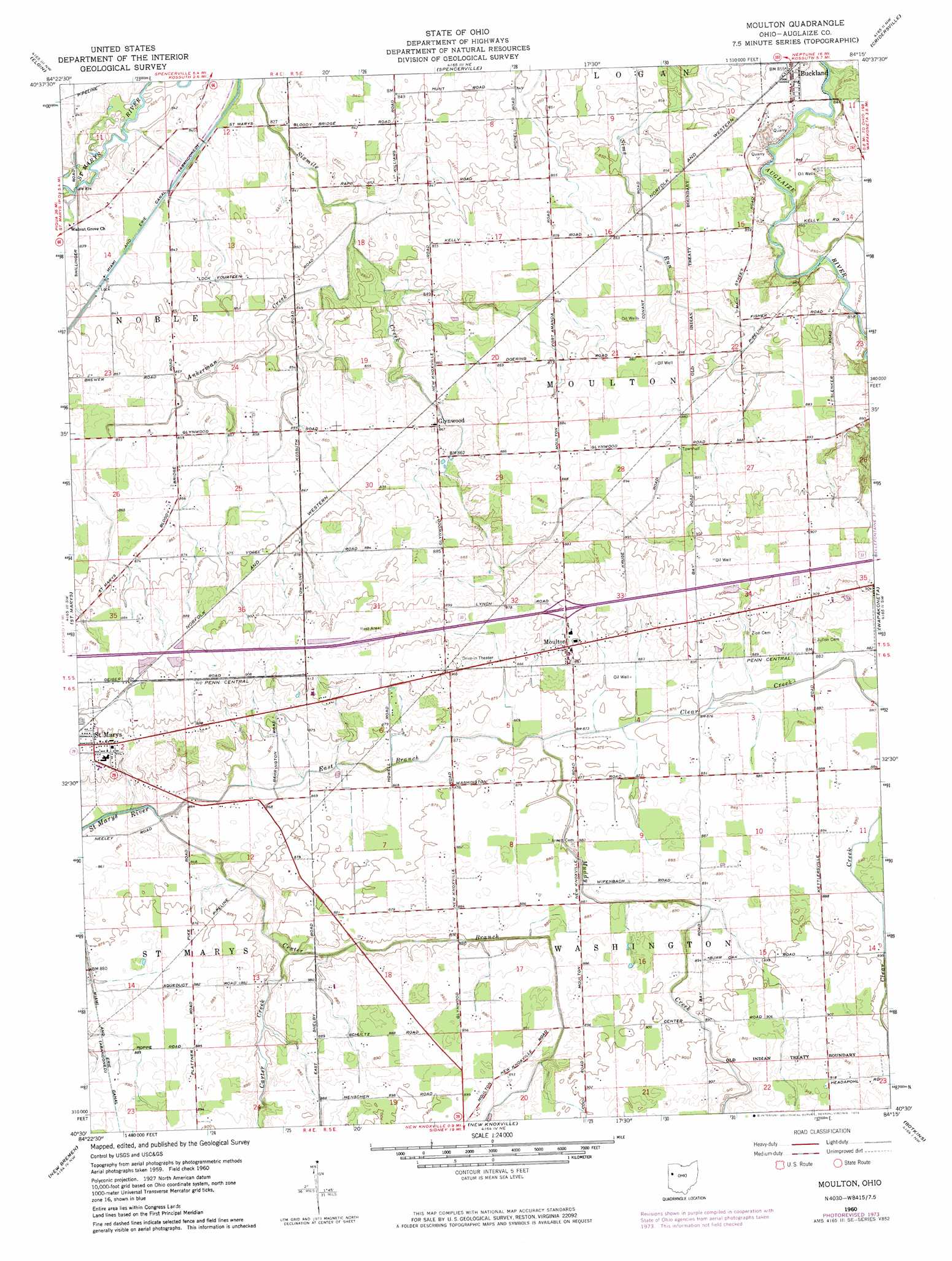
Moulton Topo Map Ohio
To zoom in, hover over the map of Moulton
USGS Topo Quad 40084e3 - 1:24,000 scale
| Topo Map Name: | Moulton |
| USGS Topo Quad ID: | 40084e3 |
| Print Size: | ca. 21 1/4" wide x 27" high |
| Southeast Coordinates: | 40.5° N latitude / 84.25° W longitude |
| Map Center Coordinates: | 40.5625° N latitude / 84.3125° W longitude |
| U.S. State: | OH |
| Filename: | o40084e3.jpg |
| Download Map JPG Image: | Moulton topo map 1:24,000 scale |
| Map Type: | Topographic |
| Topo Series: | 7.5´ |
| Map Scale: | 1:24,000 |
| Source of Map Images: | United States Geological Survey (USGS) |
| Alternate Map Versions: |
Moulton OH 1960, updated 1961 Download PDF Buy paper map Moulton OH 1960, updated 1965 Download PDF Buy paper map Moulton OH 1960, updated 1974 Download PDF Buy paper map Moulton OH 2010 Download PDF Buy paper map Moulton OH 2013 Download PDF Buy paper map Moulton OH 2016 Download PDF Buy paper map |
1:24,000 Topo Quads surrounding Moulton
Van Wert |
Middle Point |
Delphos |
Elida |
Cairo |
Mendon |
Elgin |
Spencerville |
Cridersville |
Lima |
Celina |
Saint Marys |
Moulton |
Wapakoneta |
Uniopolis |
Montezuma |
New Bremen |
New Knoxville |
Botkins |
Jackson Center |
North Star |
Osgood |
Fort Loramie |
Sidney |
Port Jefferson |
> Back to 40084e1 at 1:100,000 scale
> Back to 40084a1 at 1:250,000 scale
> Back to U.S. Topo Maps home
Moulton topo map: Gazetteer
Moulton: Airports
Sudman Field elevation 261m 856′Moulton: Dams
Lock Number 14 elevation 256m 839′Moulton: Populated Places
Bay (historical) elevation 272m 892′Buckland elevation 259m 849′
Glynwood elevation 260m 853′
Moulton elevation 274m 898′
Moulton: Post Offices
Buckland Post Office elevation 258m 846′Glynnwood Post Office (historical) elevation 260m 853′
Moulton Post Office (historical) elevation 274m 898′
Moulton: Streams
Ankerman Creek elevation 255m 836′Carter Creek elevation 262m 859′
Center Branch elevation 261m 856′
Clear Creek elevation 263m 862′
East Branch elevation 259m 849′
Muddy Creek elevation 263m 862′
Moulton digital topo map on disk
Buy this Moulton topo map showing relief, roads, GPS coordinates and other geographical features, as a high-resolution digital map file on DVD:
Northern Illinois, Northern Indiana & Southwestern Michigan
Buy digital topo maps: Northern Illinois, Northern Indiana & Southwestern Michigan