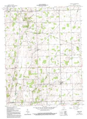
Carlos Topo Map Indiana
To zoom in, hover over the map of Carlos
USGS Topo Quad 40085a1 - 1:24,000 scale
| Topo Map Name: | Carlos |
| USGS Topo Quad ID: | 40085a1 |
| Print Size: | ca. 21 1/4" wide x 27" high |
| Southeast Coordinates: | 40° N latitude / 85° W longitude |
| Map Center Coordinates: | 40.0625° N latitude / 85.0625° W longitude |
| U.S. State: | IN |
| Filename: | o40085a1.jpg |
| Download Map JPG Image: | Carlos topo map 1:24,000 scale |
| Map Type: | Topographic |
| Topo Series: | 7.5´ |
| Map Scale: | 1:24,000 |
| Source of Map Images: | United States Geological Survey (USGS) |
| Alternate Map Versions: |
Carlos IN 1960, updated 1961 Download PDF Buy paper map Carlos IN 1960, updated 1984 Download PDF Buy paper map Carlos IN 1960, updated 1994 Download PDF Buy paper map Carlos IN 2010 Download PDF Buy paper map Carlos IN 2013 Download PDF Buy paper map Carlos IN 2016 Download PDF Buy paper map |
1:24,000 Topo Quads surrounding Carlos
> Back to 40085a1 at 1:100,000 scale
> Back to 40084a1 at 1:250,000 scale
> Back to U.S. Topo Maps home
Carlos topo map: Gazetteer
Carlos: Canals
Edwards Ditch elevation 358m 1174′Farquiner Ditch elevation 340m 1115′
Carlos: Populated Places
Buena Vista elevation 342m 1122′Carlos elevation 369m 1210′
Huntsville elevation 354m 1161′
Unionport elevation 331m 1085′
Carlos: Streams
Block Run elevation 336m 1102′Carlos Drain elevation 349m 1145′
Country Run elevation 353m 1158′
Deck Run elevation 339m 1112′
Gable Run elevation 335m 1099′
Huntsville Drain elevation 338m 1108′
Mortar Run elevation 329m 1079′
Rail Run elevation 323m 1059′
Roots Run elevation 333m 1092′
Villa Run elevation 355m 1164′
Carlos digital topo map on disk
Buy this Carlos topo map showing relief, roads, GPS coordinates and other geographical features, as a high-resolution digital map file on DVD:
Northern Illinois, Northern Indiana & Southwestern Michigan
Buy digital topo maps: Northern Illinois, Northern Indiana & Southwestern Michigan


