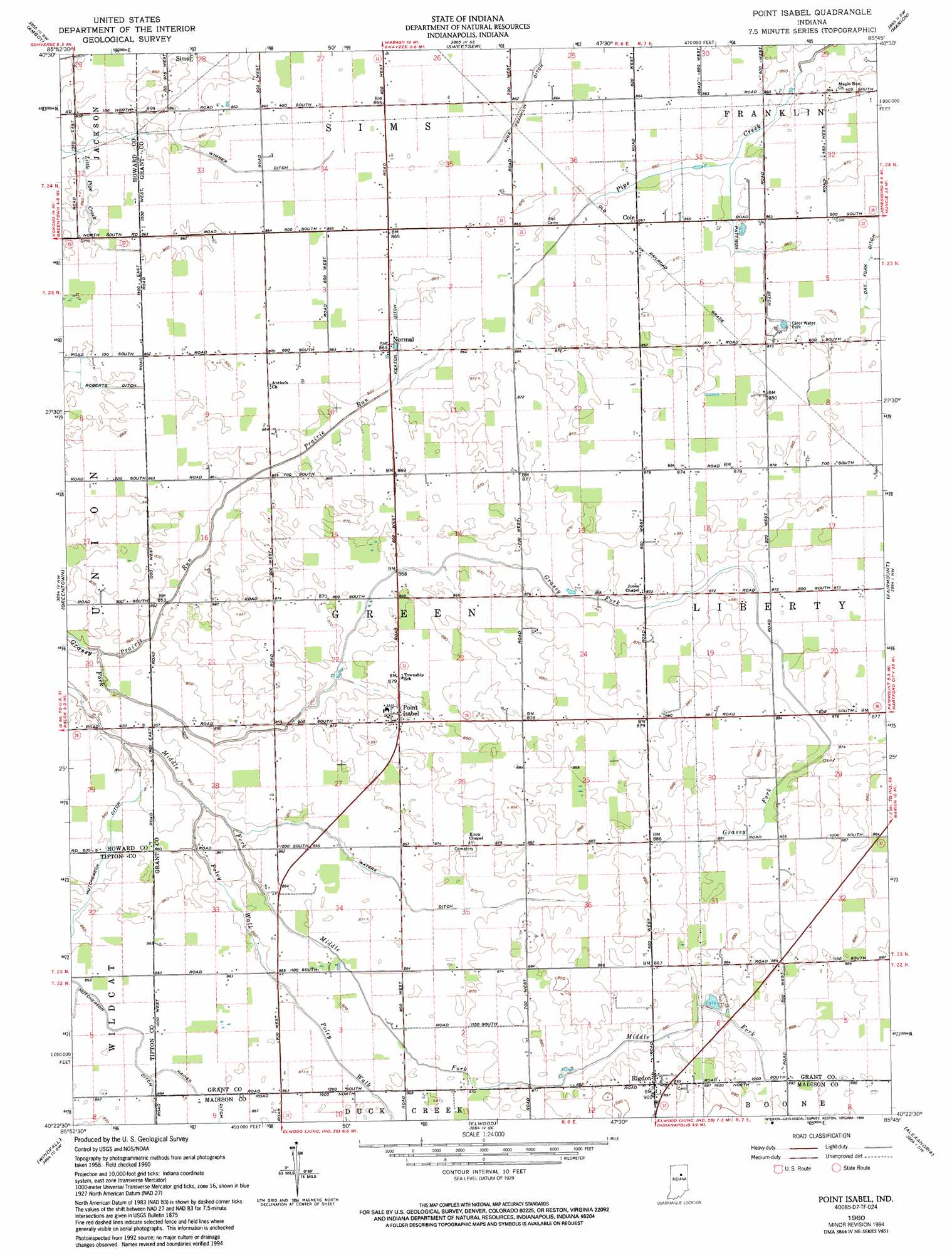
Point Isabel Topo Map Indiana
To zoom in, hover over the map of Point Isabel
USGS Topo Quad 40085d7 - 1:24,000 scale
| Topo Map Name: | Point Isabel |
| USGS Topo Quad ID: | 40085d7 |
| Print Size: | ca. 21 1/4" wide x 27" high |
| Southeast Coordinates: | 40.375° N latitude / 85.75° W longitude |
| Map Center Coordinates: | 40.4375° N latitude / 85.8125° W longitude |
| U.S. State: | IN |
| Filename: | o40085d7.jpg |
| Download Map JPG Image: | Point Isabel topo map 1:24,000 scale |
| Map Type: | Topographic |
| Topo Series: | 7.5´ |
| Map Scale: | 1:24,000 |
| Source of Map Images: | United States Geological Survey (USGS) |
| Alternate Map Versions: |
Point Isabel IN 1960, updated 1961 Download PDF Buy paper map Point Isabel IN 1960, updated 1973 Download PDF Buy paper map Point Isabel IN 1960, updated 1983 Download PDF Buy paper map Point Isabel IN 1960, updated 1994 Download PDF Buy paper map Point Isabel IN 2010 Download PDF Buy paper map Point Isabel IN 2013 Download PDF Buy paper map Point Isabel IN 2016 Download PDF Buy paper map |
1:24,000 Topo Quads surrounding Point Isabel
Bunker Hill |
Peoria |
Somerset |
La Fontaine |
Mount Etna |
Miami |
Amboy |
Sweetser |
Marion |
Van Buren |
Kokomo East |
Greentown |
Point Isabel |
Fairmount |
Gas City |
Tipton |
Windfall |
Elwood |
Alexandria |
Gaston |
Arcadia |
Omega |
Frankton |
Anderson North |
Gilman |
> Back to 40085a1 at 1:100,000 scale
> Back to 40084a1 at 1:250,000 scale
> Back to U.S. Topo Maps home
Point Isabel topo map: Gazetteer
Point Isabel: Airports
Dupouy Airport elevation 263m 862′Point Isabel: Canals
Hanes Ditch elevation 264m 866′Hutcherson Ditch elevation 262m 859′
Keaton Ditch elevation 263m 862′
Pattison Ditch elevation 261m 856′
Roberts Ditch elevation 263m 862′
Waters Ditch elevation 263m 862′
Wimmer Ditch elevation 264m 866′
Point Isabel: Parks
Clear Water Park elevation 264m 866′Point Isabel: Populated Places
Cole elevation 264m 866′Normal elevation 264m 866′
Point Isabel elevation 269m 882′
Rigdon elevation 273m 895′
Sims elevation 262m 859′
Point Isabel: Streams
Poley Walk elevation 260m 853′Prairie Run elevation 258m 846′
Point Isabel digital topo map on disk
Buy this Point Isabel topo map showing relief, roads, GPS coordinates and other geographical features, as a high-resolution digital map file on DVD:
Northern Illinois, Northern Indiana & Southwestern Michigan
Buy digital topo maps: Northern Illinois, Northern Indiana & Southwestern Michigan