Peoria Topo Map Indiana
To zoom in, hover over the map of Peoria
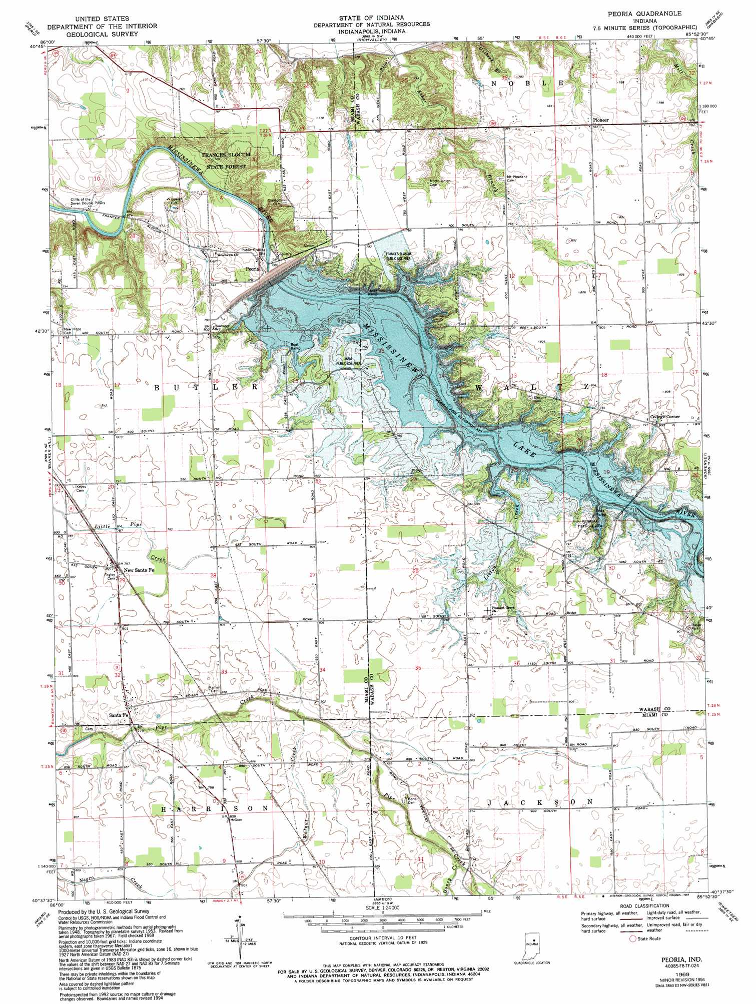
USGS Topo Quad 40085f8 - 1:24,000 scale
| Topo Map Name: | Peoria |
| USGS Topo Quad ID: | 40085f8 |
| Print Size: | ca. 21 1/4" wide x 27" high |
| Southeast Coordinates: | 40.625° N latitude / 85.875° W longitude |
| Map Center Coordinates: | 40.6875° N latitude / 85.9375° W longitude |
| U.S. State: | IN |
| Filename: | o40085f8.jpg |
| Download Map JPG Image: | Peoria topo map 1:24,000 scale |
| Map Type: | Topographic |
| Topo Series: | 7.5´ |
| Map Scale: | 1:24,000 |
| Source of Map Images: | United States Geological Survey (USGS) |
| Alternate Map Versions: |
Peoria IN 1953, updated 1955 Download PDF Buy paper map Peoria IN 1953, updated 1966 Download PDF Buy paper map Peoria IN 1969, updated 1971 Download PDF Buy paper map Peoria IN 1969, updated 1987 Download PDF Buy paper map Peoria IN 1969, updated 1994 Download PDF Buy paper map Peoria IN 2010 Download PDF Buy paper map Peoria IN 2013 Download PDF Buy paper map Peoria IN 2016 Download PDF Buy paper map |
1:24,000 Topo Quads surrounding Peoria
Macy |
Deedsville |
Roann |
North Manchester South |
Servia |
Twelve Mile |
Peru |
Richvalley |
Wabash |
Lagro |
Onward |
Bunker Hill |
Peoria |
Somerset |
La Fontaine |
Galveston |
Miami |
Amboy |
Sweetser |
Marion |
Kokomo West |
Kokomo East |
Greentown |
Point Isabel |
Fairmount |
> Back to 40085e1 at 1:100,000 scale
> Back to 40084a1 at 1:250,000 scale
> Back to U.S. Topo Maps home
Peoria topo map: Gazetteer
Peoria: Bridges
Red Bridge elevation 220m 721′Peoria: Cliffs
Cliffs of the Seven Double Pillars elevation 205m 672′Peoria: Dams
Johnson Heights Dam elevation 237m 777′Mississinewa Lake Dam elevation 221m 725′
Peoria: Forests
Frances Slocum State Forest elevation 214m 702′Peoria: Parks
Frances Slocum State Recreation Area elevation 226m 741′Miami State Recreation Area elevation 233m 764′
Red Bridge State Recreation Area elevation 220m 721′
Peoria: Populated Places
College Corner elevation 245m 803′New Santa Fe elevation 244m 800′
Peoria elevation 216m 708′
Pioneer elevation 239m 784′
Santa Fe elevation 240m 787′
Peoria: Reservoirs
Lake Niconzah elevation 237m 777′Mississinewa Lake elevation 224m 734′
Peoria: Streams
Honey Creek elevation 237m 777′Liston Creek elevation 226m 741′
Walnut Creek elevation 237m 777′
Peoria digital topo map on disk
Buy this Peoria topo map showing relief, roads, GPS coordinates and other geographical features, as a high-resolution digital map file on DVD:
Northern Illinois, Northern Indiana & Southwestern Michigan
Buy digital topo maps: Northern Illinois, Northern Indiana & Southwestern Michigan