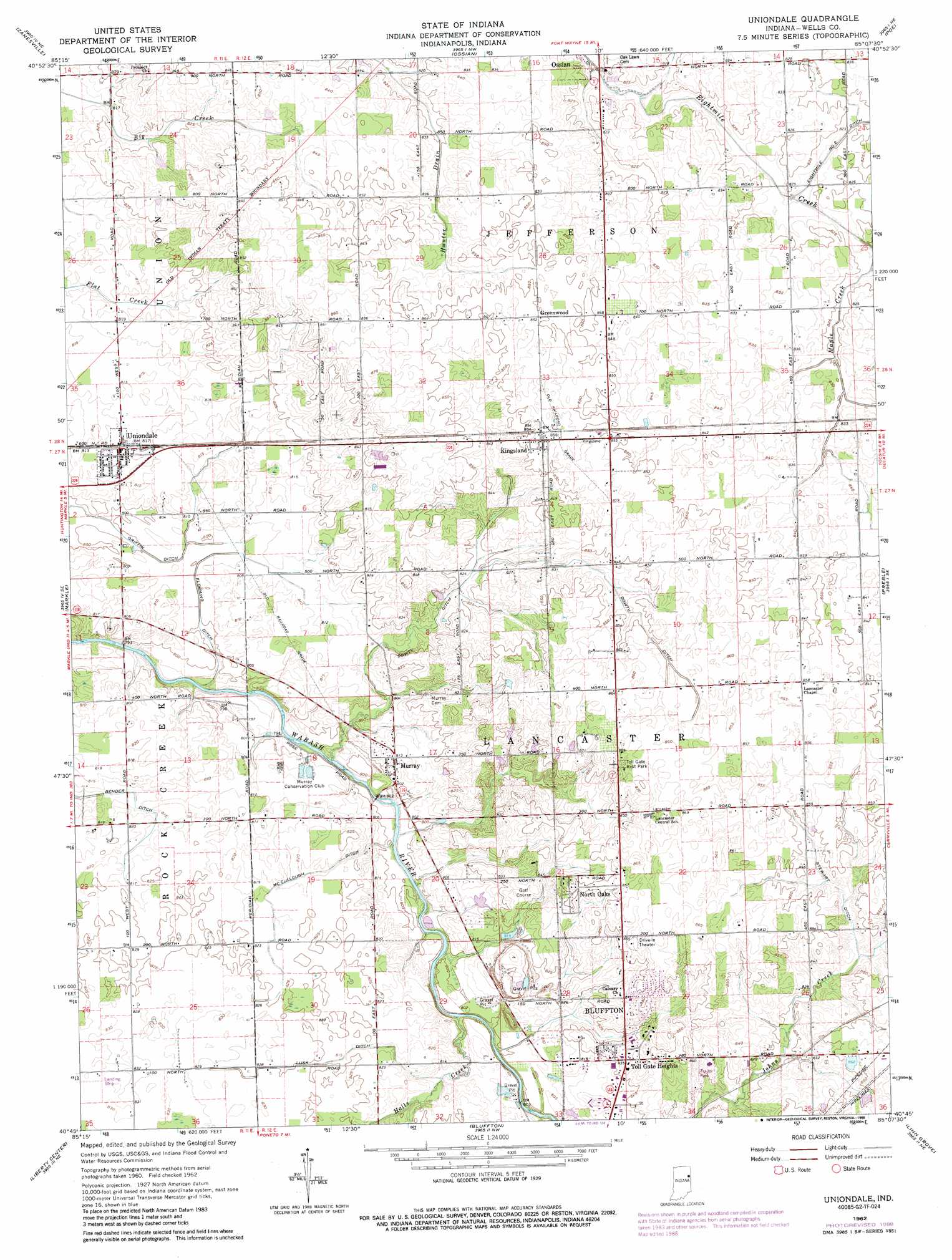
Uniondale Topo Map Indiana
To zoom in, hover over the map of Uniondale
USGS Topo Quad 40085g2 - 1:24,000 scale
| Topo Map Name: | Uniondale |
| USGS Topo Quad ID: | 40085g2 |
| Print Size: | ca. 21 1/4" wide x 27" high |
| Southeast Coordinates: | 40.75° N latitude / 85.125° W longitude |
| Map Center Coordinates: | 40.8125° N latitude / 85.1875° W longitude |
| U.S. State: | IN |
| Filename: | o40085g2.jpg |
| Download Map JPG Image: | Uniondale topo map 1:24,000 scale |
| Map Type: | Topographic |
| Topo Series: | 7.5´ |
| Map Scale: | 1:24,000 |
| Source of Map Images: | United States Geological Survey (USGS) |
| Alternate Map Versions: |
Uniondale IN 1962, updated 1963 Download PDF Buy paper map Uniondale IN 1962, updated 1988 Download PDF Buy paper map Uniondale IN 2010 Download PDF Buy paper map Uniondale IN 2013 Download PDF Buy paper map Uniondale IN 2016 Download PDF Buy paper map |
1:24,000 Topo Quads surrounding Uniondale
Laud |
Arcola |
Fort Wayne West |
Fort Wayne East |
Maples |
Huntington |
Zanesville |
Ossian |
Poe |
Hoagland |
Majenica |
Markle |
Uniondale |
Preble |
Decatur |
Warren |
Liberty Center |
Bluffton |
Linn Grove |
Berne |
Roll |
Montpelier |
Petroleum |
Domestic |
Geneva |
> Back to 40085e1 at 1:100,000 scale
> Back to 40084a1 at 1:250,000 scale
> Back to U.S. Topo Maps home
Uniondale topo map: Gazetteer
Uniondale: Canals
Bender Ditch elevation 244m 800′Dowty Ditch elevation 247m 810′
Flemming Ditch elevation 244m 800′
Lusk Ditch elevation 250m 820′
McCullough Ditch elevation 248m 813′
Stewart Ditch elevation 254m 833′
Uniondale: Parks
Toll Gate Rest Park elevation 263m 862′Uniondale: Populated Places
Greenwood elevation 259m 849′Kingsland elevation 261m 856′
Murray elevation 246m 807′
North Oaks elevation 259m 849′
Toll Gate Heights elevation 255m 836′
Uniondale elevation 248m 813′
Uniondale: Streams
Halls Creek elevation 239m 784′Johns Creek elevation 250m 820′
Uniondale digital topo map on disk
Buy this Uniondale topo map showing relief, roads, GPS coordinates and other geographical features, as a high-resolution digital map file on DVD:
Northern Illinois, Northern Indiana & Southwestern Michigan
Buy digital topo maps: Northern Illinois, Northern Indiana & Southwestern Michigan