Shannondale Topo Map Indiana
To zoom in, hover over the map of Shannondale
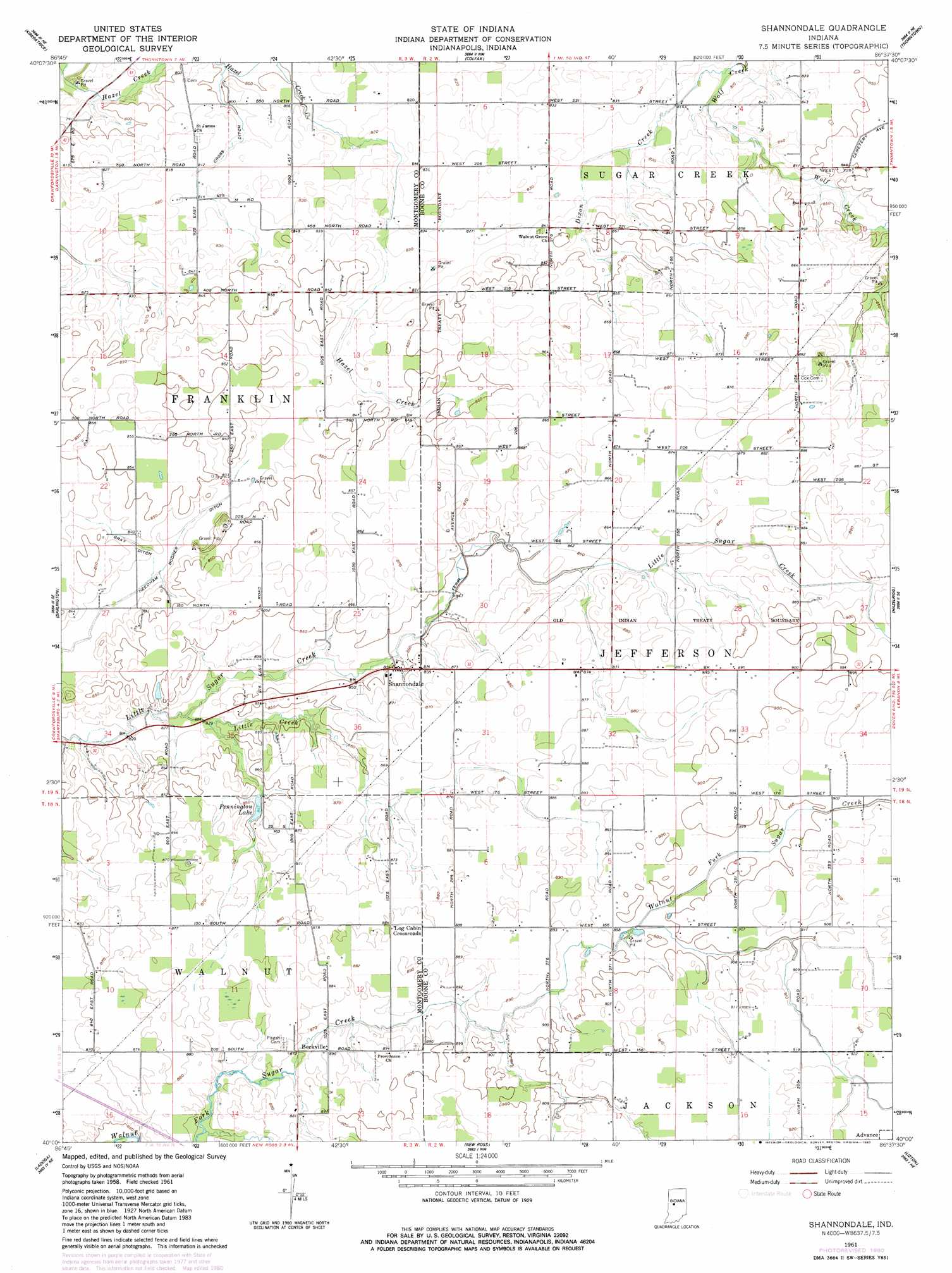
USGS Topo Quad 40086a6 - 1:24,000 scale
| Topo Map Name: | Shannondale |
| USGS Topo Quad ID: | 40086a6 |
| Print Size: | ca. 21 1/4" wide x 27" high |
| Southeast Coordinates: | 40° N latitude / 86.625° W longitude |
| Map Center Coordinates: | 40.0625° N latitude / 86.6875° W longitude |
| U.S. State: | IN |
| Filename: | o40086a6.jpg |
| Download Map JPG Image: | Shannondale topo map 1:24,000 scale |
| Map Type: | Topographic |
| Topo Series: | 7.5´ |
| Map Scale: | 1:24,000 |
| Source of Map Images: | United States Geological Survey (USGS) |
| Alternate Map Versions: |
Shannondale IN 1961, updated 1963 Download PDF Buy paper map Shannondale IN 1961, updated 1980 Download PDF Buy paper map Shannondale IN 2010 Download PDF Buy paper map Shannondale IN 2013 Download PDF Buy paper map Shannondale IN 2016 Download PDF Buy paper map |
1:24,000 Topo Quads surrounding Shannondale
Romney |
Stockwell |
Mulberry |
Frankfort |
Michigantown |
Linden |
Kirkpatrick |
Colfax |
Thorntown |
Mechanicsburg |
Crawfordsville |
Darlington |
Shannondale |
Hazelrigg |
Lebanon |
New Market |
Ladoga |
New Ross |
Lizton |
Fayette |
Russellville |
Roachdale |
North Salem |
Danville |
Brownsburg |
> Back to 40086a1 at 1:100,000 scale
> Back to 40086a1 at 1:250,000 scale
> Back to U.S. Topo Maps home
Shannondale topo map: Gazetteer
Shannondale: Canals
Cross Ditch elevation 248m 813′Gray Ditch elevation 253m 830′
Needham Booher Ditch elevation 251m 823′
Shannondale: Populated Places
Beckville elevation 271m 889′Log Cabin Crossroads elevation 269m 882′
Shannondale elevation 262m 859′
Shannondale: Reservoirs
Pennington Lake elevation 258m 846′Shannondale: Streams
Dixon Creek elevation 246m 807′Little Creek elevation 250m 820′
Shannondale digital topo map on disk
Buy this Shannondale topo map showing relief, roads, GPS coordinates and other geographical features, as a high-resolution digital map file on DVD:
Northern Illinois, Northern Indiana & Southwestern Michigan
Buy digital topo maps: Northern Illinois, Northern Indiana & Southwestern Michigan