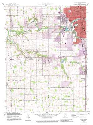
Kokomo West Topo Map Indiana
To zoom in, hover over the map of Kokomo West
USGS Topo Quad 40086d2 - 1:24,000 scale
| Topo Map Name: | Kokomo West |
| USGS Topo Quad ID: | 40086d2 |
| Print Size: | ca. 21 1/4" wide x 27" high |
| Southeast Coordinates: | 40.375° N latitude / 86.125° W longitude |
| Map Center Coordinates: | 40.4375° N latitude / 86.1875° W longitude |
| U.S. State: | IN |
| Filename: | o40086d2.jpg |
| Download Map JPG Image: | Kokomo West topo map 1:24,000 scale |
| Map Type: | Topographic |
| Topo Series: | 7.5´ |
| Map Scale: | 1:24,000 |
| Source of Map Images: | United States Geological Survey (USGS) |
| Alternate Map Versions: |
Kokomo West IN 1960, updated 1961 Download PDF Buy paper map Kokomo West IN 1960, updated 1976 Download PDF Buy paper map Kokomo West IN 1960, updated 1981 Download PDF Buy paper map Kokomo West IN 1992, updated 1995 Download PDF Buy paper map Kokomo West IN 2010 Download PDF Buy paper map Kokomo West IN 2013 Download PDF Buy paper map Kokomo West IN 2016 Download PDF Buy paper map |
1:24,000 Topo Quads surrounding Kokomo West
> Back to 40086a1 at 1:100,000 scale
> Back to 40086a1 at 1:250,000 scale
> Back to U.S. Topo Maps home
Kokomo West topo map: Gazetteer
Kokomo West: Airports
Glenndale Airport elevation 256m 839′Ruzicka Airport elevation 254m 833′
Kokomo West: Canals
Butler Ditch elevation 254m 833′Edwards Ditch elevation 242m 793′
Hallihan Ditch elevation 244m 800′
Kelly West Ditch elevation 270m 885′
Reed Ditch elevation 256m 839′
William Vogus Ditch elevation 255m 836′
Kokomo West: Parks
Foster Park elevation 241m 790′Highland Park elevation 242m 793′
Kokomo West: Populated Places
Alto elevation 256m 839′Indian Heights elevation 262m 859′
Kokomo elevation 247m 810′
Shambaugh Siding elevation 247m 810′
West Middleton elevation 253m 830′
Kokomo West: Streams
Claw Creek elevation 243m 797′East Fork Little Wildcat Creek elevation 248m 813′
Kitty Run elevation 236m 774′
Kokomo Creek elevation 239m 784′
Little Wildcat Creek elevation 226m 741′
Lynn Run elevation 242m 793′
Ruzicka Drain elevation 245m 803′
Shambaugh Run elevation 241m 790′
Spring Run elevation 229m 751′
Villa Run elevation 231m 757′
West Fork Little Wildcat Creek elevation 248m 813′
Kokomo West digital topo map on disk
Buy this Kokomo West topo map showing relief, roads, GPS coordinates and other geographical features, as a high-resolution digital map file on DVD:
Northern Illinois, Northern Indiana & Southwestern Michigan
Buy digital topo maps: Northern Illinois, Northern Indiana & Southwestern Michigan


