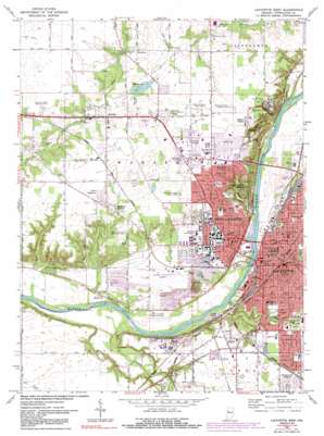
Lafayette West Topo Map Indiana
To zoom in, hover over the map of Lafayette West
USGS Topo Quad 40086d8 - 1:24,000 scale
| Topo Map Name: | Lafayette West |
| USGS Topo Quad ID: | 40086d8 |
| Print Size: | ca. 21 1/4" wide x 27" high |
| Southeast Coordinates: | 40.375° N latitude / 86.875° W longitude |
| Map Center Coordinates: | 40.4375° N latitude / 86.9375° W longitude |
| U.S. State: | IN |
| Filename: | o40086d8.jpg |
| Download Map JPG Image: | Lafayette West topo map 1:24,000 scale |
| Map Type: | Topographic |
| Topo Series: | 7.5´ |
| Map Scale: | 1:24,000 |
| Source of Map Images: | United States Geological Survey (USGS) |
| Alternate Map Versions: |
Lafayette IN 1942 Download PDF Buy paper map Lafayette IN 1950, updated 1952 Download PDF Buy paper map Lafayette West IN 1961, updated 1964 Download PDF Buy paper map Lafayette West IN 1961, updated 1972 Download PDF Buy paper map Lafayette West IN 1961, updated 1981 Download PDF Buy paper map Lafayette West IN 1961, updated 1987 Download PDF Buy paper map Lafayette West IN 1961, updated 1991 Download PDF Buy paper map Lafayette West IN 1961, updated 1991 Download PDF Buy paper map Lafayette West IN 1998, updated 2001 Download PDF Buy paper map Lafayette West IN 2010 Download PDF Buy paper map Lafayette West IN 2013 Download PDF Buy paper map Lafayette West IN 2016 Download PDF Buy paper map |
1:24,000 Topo Quads surrounding Lafayette West
> Back to 40086a1 at 1:100,000 scale
> Back to 40086a1 at 1:250,000 scale
> Back to U.S. Topo Maps home
Lafayette West topo map: Gazetteer
Lafayette West: Airports
Oahnke Airport elevation 204m 669′Perdue University Airport elevation 182m 597′
Rush Airport elevation 207m 679′
Lafayette West: Canals
Cole Ditch elevation 200m 656′McClure Ditch elevation 200m 656′
Lafayette West: Lakes
Hadley Lake elevation 198m 649′Lafayette West: Parks
Ross-Ade Stadium elevation 195m 639′Lafayette West: Populated Places
Bar-Barry Heights elevation 218m 715′Crumb Corner elevation 220m 721′
Elston elevation 193m 633′
Green Meadows elevation 216m 708′
Happy Hollow Heights elevation 214m 702′
Indian Village elevation 212m 695′
Klondike elevation 201m 659′
Lafayette elevation 214m 702′
McQuinn Estates elevation 200m 656′
Norma Jean Addition elevation 198m 649′
Ravinamy elevation 214m 702′
Summit elevation 186m 610′
Wabash Shores elevation 220m 721′
West Lafayette elevation 186m 610′
Lafayette West: Streams
Jordan Creek elevation 156m 511′Wea Creek elevation 156m 511′
Lafayette West: Valleys
Cedar Hollow elevation 161m 528′Happy Hollow elevation 161m 528′
Lafayette West digital topo map on disk
Buy this Lafayette West topo map showing relief, roads, GPS coordinates and other geographical features, as a high-resolution digital map file on DVD:
Northern Illinois, Northern Indiana & Southwestern Michigan
Buy digital topo maps: Northern Illinois, Northern Indiana & Southwestern Michigan


