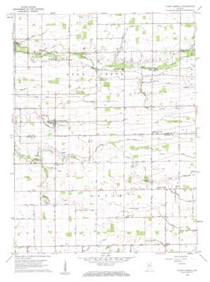
Young America Topo Map Indiana
To zoom in, hover over the map of Young America
USGS Topo Quad 40086e3 - 1:24,000 scale
| Topo Map Name: | Young America |
| USGS Topo Quad ID: | 40086e3 |
| Print Size: | ca. 21 1/4" wide x 27" high |
| Southeast Coordinates: | 40.5° N latitude / 86.25° W longitude |
| Map Center Coordinates: | 40.5625° N latitude / 86.3125° W longitude |
| U.S. State: | IN |
| Filename: | o40086e3.jpg |
| Download Map JPG Image: | Young America topo map 1:24,000 scale |
| Map Type: | Topographic |
| Topo Series: | 7.5´ |
| Map Scale: | 1:24,000 |
| Source of Map Images: | United States Geological Survey (USGS) |
| Alternate Map Versions: |
Young America IN 1959, updated 1961 Download PDF Buy paper map Young America IN 1959, updated 1961 Download PDF Buy paper map Young America IN 2010 Download PDF Buy paper map Young America IN 2013 Download PDF Buy paper map Young America IN 2016 Download PDF Buy paper map |
1:24,000 Topo Quads surrounding Young America
> Back to 40086e1 at 1:100,000 scale
> Back to 40086a1 at 1:250,000 scale
> Back to U.S. Topo Maps home
Young America topo map: Gazetteer
Young America: Airports
Galveston Airport elevation 240m 787′Young America: Canals
Brown Ditch elevation 219m 718′De Haven Ditch elevation 232m 761′
Geetings Ditch elevation 231m 757′
Gillam Ditch elevation 237m 777′
Harness Ditch elevation 229m 751′
Hartman Ditch elevation 243m 797′
Henry Gilbert Ditch elevation 241m 790′
Hyman Ditch elevation 220m 721′
Mathias Young Ditch elevation 241m 790′
McDowell Ditch elevation 239m 784′
Moore Ditch elevation 241m 790′
Munson Ditch elevation 232m 761′
Peter Ditch elevation 232m 761′
Shankland Ditch elevation 222m 728′
Turley Ditch elevation 241m 790′
Young America: Populated Places
Judson elevation 247m 810′Kappa Corner elevation 245m 803′
Poplar Grove elevation 237m 777′
Young America elevation 234m 767′
Young America digital topo map on disk
Buy this Young America topo map showing relief, roads, GPS coordinates and other geographical features, as a high-resolution digital map file on DVD:
Northern Illinois, Northern Indiana & Southwestern Michigan
Buy digital topo maps: Northern Illinois, Northern Indiana & Southwestern Michigan


