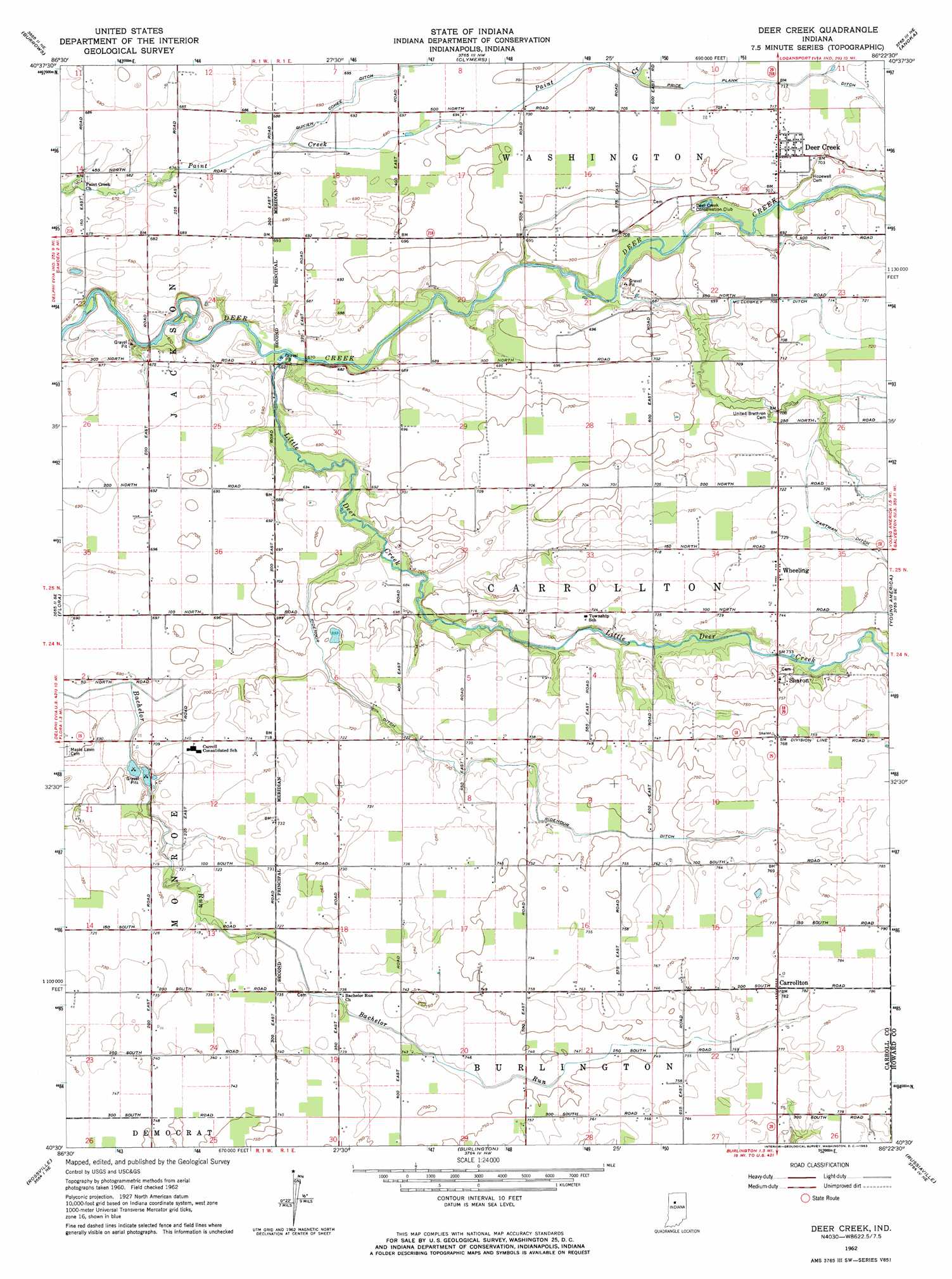
Deer Creek Topo Map Indiana
To zoom in, hover over the map of Deer Creek
USGS Topo Quad 40086e4 - 1:24,000 scale
| Topo Map Name: | Deer Creek |
| USGS Topo Quad ID: | 40086e4 |
| Print Size: | ca. 21 1/4" wide x 27" high |
| Southeast Coordinates: | 40.5° N latitude / 86.375° W longitude |
| Map Center Coordinates: | 40.5625° N latitude / 86.4375° W longitude |
| U.S. State: | IN |
| Filename: | o40086e4.jpg |
| Download Map JPG Image: | Deer Creek topo map 1:24,000 scale |
| Map Type: | Topographic |
| Topo Series: | 7.5´ |
| Map Scale: | 1:24,000 |
| Source of Map Images: | United States Geological Survey (USGS) |
| Alternate Map Versions: |
Deer Creek IN 1962, updated 1963 Download PDF Buy paper map Deer Creek IN 2010 Download PDF Buy paper map Deer Creek IN 2013 Download PDF Buy paper map Deer Creek IN 2016 Download PDF Buy paper map |
1:24,000 Topo Quads surrounding Deer Creek
Idaville |
Burnettsville |
Lucerne |
Logansport |
Twelve Mile |
Yeoman |
Burrows |
Clymers |
Anoka |
Onward |
Delphi |
Flora |
Deer Creek |
Young America |
Galveston |
Pyrmont |
Rossville |
Burlington |
Russiaville |
Kokomo West |
Mulberry |
Frankfort |
Michigantown |
Hillisburg |
Kempton |
> Back to 40086e1 at 1:100,000 scale
> Back to 40086a1 at 1:250,000 scale
> Back to U.S. Topo Maps home
Deer Creek topo map: Gazetteer
Deer Creek: Canals
McCloskey Ditch elevation 218m 715′Ridenour Ditch elevation 222m 728′
Zartman Ditch elevation 222m 728′
Deer Creek: Populated Places
Carrollton elevation 238m 780′Deer Creek elevation 217m 711′
Sharon elevation 232m 761′
Wheeling elevation 226m 741′
Deer Creek: Streams
Little Deer Creek elevation 199m 652′Price Plank Ditch elevation 214m 702′
Deer Creek digital topo map on disk
Buy this Deer Creek topo map showing relief, roads, GPS coordinates and other geographical features, as a high-resolution digital map file on DVD:
Northern Illinois, Northern Indiana & Southwestern Michigan
Buy digital topo maps: Northern Illinois, Northern Indiana & Southwestern Michigan