Brookston Nw Topo Map Indiana
To zoom in, hover over the map of Brookston Nw
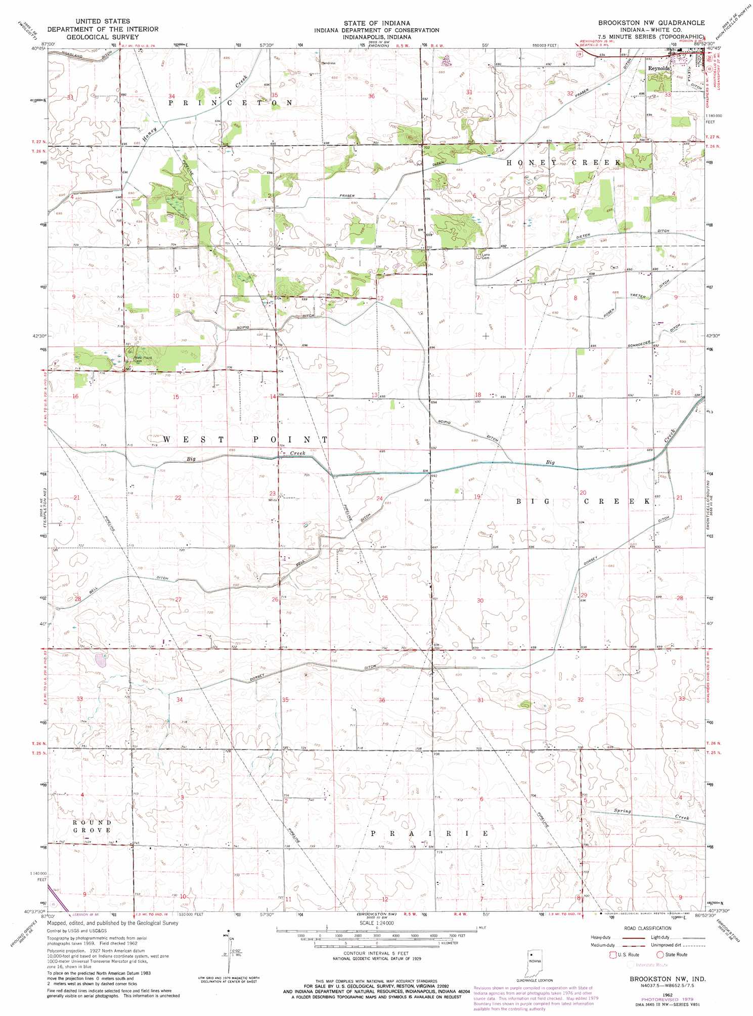
USGS Topo Quad 40086f8 - 1:24,000 scale
| Topo Map Name: | Brookston Nw |
| USGS Topo Quad ID: | 40086f8 |
| Print Size: | ca. 21 1/4" wide x 27" high |
| Southeast Coordinates: | 40.625° N latitude / 86.875° W longitude |
| Map Center Coordinates: | 40.6875° N latitude / 86.9375° W longitude |
| U.S. State: | IN |
| Filename: | o40086f8.jpg |
| Download Map JPG Image: | Brookston Nw topo map 1:24,000 scale |
| Map Type: | Topographic |
| Topo Series: | 7.5´ |
| Map Scale: | 1:24,000 |
| Source of Map Images: | United States Geological Survey (USGS) |
| Alternate Map Versions: |
Brookston NW IN 1962, updated 1963 Download PDF Buy paper map Brookston NW IN 1962, updated 1964 Download PDF Buy paper map Brookston NW IN 1962, updated 1980 Download PDF Buy paper map Brookston NW IN 2010 Download PDF Buy paper map Brookston NW IN 2013 Download PDF Buy paper map Brookston NW IN 2016 Download PDF Buy paper map |
1:24,000 Topo Quads surrounding Brookston Nw
Rensselaer |
Mccoysburg |
Francesville |
Monon Ne |
Buffalo |
Remington |
Wolcott |
Monon |
Monticello North |
Idaville |
Mount Gilboa |
Templeton Ne |
Brookston Nw |
Monticello South |
Yeoman |
Templeton |
Round Grove |
Brookston Sw |
Brookston |
Delphi |
Chatterton |
Otterbein |
Lafayette West |
Lafayette East |
Pyrmont |
> Back to 40086e1 at 1:100,000 scale
> Back to 40086a1 at 1:250,000 scale
> Back to U.S. Topo Maps home
Brookston Nw topo map: Gazetteer
Brookston Nw: Canals
Bell Ditch elevation 215m 705′Dieter Ditch elevation 212m 695′
Dorsey Ditch elevation 213m 698′
Fraser Ditch elevation 210m 688′
Rosen Treter Ditch elevation 210m 688′
Schroeder Ditch elevation 210m 688′
Scipio Ditch elevation 211m 692′
Brookston Nw digital topo map on disk
Buy this Brookston Nw topo map showing relief, roads, GPS coordinates and other geographical features, as a high-resolution digital map file on DVD:
Northern Illinois, Northern Indiana & Southwestern Michigan
Buy digital topo maps: Northern Illinois, Northern Indiana & Southwestern Michigan