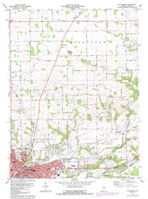
Logansport Topo Map Indiana
To zoom in, hover over the map of Logansport
USGS Topo Quad 40086g3 - 1:24,000 scale
| Topo Map Name: | Logansport |
| USGS Topo Quad ID: | 40086g3 |
| Print Size: | ca. 21 1/4" wide x 27" high |
| Southeast Coordinates: | 40.75° N latitude / 86.25° W longitude |
| Map Center Coordinates: | 40.8125° N latitude / 86.3125° W longitude |
| U.S. State: | IN |
| Filename: | o40086g3.jpg |
| Download Map JPG Image: | Logansport topo map 1:24,000 scale |
| Map Type: | Topographic |
| Topo Series: | 7.5´ |
| Map Scale: | 1:24,000 |
| Source of Map Images: | United States Geological Survey (USGS) |
| Alternate Map Versions: |
Logansport IN 1955, updated 1957 Download PDF Buy paper map Logansport IN 1972, updated 1974 Download PDF Buy paper map Logansport IN 1972, updated 1987 Download PDF Buy paper map Logansport IN 2010 Download PDF Buy paper map Logansport IN 2013 Download PDF Buy paper map Logansport IN 2016 Download PDF Buy paper map |
1:24,000 Topo Quads surrounding Logansport
> Back to 40086e1 at 1:100,000 scale
> Back to 40086a1 at 1:250,000 scale
> Back to U.S. Topo Maps home
Logansport topo map: Gazetteer
Logansport: Airports
Williamson Airport elevation 239m 784′Logansport: Bridges
Broad Ripple Bridge elevation 189m 620′Cass Station Bridge elevation 184m 603′
Logansport: Canals
Forgey Ditch elevation 204m 669′Gardner Powell Ditch elevation 233m 764′
Gault Ditch elevation 236m 774′
Howard Ditch elevation 202m 662′
Ream Ditch elevation 233m 764′
Shackelford Ditch elevation 197m 646′
Logansport: Dams
Lake Perry Dam elevation 189m 620′Logansport: Islands
Rock Island elevation 191m 626′Logansport: Parks
Riverside Park elevation 184m 603′Spencer Park elevation 193m 633′
Tower Park elevation 201m 659′
Logansport: Populated Places
Adamsboro elevation 197m 646′Danes elevation 194m 636′
Leases Corner elevation 244m 800′
Logansport elevation 195m 639′
Metea elevation 239m 784′
Miami Bend elevation 185m 606′
Mount Pleasant elevation 238m 780′
Old Adamsboro elevation 198m 649′
Verona elevation 228m 748′
Logansport: Post Offices
Metea Post Office elevation 238m 780′Logansport: Reservoirs
Lake Perry elevation 189m 620′Logansport: Streams
Eel River elevation 176m 577′Spring Creek elevation 191m 626′
Tick Creek elevation 186m 610′
Logansport digital topo map on disk
Buy this Logansport topo map showing relief, roads, GPS coordinates and other geographical features, as a high-resolution digital map file on DVD:
Northern Illinois, Northern Indiana & Southwestern Michigan
Buy digital topo maps: Northern Illinois, Northern Indiana & Southwestern Michigan


