Wadena Topo Map Indiana
To zoom in, hover over the map of Wadena
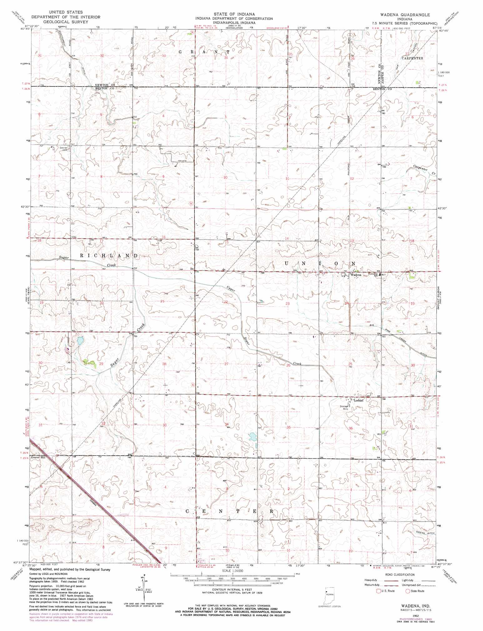
USGS Topo Quad 40087f3 - 1:24,000 scale
| Topo Map Name: | Wadena |
| USGS Topo Quad ID: | 40087f3 |
| Print Size: | ca. 21 1/4" wide x 27" high |
| Southeast Coordinates: | 40.625° N latitude / 87.25° W longitude |
| Map Center Coordinates: | 40.6875° N latitude / 87.3125° W longitude |
| U.S. State: | IN |
| Filename: | o40087f3.jpg |
| Download Map JPG Image: | Wadena topo map 1:24,000 scale |
| Map Type: | Topographic |
| Topo Series: | 7.5´ |
| Map Scale: | 1:24,000 |
| Source of Map Images: | United States Geological Survey (USGS) |
| Alternate Map Versions: |
Wadena IN 1962, updated 1963 Download PDF Buy paper map Wadena IN 1962, updated 1981 Download PDF Buy paper map Wadena IN 2010 Download PDF Buy paper map Wadena IN 2013 Download PDF Buy paper map Wadena IN 2016 Download PDF Buy paper map |
1:24,000 Topo Quads surrounding Wadena
Donovan |
Morocco |
Mount Ayr |
Rensselaer |
Mccoysburg |
Sheldon |
Kentland |
Goodland |
Remington |
Wolcott |
Darrow |
Earl Park |
Wadena |
Mount Gilboa |
Templeton Ne |
Stockland |
Boswell |
Fowler |
Templeton |
Round Grove |
Ambia |
Tab |
Pine Village |
Chatterton |
Otterbein |
> Back to 40087e1 at 1:100,000 scale
> Back to 40086a1 at 1:250,000 scale
> Back to U.S. Topo Maps home
Wadena topo map: Gazetteer
Wadena: Canals
Ham Lateral elevation 230m 754′Wadena: Populated Places
Gravel Hill elevation 247m 810′Lochiel elevation 243m 797′
Wadena elevation 243m 797′
Wadena: Streams
Upper Sugar Creek elevation 232m 761′Wadena digital topo map on disk
Buy this Wadena topo map showing relief, roads, GPS coordinates and other geographical features, as a high-resolution digital map file on DVD:
Northern Illinois, Northern Indiana & Southwestern Michigan
Buy digital topo maps: Northern Illinois, Northern Indiana & Southwestern Michigan