Remington Topo Map Indiana
To zoom in, hover over the map of Remington
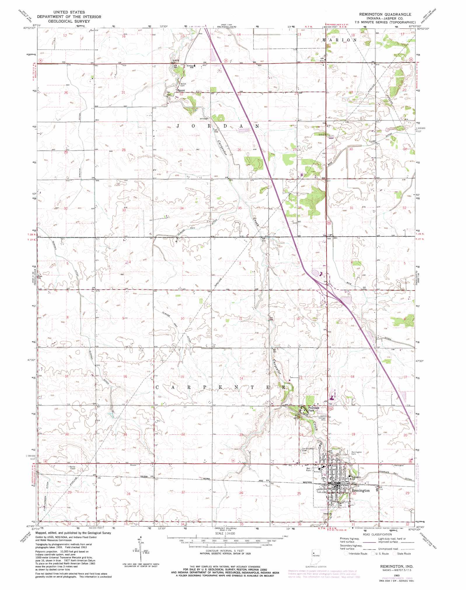
USGS Topo Quad 40087g2 - 1:24,000 scale
| Topo Map Name: | Remington |
| USGS Topo Quad ID: | 40087g2 |
| Print Size: | ca. 21 1/4" wide x 27" high |
| Southeast Coordinates: | 40.75° N latitude / 87.125° W longitude |
| Map Center Coordinates: | 40.8125° N latitude / 87.1875° W longitude |
| U.S. State: | IN |
| Filename: | o40087g2.jpg |
| Download Map JPG Image: | Remington topo map 1:24,000 scale |
| Map Type: | Topographic |
| Topo Series: | 7.5´ |
| Map Scale: | 1:24,000 |
| Source of Map Images: | United States Geological Survey (USGS) |
| Alternate Map Versions: |
Remington IN 1963, updated 1964 Download PDF Buy paper map Remington IN 1963, updated 1981 Download PDF Buy paper map Remington IN 2010 Download PDF Buy paper map Remington IN 2013 Download PDF Buy paper map Remington IN 2016 Download PDF Buy paper map |
1:24,000 Topo Quads surrounding Remington
Enos |
Fair Oaks |
Parr |
Gifford |
Medaryville |
Morocco |
Mount Ayr |
Rensselaer |
Mccoysburg |
Francesville |
Kentland |
Goodland |
Remington |
Wolcott |
Monon |
Earl Park |
Wadena |
Mount Gilboa |
Templeton Ne |
Brookston Nw |
Boswell |
Fowler |
Templeton |
Round Grove |
Brookston Sw |
> Back to 40087e1 at 1:100,000 scale
> Back to 40086a1 at 1:250,000 scale
> Back to U.S. Topo Maps home
Remington topo map: Gazetteer
Remington: Canals
Bice Ditch elevation 205m 672′Charles May Ditch elevation 223m 731′
Claude May Ditch elevation 209m 685′
Gushwa Ditch elevation 203m 666′
Kirkpatrick Ditch elevation 224m 734′
Simonin Ditch elevation 202m 662′
Remington: Populated Places
Egypt elevation 203m 666′Fountain Park elevation 221m 725′
Remington elevation 224m 734′
Remington digital topo map on disk
Buy this Remington topo map showing relief, roads, GPS coordinates and other geographical features, as a high-resolution digital map file on DVD:
Northern Illinois, Northern Indiana & Southwestern Michigan
Buy digital topo maps: Northern Illinois, Northern Indiana & Southwestern Michigan