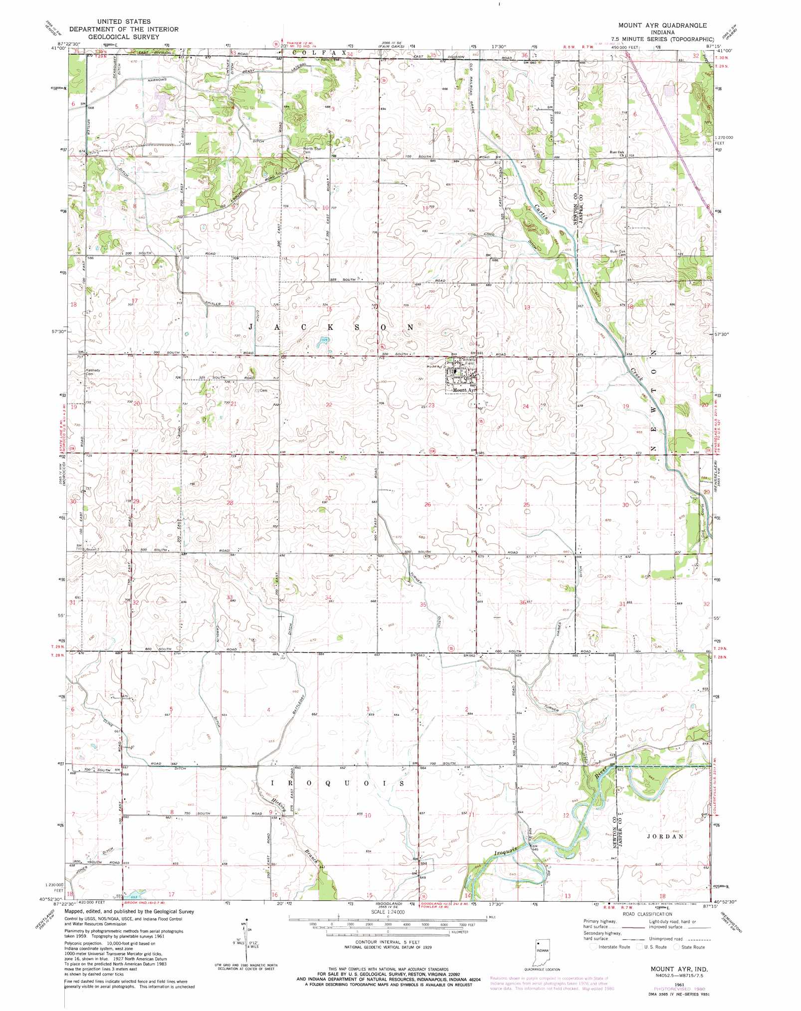
Mount Ayr Topo Map Indiana
To zoom in, hover over the map of Mount Ayr
USGS Topo Quad 40087h3 - 1:24,000 scale
| Topo Map Name: | Mount Ayr |
| USGS Topo Quad ID: | 40087h3 |
| Print Size: | ca. 21 1/4" wide x 27" high |
| Southeast Coordinates: | 40.875° N latitude / 87.25° W longitude |
| Map Center Coordinates: | 40.9375° N latitude / 87.3125° W longitude |
| U.S. State: | IN |
| Filename: | o40087h3.jpg |
| Download Map JPG Image: | Mount Ayr topo map 1:24,000 scale |
| Map Type: | Topographic |
| Topo Series: | 7.5´ |
| Map Scale: | 1:24,000 |
| Source of Map Images: | United States Geological Survey (USGS) |
| Alternate Map Versions: |
Mount Ayr IN 1961, updated 1964 Download PDF Buy paper map Mount Ayr IN 1961, updated 1980 Download PDF Buy paper map Mount Ayr IN 2010 Download PDF Buy paper map Mount Ayr IN 2013 Download PDF Buy paper map Mount Ayr IN 2016 Download PDF Buy paper map |
1:24,000 Topo Quads surrounding Mount Ayr
Illiana Heights |
Schneider |
Shelby |
Demotte |
Wheatfield |
Leesville |
Enos |
Fair Oaks |
Parr |
Gifford |
Donovan |
Morocco |
Mount Ayr |
Rensselaer |
Mccoysburg |
Sheldon |
Kentland |
Goodland |
Remington |
Wolcott |
Darrow |
Earl Park |
Wadena |
Mount Gilboa |
Templeton Ne |
> Back to 40087e1 at 1:100,000 scale
> Back to 40086a1 at 1:250,000 scale
> Back to U.S. Topo Maps home
Mount Ayr topo map: Gazetteer
Mount Ayr: Canals
Battleday Ditch elevation 203m 666′Beasy Lateral elevation 207m 679′
Camblin Ditch elevation 202m 662′
Cline Ditch elevation 204m 669′
Haines Ditch elevation 202m 662′
Spitler Ditch elevation 213m 698′
Turner Ditch elevation 200m 656′
Mount Ayr: Populated Places
Mount Ayr elevation 216m 708′Mount Ayr digital topo map on disk
Buy this Mount Ayr topo map showing relief, roads, GPS coordinates and other geographical features, as a high-resolution digital map file on DVD:
Northern Illinois, Northern Indiana & Southwestern Michigan
Buy digital topo maps: Northern Illinois, Northern Indiana & Southwestern Michigan