Le Roy Topo Map Illinois
To zoom in, hover over the map of Le Roy
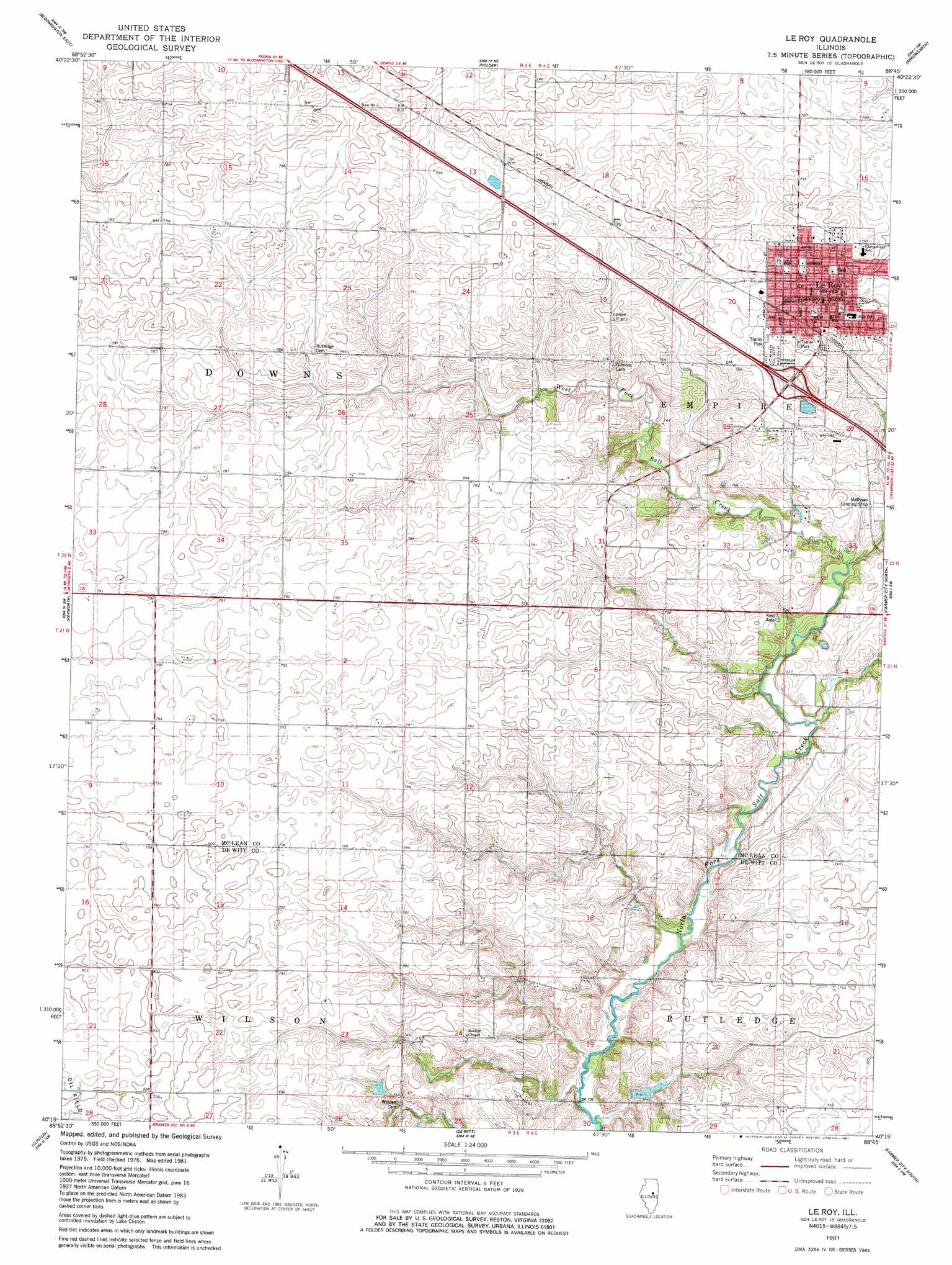
USGS Topo Quad 40088c7 - 1:24,000 scale
| Topo Map Name: | Le Roy |
| USGS Topo Quad ID: | 40088c7 |
| Print Size: | ca. 21 1/4" wide x 27" high |
| Southeast Coordinates: | 40.25° N latitude / 88.75° W longitude |
| Map Center Coordinates: | 40.3125° N latitude / 88.8125° W longitude |
| U.S. State: | IL |
| Filename: | o40088c7.jpg |
| Download Map JPG Image: | Le Roy topo map 1:24,000 scale |
| Map Type: | Topographic |
| Topo Series: | 7.5´ |
| Map Scale: | 1:24,000 |
| Source of Map Images: | United States Geological Survey (USGS) |
| Alternate Map Versions: |
Le Roy IL 1981, updated 1981 Download PDF Buy paper map Le Roy IL 2012 Download PDF Buy paper map Le Roy IL 2015 Download PDF Buy paper map |
1:24,000 Topo Quads surrounding Le Roy
Normal West |
Normal East |
Merna |
Cooksville |
Colfax |
Bloomington West |
Bloomington East |
Holder |
Arrowsmith |
Saybrook |
Funks Grove |
Heyworth |
Le Roy |
Farmer City North |
Belleflower |
Waynesville East |
Clinton |
De Witt |
Farmer City South |
Mansfield |
Kenney |
Maroa |
Weldon West |
Weldon East |
Monticello |
> Back to 40088a1 at 1:100,000 scale
> Back to 40088a1 at 1:250,000 scale
> Back to U.S. Topo Maps home
Le Roy topo map: Gazetteer
Le Roy: Airports
Mathews Landing Strip elevation 227m 744′Le Roy: Crossings
Interchange 149 elevation 237m 777′Le Roy: Dams
Clyde Vance Lake Dam elevation 218m 715′Le Roy: Populated Places
Le Roy elevation 241m 790′Le Roy: Post Offices
Le Roy Post Office elevation 240m 787′Le Roy: Reservoirs
Clyde Vance Lake elevation 218m 715′Le Roy: Streams
Long Point Creek elevation 242m 793′West Fork Salt Creek elevation 220m 721′
Le Roy digital topo map on disk
Buy this Le Roy topo map showing relief, roads, GPS coordinates and other geographical features, as a high-resolution digital map file on DVD:
Northern Illinois, Northern Indiana & Southwestern Michigan
Buy digital topo maps: Northern Illinois, Northern Indiana & Southwestern Michigan