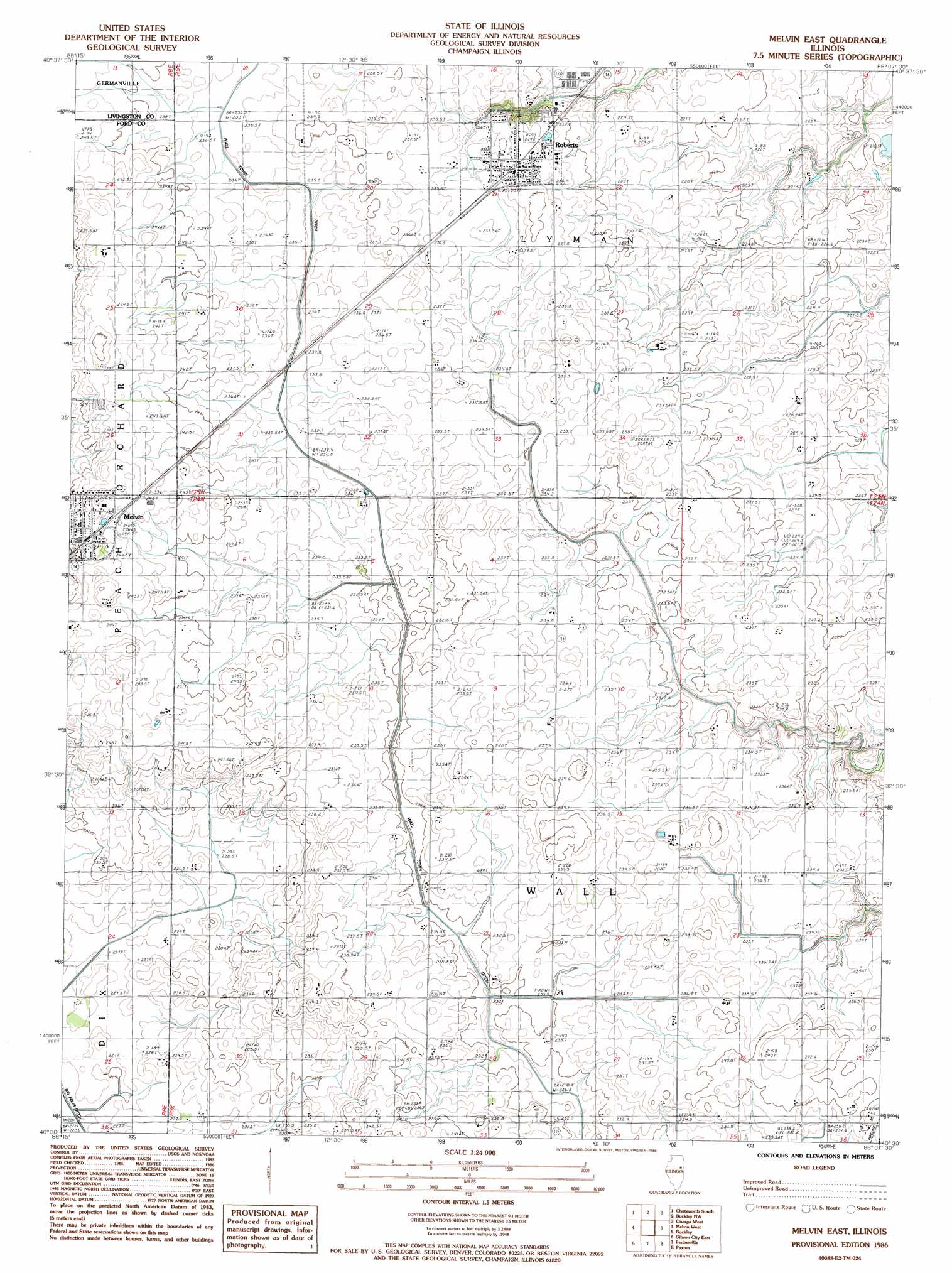
Melvin East Topo Map Illinois
To zoom in, hover over the map of Melvin East
USGS Topo Quad 40088e2 - 1:24,000 scale
| Topo Map Name: | Melvin East |
| USGS Topo Quad ID: | 40088e2 |
| Print Size: | ca. 21 1/4" wide x 27" high |
| Southeast Coordinates: | 40.5° N latitude / 88.125° W longitude |
| Map Center Coordinates: | 40.5625° N latitude / 88.1875° W longitude |
| U.S. State: | IL |
| Filename: | o40088e2.jpg |
| Download Map JPG Image: | Melvin East topo map 1:24,000 scale |
| Map Type: | Topographic |
| Topo Series: | 7.5´ |
| Map Scale: | 1:24,000 |
| Source of Map Images: | United States Geological Survey (USGS) |
| Alternate Map Versions: |
Melvin East IL 1986, updated 1986 Download PDF Buy paper map Melvin East IL 2012 Download PDF Buy paper map Melvin East IL 2015 Download PDF Buy paper map |
1:24,000 Topo Quads surrounding Melvin East
Forrest North |
Chatsworth North |
Piper City |
La Hogue |
Gilman |
Forrest South |
Chatsworth South |
Buckley Nw |
Onarga West |
Onarga East |
Sibley |
Melvin West |
Melvin East |
Buckley |
Cissna Park |
Gibson City West |
Gibson City East |
Perdueville |
Paxton |
Rankin |
Foosland |
Fisher |
Rantoul |
Gifford |
Penfield |
> Back to 40088e1 at 1:100,000 scale
> Back to 40088a1 at 1:250,000 scale
> Back to U.S. Topo Maps home
Melvin East topo map: Gazetteer
Melvin East: Airports
Beherns Airport elevation 241m 790′Melvin East: Populated Places
Melvin elevation 248m 813′Roberts elevation 238m 780′
Melvin East: Woods
Heiting Grove elevation 232m 761′Sharps Grove (historical) elevation 228m 748′
Melvin East digital topo map on disk
Buy this Melvin East topo map showing relief, roads, GPS coordinates and other geographical features, as a high-resolution digital map file on DVD:
Northern Illinois, Northern Indiana & Southwestern Michigan
Buy digital topo maps: Northern Illinois, Northern Indiana & Southwestern Michigan