Colfax Topo Map Illinois
To zoom in, hover over the map of Colfax
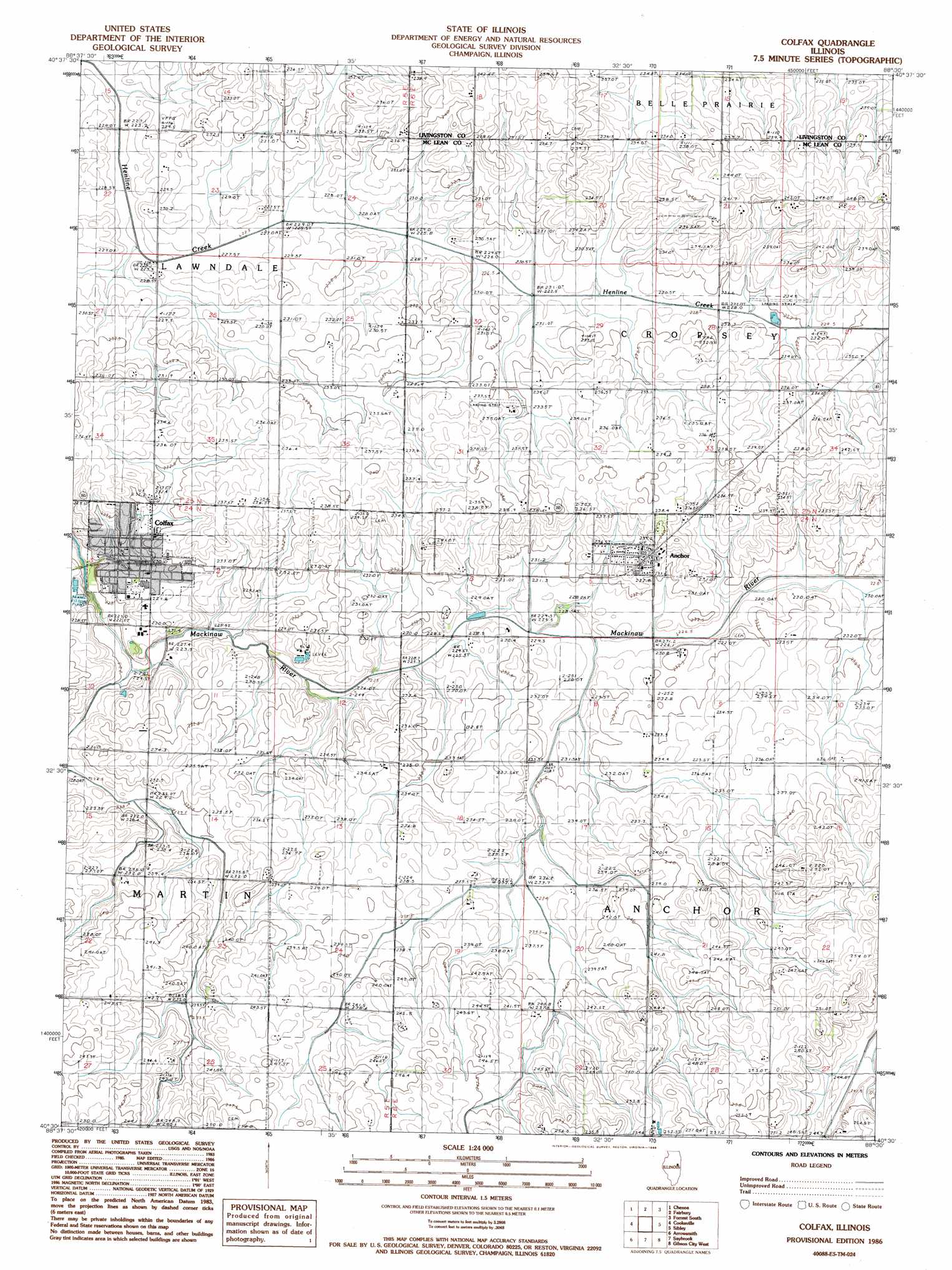
USGS Topo Quad 40088e5 - 1:24,000 scale
| Topo Map Name: | Colfax |
| USGS Topo Quad ID: | 40088e5 |
| Print Size: | ca. 21 1/4" wide x 27" high |
| Southeast Coordinates: | 40.5° N latitude / 88.5° W longitude |
| Map Center Coordinates: | 40.5625° N latitude / 88.5625° W longitude |
| U.S. State: | IL |
| Filename: | o40088e5.jpg |
| Download Map JPG Image: | Colfax topo map 1:24,000 scale |
| Map Type: | Topographic |
| Topo Series: | 7.5´ |
| Map Scale: | 1:24,000 |
| Source of Map Images: | United States Geological Survey (USGS) |
| Alternate Map Versions: |
Colfax IL 1986, updated 1986 Download PDF Buy paper map Colfax IL 2012 Download PDF Buy paper map Colfax IL 2015 Download PDF Buy paper map |
1:24,000 Topo Quads surrounding Colfax
Flanagan South |
Southwest Pontiac |
Southeast Pontiac |
Forrest North |
Chatsworth North |
Lexington |
Chenoa |
Fairbury |
Forrest South |
Chatsworth South |
Merna |
Cooksville |
Colfax |
Sibley |
Melvin West |
Holder |
Arrowsmith |
Saybrook |
Gibson City West |
Gibson City East |
Le Roy |
Farmer City North |
Belleflower |
Foosland |
Fisher |
> Back to 40088e1 at 1:100,000 scale
> Back to 40088a1 at 1:250,000 scale
> Back to U.S. Topo Maps home
Colfax topo map: Gazetteer
Colfax: Populated Places
Anchor elevation 237m 777′Colfax elevation 230m 754′
Colfax: Post Offices
Colfax Post Office elevation 230m 754′Potosi Post Office (historical) elevation 240m 787′
Colfax: Streams
Colfax Creek elevation 221m 725′Colfax digital topo map on disk
Buy this Colfax topo map showing relief, roads, GPS coordinates and other geographical features, as a high-resolution digital map file on DVD:
Northern Illinois, Northern Indiana & Southwestern Michigan
Buy digital topo maps: Northern Illinois, Northern Indiana & Southwestern Michigan