Middleton Topo Map Illinois
To zoom in, hover over the map of Middleton
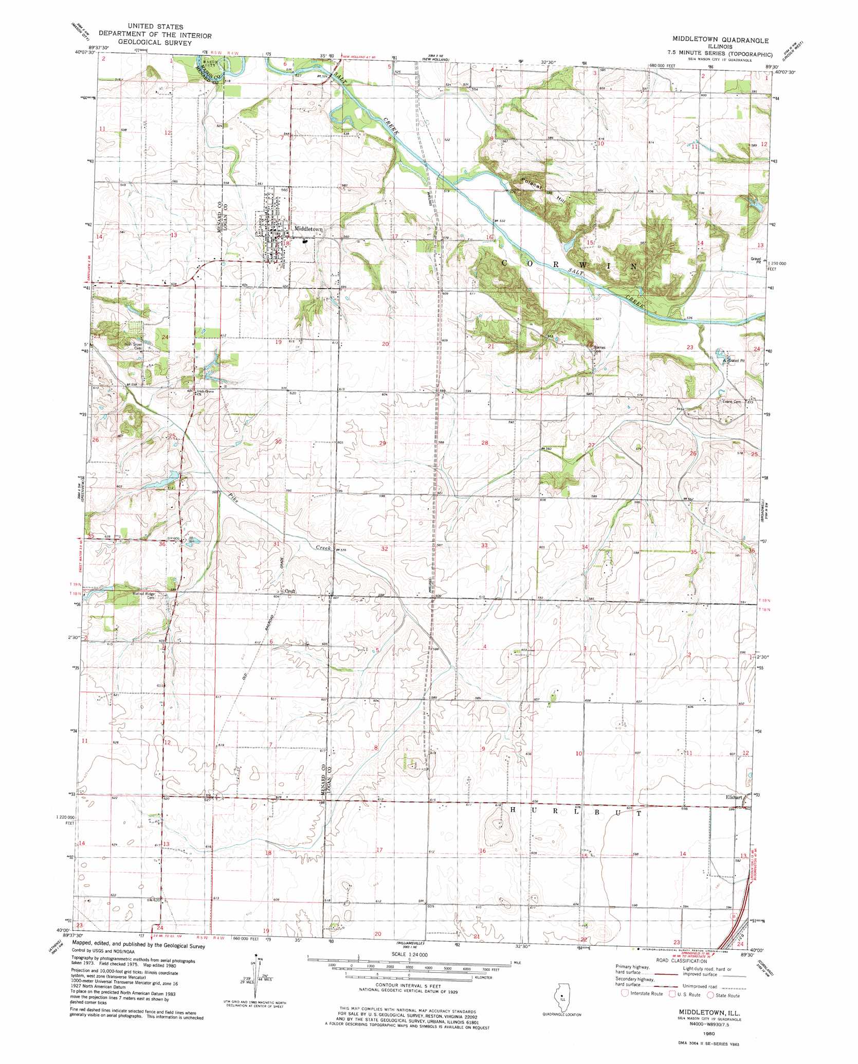
USGS Topo Quad 40089a5 - 1:24,000 scale
| Topo Map Name: | Middleton |
| USGS Topo Quad ID: | 40089a5 |
| Print Size: | ca. 21 1/4" wide x 27" high |
| Southeast Coordinates: | 40° N latitude / 89.5° W longitude |
| Map Center Coordinates: | 40.0625° N latitude / 89.5625° W longitude |
| U.S. State: | IL |
| Filename: | o40089a5.jpg |
| Download Map JPG Image: | Middleton topo map 1:24,000 scale |
| Map Type: | Topographic |
| Topo Series: | 7.5´ |
| Map Scale: | 1:24,000 |
| Source of Map Images: | United States Geological Survey (USGS) |
| Alternate Map Versions: |
Middletown IL 2012 Download PDF Buy paper map Middletown IL 2015 Download PDF Buy paper map |
1:24,000 Topo Quads surrounding Middleton
Forest City |
Natrona |
Delavan South |
Emden |
Armington |
Easton |
Mason City |
New Holland |
Lincoln West |
Lincoln East |
Petersburg |
Greenview |
Middleton |
Broadwell |
Mount Pulaski |
Salisbury |
Athens |
Williamsville |
Cornland |
Lake Fork |
Farmingdale |
Springfield West |
Springfield East |
Mechanicsburg |
Mount Auburn |
> Back to 40089a1 at 1:100,000 scale
> Back to 40088a1 at 1:250,000 scale
> Back to U.S. Topo Maps home
Middleton topo map: Gazetteer
Middleton: Airports
Leigh Farm Airport elevation 186m 610′Middleton: Dams
McMann Lake Dam elevation 185m 606′Middleton: Mines
Johnson Valley Mine elevation 180m 590′Middleton: Parks
Barton - Sommers Woodland Nature Preserve elevation 157m 515′Middleton: Populated Places
Croft elevation 184m 603′Middletown elevation 178m 583′
Middleton: Reservoirs
McMann Lake elevation 185m 606′Middleton: Summits
Polecat Hill elevation 187m 613′Middleton digital topo map on disk
Buy this Middleton topo map showing relief, roads, GPS coordinates and other geographical features, as a high-resolution digital map file on DVD:
Northern Illinois, Northern Indiana & Southwestern Michigan
Buy digital topo maps: Northern Illinois, Northern Indiana & Southwestern Michigan