Petersburg Topo Map Illinois
To zoom in, hover over the map of Petersburg
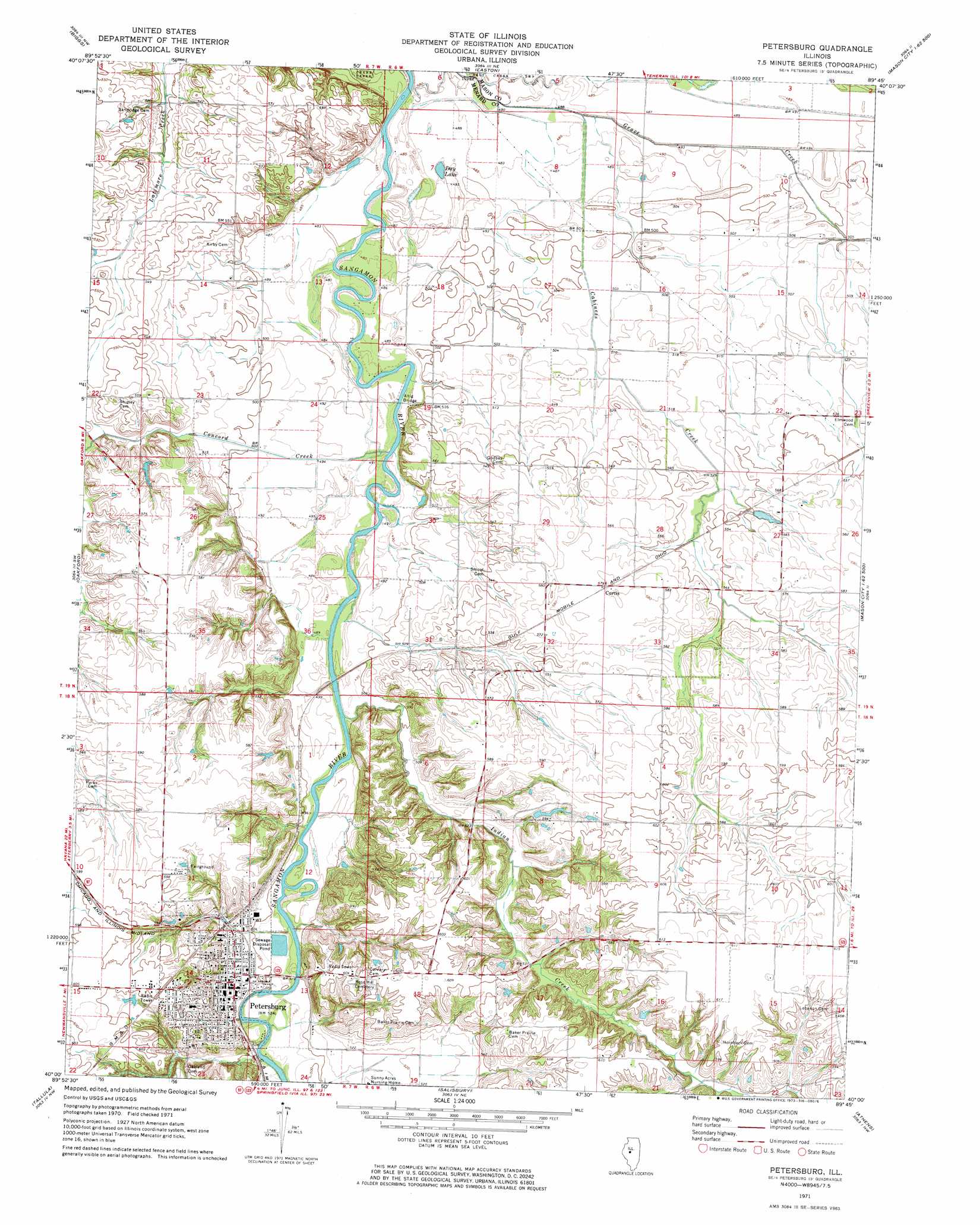
USGS Topo Quad 40089a7 - 1:24,000 scale
| Topo Map Name: | Petersburg |
| USGS Topo Quad ID: | 40089a7 |
| Print Size: | ca. 21 1/4" wide x 27" high |
| Southeast Coordinates: | 40° N latitude / 89.75° W longitude |
| Map Center Coordinates: | 40.0625° N latitude / 89.8125° W longitude |
| U.S. State: | IL |
| Filename: | o40089a7.jpg |
| Download Map JPG Image: | Petersburg topo map 1:24,000 scale |
| Map Type: | Topographic |
| Topo Series: | 7.5´ |
| Map Scale: | 1:24,000 |
| Source of Map Images: | United States Geological Survey (USGS) |
| Alternate Map Versions: |
Petersburg IL 1971, updated 1973 Download PDF Buy paper map Petersburg IL 2012 Download PDF Buy paper map Petersburg IL 2015 Download PDF Buy paper map |
1:24,000 Topo Quads surrounding Petersburg
Havana |
Topeka |
Forest City |
Natrona |
Delavan South |
Kilbourne |
Biggs |
Easton |
Mason City |
New Holland |
Newmansville |
Oakford |
Petersburg |
Greenview |
Middleton |
Ashland |
Tallula |
Salisbury |
Athens |
Williamsville |
Prentice |
Pleasant Plains |
Farmingdale |
Springfield West |
Springfield East |
> Back to 40089a1 at 1:100,000 scale
> Back to 40088a1 at 1:250,000 scale
> Back to U.S. Topo Maps home
Petersburg topo map: Gazetteer
Petersburg: Airports
Petersburg Airport elevation 186m 610′Petersburg: Bridges
Altig Bridge elevation 146m 479′Petersburg: Lakes
Day Lake elevation 146m 479′Petersburg: Mines
Indian Creek Mine elevation 170m 557′Riverside Mine elevation 154m 505′
Petersburg: Parks
Petersburg Historic District elevation 157m 515′Petersburg: Populated Places
Curtis elevation 177m 580′Petersburg elevation 156m 511′
Petersburg: Streams
Cabiness Creek elevation 146m 479′Concord Creek elevation 146m 479′
Crawford Branch elevation 146m 479′
Hemp Factory Branch elevation 149m 488′
Indian Creek elevation 149m 488′
Petersburg digital topo map on disk
Buy this Petersburg topo map showing relief, roads, GPS coordinates and other geographical features, as a high-resolution digital map file on DVD:
Northern Illinois, Northern Indiana & Southwestern Michigan
Buy digital topo maps: Northern Illinois, Northern Indiana & Southwestern Michigan