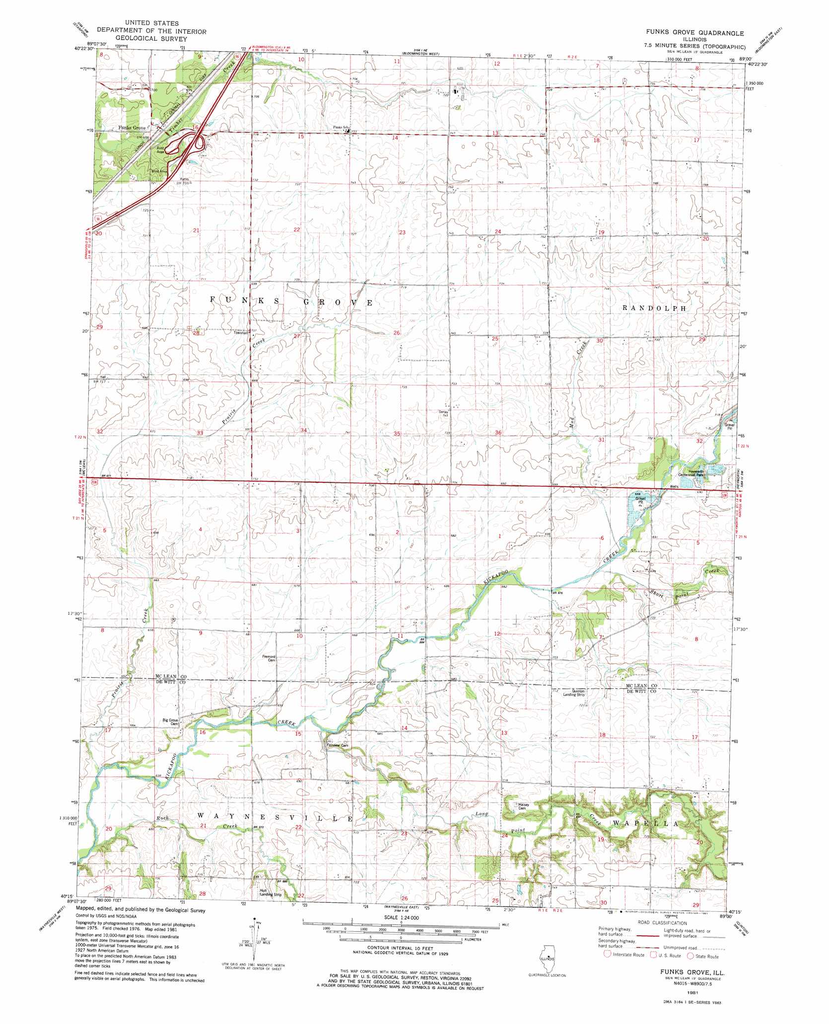
Funks Grove Topo Map Illinois
To zoom in, hover over the map of Funks Grove
USGS Topo Quad 40089c1 - 1:24,000 scale
| Topo Map Name: | Funks Grove |
| USGS Topo Quad ID: | 40089c1 |
| Print Size: | ca. 21 1/4" wide x 27" high |
| Southeast Coordinates: | 40.25° N latitude / 89° W longitude |
| Map Center Coordinates: | 40.3125° N latitude / 89.0625° W longitude |
| U.S. State: | IL |
| Filename: | o40089c1.jpg |
| Download Map JPG Image: | Funks Grove topo map 1:24,000 scale |
| Map Type: | Topographic |
| Topo Series: | 7.5´ |
| Map Scale: | 1:24,000 |
| Source of Map Images: | United States Geological Survey (USGS) |
| Alternate Map Versions: |
Funks Grove IL 1981, updated 1981 Download PDF Buy paper map Funks Grove IL 2012 Download PDF Buy paper map Funks Grove IL 2015 Download PDF Buy paper map |
1:24,000 Topo Quads surrounding Funks Grove
Mackinaw |
Danvers |
Normal West |
Normal East |
Merna |
Minier |
Stanford |
Bloomington West |
Bloomington East |
Holder |
Armington |
Mclean |
Funks Grove |
Heyworth |
Le Roy |
Lincoln East |
Waynesville West |
Waynesville East |
Clinton |
De Witt |
Mount Pulaski |
Chestnut |
Kenney |
Maroa |
Weldon West |
> Back to 40089a1 at 1:100,000 scale
> Back to 40088a1 at 1:250,000 scale
> Back to U.S. Topo Maps home
Funks Grove topo map: Gazetteer
Funks Grove: Airports
Holt Landing Strip elevation 218m 715′William Quinton RLA Airport elevation 217m 711′
Funks Grove: Parks
Funks Grove Nature Preserve elevation 204m 669′Heyworth Centennial Park elevation 208m 682′
Stubblefield Woodlots Nature Preserve elevation 213m 698′
Funks Grove: Populated Places
Funks Grove elevation 211m 692′Funks Grove: Streams
Long Point Creek elevation 197m 646′Mud Creek elevation 204m 669′
Prairie Creek elevation 194m 636′
Rock Creek elevation 192m 629′
Short Point Creek elevation 204m 669′
Funks Grove digital topo map on disk
Buy this Funks Grove topo map showing relief, roads, GPS coordinates and other geographical features, as a high-resolution digital map file on DVD:
Northern Illinois, Northern Indiana & Southwestern Michigan
Buy digital topo maps: Northern Illinois, Northern Indiana & Southwestern Michigan