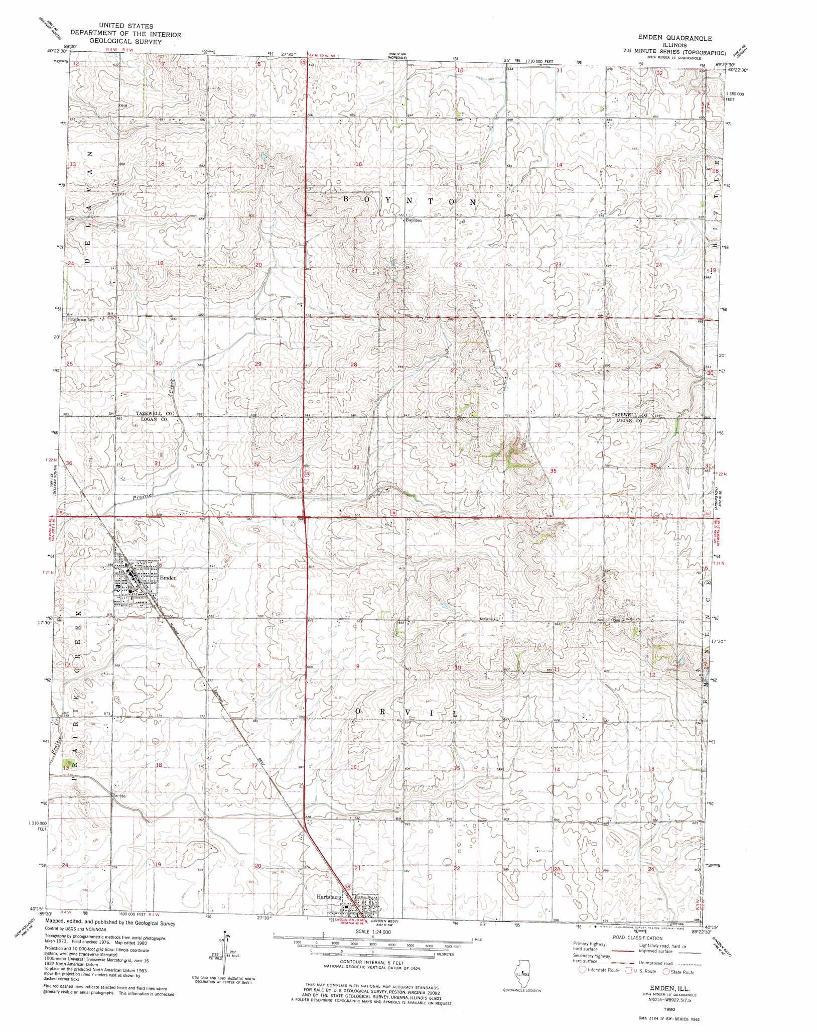
Emden Topo Map Illinois
To zoom in, hover over the map of Emden
USGS Topo Quad 40089c4 - 1:24,000 scale
| Topo Map Name: | Emden |
| USGS Topo Quad ID: | 40089c4 |
| Print Size: | ca. 21 1/4" wide x 27" high |
| Southeast Coordinates: | 40.25° N latitude / 89.375° W longitude |
| Map Center Coordinates: | 40.3125° N latitude / 89.4375° W longitude |
| U.S. State: | IL |
| Filename: | o40089c4.jpg |
| Download Map JPG Image: | Emden topo map 1:24,000 scale |
| Map Type: | Topographic |
| Topo Series: | 7.5´ |
| Map Scale: | 1:24,000 |
| Source of Map Images: | United States Geological Survey (USGS) |
| Alternate Map Versions: |
Emden IL 1980, updated 1980 Download PDF Buy paper map Emden IL 1996, updated 1997 Download PDF Buy paper map Emden IL 2012 Download PDF Buy paper map Emden IL 2015 Download PDF Buy paper map |
1:24,000 Topo Quads surrounding Emden
Pekin |
Marquette Heights |
Morton |
Mackinaw |
Danvers |
South Pekin |
Delavan North |
Hopedale |
Minier |
Stanford |
Natrona |
Delavan South |
Emden |
Armington |
Mclean |
Mason City |
New Holland |
Lincoln West |
Lincoln East |
Waynesville West |
Greenview |
Middleton |
Broadwell |
Mount Pulaski |
Chestnut |
> Back to 40089a1 at 1:100,000 scale
> Back to 40088a1 at 1:250,000 scale
> Back to U.S. Topo Maps home
Emden topo map: Gazetteer
Emden: Airports
Hobby Hideaway RLA Airport elevation 199m 652′Emden: Crossings
Interchange 10 elevation 178m 583′Emden: Populated Places
Boynton elevation 220m 721′Emden elevation 180m 590′
Hartsburg elevation 184m 603′
Emden: Post Offices
Emden Post Office elevation 180m 590′Hartsburg Post Office elevation 184m 603′
Emden digital topo map on disk
Buy this Emden topo map showing relief, roads, GPS coordinates and other geographical features, as a high-resolution digital map file on DVD:
Northern Illinois, Northern Indiana & Southwestern Michigan
Buy digital topo maps: Northern Illinois, Northern Indiana & Southwestern Michigan