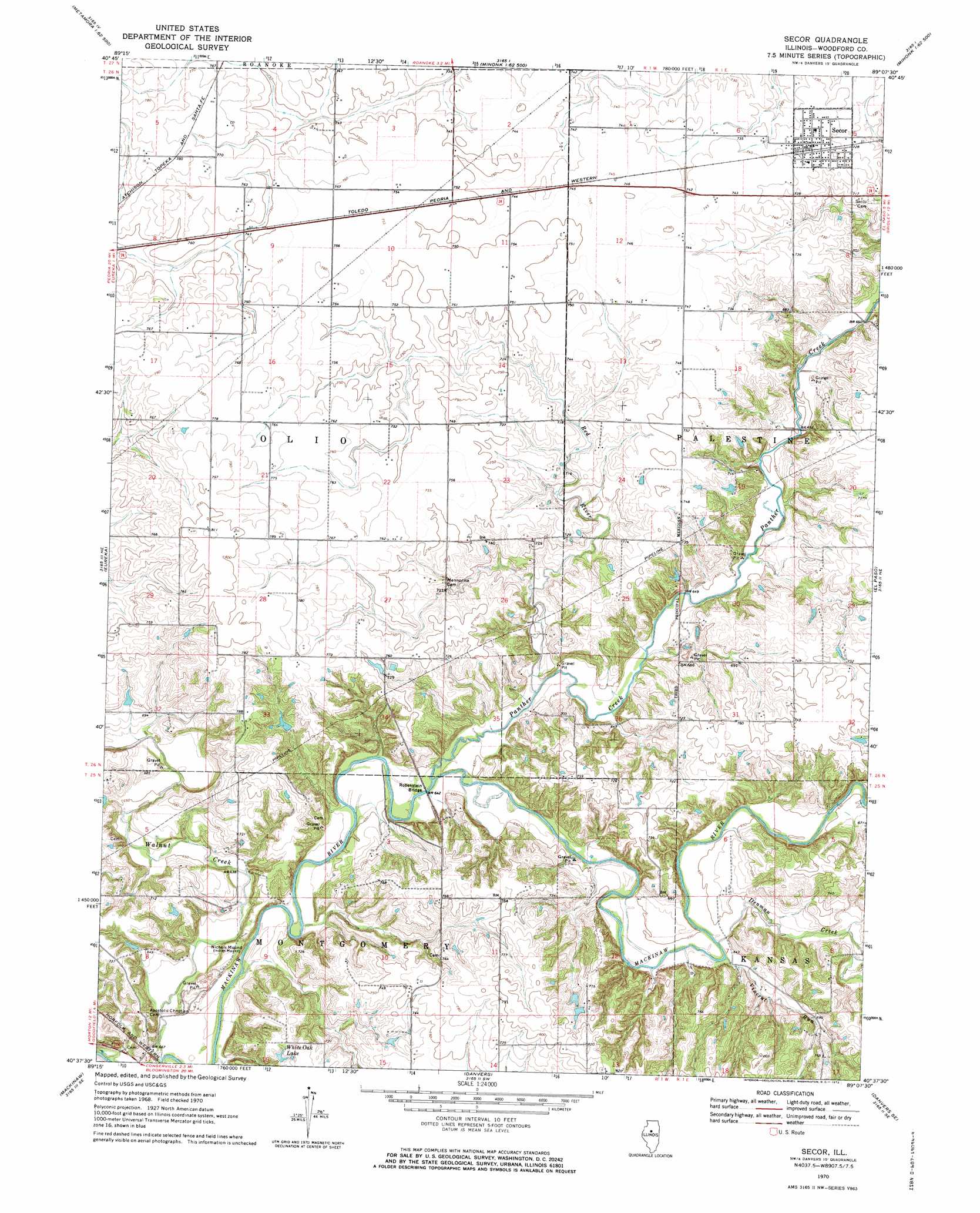
Secor Topo Map Illinois
To zoom in, hover over the map of Secor
USGS Topo Quad 40089f2 - 1:24,000 scale
| Topo Map Name: | Secor |
| USGS Topo Quad ID: | 40089f2 |
| Print Size: | ca. 21 1/4" wide x 27" high |
| Southeast Coordinates: | 40.625° N latitude / 89.125° W longitude |
| Map Center Coordinates: | 40.6875° N latitude / 89.1875° W longitude |
| U.S. State: | IL |
| Filename: | o40089f2.jpg |
| Download Map JPG Image: | Secor topo map 1:24,000 scale |
| Map Type: | Topographic |
| Topo Series: | 7.5´ |
| Map Scale: | 1:24,000 |
| Source of Map Images: | United States Geological Survey (USGS) |
| Alternate Map Versions: |
Secor IL 1970, updated 1972 Download PDF Buy paper map Secor IL 1970, updated 1972 Download PDF Buy paper map Secor IL 2012 Download PDF Buy paper map Secor IL 2015 Download PDF Buy paper map |
1:24,000 Topo Quads surrounding Secor
Chillicothe |
Washburn |
La Rose |
Minonk |
Dana |
Germantown Hills |
Metamora |
Roanoke |
Benson |
Flanagan Sw |
Washington |
Eureka |
Secor |
El Paso |
Gridley |
Morton |
Mackinaw |
Danvers |
Normal West |
Normal East |
Hopedale |
Minier |
Stanford |
Bloomington West |
Bloomington East |
> Back to 40089e1 at 1:100,000 scale
> Back to 40088a1 at 1:250,000 scale
> Back to U.S. Topo Maps home
Secor topo map: Gazetteer
Secor: Bridges
Robenstein Bridge elevation 191m 626′Secor: Parks
Ridgetop Hill Prairie Nature Preserve elevation 212m 695′Secor: Populated Places
Bowling Green (historical) elevation 230m 754′Secor elevation 223m 731′
Secor: Reservoirs
White Oak Lake elevation 216m 708′Secor: Streams
Denman Creek elevation 194m 636′Panther Creek elevation 191m 626′
Red River elevation 191m 626′
Vincent Run elevation 194m 636′
Walnut Creek elevation 189m 620′
Secor: Summits
Nichols Mound elevation 205m 672′Secor digital topo map on disk
Buy this Secor topo map showing relief, roads, GPS coordinates and other geographical features, as a high-resolution digital map file on DVD:
Northern Illinois, Northern Indiana & Southwestern Michigan
Buy digital topo maps: Northern Illinois, Northern Indiana & Southwestern Michigan