Kilbourne Topo Map Illinois
To zoom in, hover over the map of Kilbourne
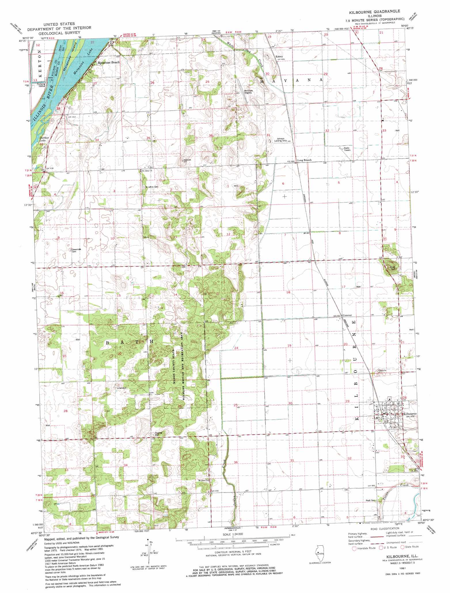
USGS Topo Quad 40090b1 - 1:24,000 scale
| Topo Map Name: | Kilbourne |
| USGS Topo Quad ID: | 40090b1 |
| Print Size: | ca. 21 1/4" wide x 27" high |
| Southeast Coordinates: | 40.125° N latitude / 90° W longitude |
| Map Center Coordinates: | 40.1875° N latitude / 90.0625° W longitude |
| U.S. State: | IL |
| Filename: | o40090b1.jpg |
| Download Map JPG Image: | Kilbourne topo map 1:24,000 scale |
| Map Type: | Topographic |
| Topo Series: | 7.5´ |
| Map Scale: | 1:24,000 |
| Source of Map Images: | United States Geological Survey (USGS) |
| Alternate Map Versions: |
Kilbourne IL 1981, updated 1981 Download PDF Buy paper map Kilbourne IL 2012 Download PDF Buy paper map Kilbourne IL 2015 Download PDF Buy paper map |
1:24,000 Topo Quads surrounding Kilbourne
Smithfield |
Lewiston |
Saint David |
Duck Island |
Manito |
Ipava |
Duncan Mills |
Havana |
Topeka |
Forest City |
Astoria |
Bath |
Kilbourne |
Biggs |
Easton |
Clear Lake |
Chandlerville |
Newmansville |
Oakford |
Petersburg |
Arenzville East |
Virginia |
Ashland |
Tallula |
Salisbury |
> Back to 40090a1 at 1:100,000 scale
> Back to 40090a1 at 1:250,000 scale
> Back to U.S. Topo Maps home
Kilbourne topo map: Gazetteer
Kilbourne: Airports
Havana Regional Airport elevation 148m 485′Johnson Landing Strip elevation 147m 482′
Kilbourne: Lakes
Matanzas Lake elevation 135m 442′Kilbourne: Parks
Long Branch Sand Prairie Nature Preserve elevation 150m 492′Mason County State Wildlife Refuge and Recreation Area elevation 155m 508′
Matanzas Prairie Nature Preserve elevation 139m 456′
Sand Prairie - Scrub Oak Nature Preserve elevation 155m 508′
Kilbourne: Populated Places
Conover elevation 149m 488′Kelsey elevation 148m 485′
Kilbourne elevation 151m 495′
Lakewood elevation 142m 465′
Long Branch elevation 148m 485′
Matanzas elevation 141m 462′
Matanzas Beach elevation 140m 459′
Kilbourne digital topo map on disk
Buy this Kilbourne topo map showing relief, roads, GPS coordinates and other geographical features, as a high-resolution digital map file on DVD: