Astoria Topo Map Illinois
To zoom in, hover over the map of Astoria
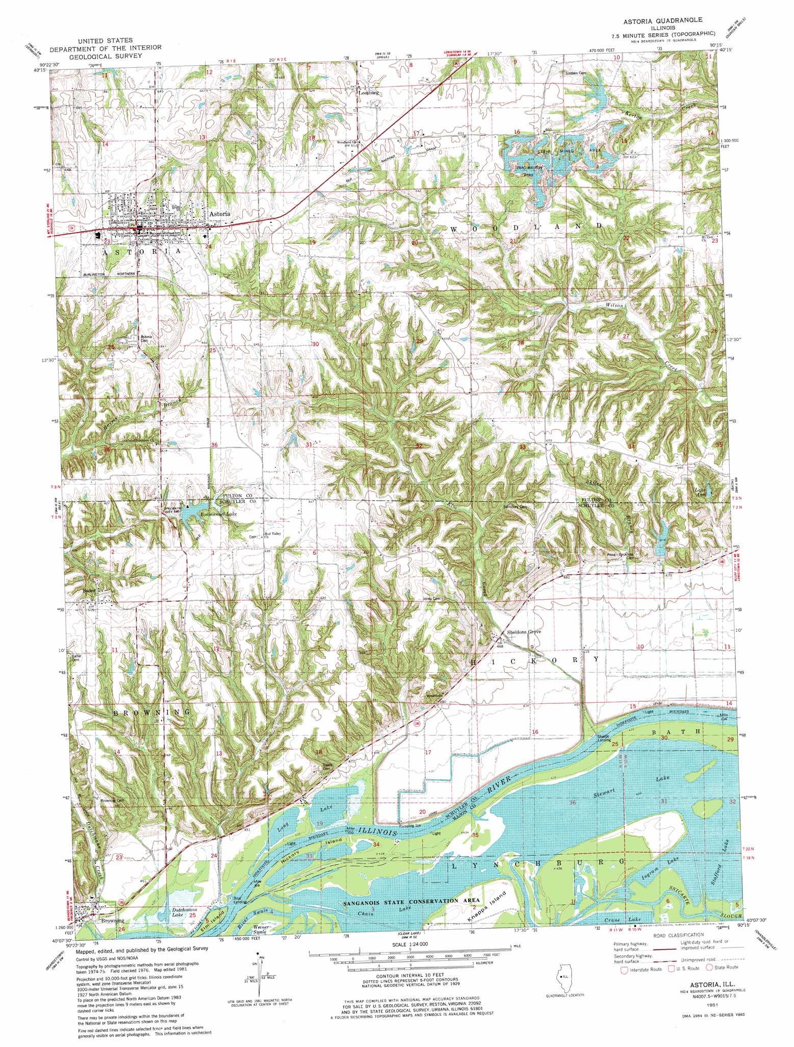
USGS Topo Quad 40090b3 - 1:24,000 scale
| Topo Map Name: | Astoria |
| USGS Topo Quad ID: | 40090b3 |
| Print Size: | ca. 21 1/4" wide x 27" high |
| Southeast Coordinates: | 40.125° N latitude / 90.25° W longitude |
| Map Center Coordinates: | 40.1875° N latitude / 90.3125° W longitude |
| U.S. State: | IL |
| Filename: | o40090b3.jpg |
| Download Map JPG Image: | Astoria topo map 1:24,000 scale |
| Map Type: | Topographic |
| Topo Series: | 7.5´ |
| Map Scale: | 1:24,000 |
| Source of Map Images: | United States Geological Survey (USGS) |
| Alternate Map Versions: |
Astoria IL 1981, updated 1981 Download PDF Buy paper map Astoria IL 2012 Download PDF Buy paper map Astoria IL 2015 Download PDF Buy paper map |
1:24,000 Topo Quads surrounding Astoria
Bardolph |
Adair |
Smithfield |
Lewiston |
Saint David |
Industry |
Vermont |
Ipava |
Duncan Mills |
Havana |
Rushville North |
Ray |
Astoria |
Bath |
Kilbourne |
Rushville South |
Beardstown |
Clear Lake |
Chandlerville |
Newmansville |
Cooperstown |
Arenzville West |
Arenzville East |
Virginia |
Ashland |
> Back to 40090a1 at 1:100,000 scale
> Back to 40090a1 at 1:250,000 scale
> Back to U.S. Topo Maps home
Astoria topo map: Gazetteer
Astoria: Airports
J R Briney and Sons Airport elevation 140m 459′Astoria: Dams
Briney Lake Dam elevation 148m 485′Briney Lake Dam Number 1 elevation 148m 485′
Camp Immanuel Lake Dam elevation 187m 613′
Astoria: Guts
Cross Slough elevation 134m 439′Hickory Slough elevation 135m 442′
Panther Slough elevation 135m 442′
Astoria: Islands
Elm Island elevation 135m 442′Hickory Island elevation 135m 442′
Knapps Island elevation 134m 439′
Astoria: Lakes
Chain Lake elevation 134m 439′Dutchmans Lake elevation 134m 439′
Ingram Lake elevation 135m 442′
Long Lake elevation 134m 439′
Stewart Lake elevation 135m 442′
Astoria: Parks
Izaac Walton Park elevation 192m 629′Astoria: Populated Places
Astoria elevation 217m 711′Bader elevation 188m 616′
Browning elevation 137m 449′
Leesburg elevation 198m 649′
Sheldons Grove elevation 142m 465′
Astoria: Reservoirs
Briney Lake elevation 148m 485′Briney Lake Number 1 elevation 148m 485′
Camp Immanuel Lake elevation 187m 613′
Emmanuel Lake elevation 180m 590′
Lake Ann elevation 164m 538′
Astoria: Streams
Dixon Branch elevation 156m 511′Dutchmans Creek elevation 134m 439′
Elm Creek elevation 134m 439′
Skiles Branch elevation 131m 429′
Astoria digital topo map on disk
Buy this Astoria topo map showing relief, roads, GPS coordinates and other geographical features, as a high-resolution digital map file on DVD: