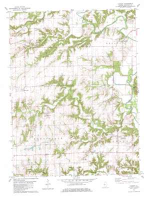
Camden Topo Map Illinois
To zoom in, hover over the map of Camden
USGS Topo Quad 40090b7 - 1:24,000 scale
| Topo Map Name: | Camden |
| USGS Topo Quad ID: | 40090b7 |
| Print Size: | ca. 21 1/4" wide x 27" high |
| Southeast Coordinates: | 40.125° N latitude / 90.75° W longitude |
| Map Center Coordinates: | 40.1875° N latitude / 90.8125° W longitude |
| U.S. State: | IL |
| Filename: | o40090b7.jpg |
| Download Map JPG Image: | Camden topo map 1:24,000 scale |
| Map Type: | Topographic |
| Topo Series: | 7.5´ |
| Map Scale: | 1:24,000 |
| Source of Map Images: | United States Geological Survey (USGS) |
| Alternate Map Versions: |
Camden IL 1981, updated 1981 Download PDF Buy paper map Camden IL 2012 Download PDF Buy paper map Camden IL 2015 Download PDF Buy paper map |
1:24,000 Topo Quads surrounding Camden
> Back to 40090a1 at 1:100,000 scale
> Back to 40090a1 at 1:250,000 scale
> Back to U.S. Topo Maps home
Camden topo map: Gazetteer
Camden: Cliffs
Clay Bank elevation 161m 528′Camden: Dams
Croxton Lake Dam elevation 195m 639′Musick Pond Dam elevation 175m 574′
Camden: Mines
Lambert Mine elevation 176m 577′Pit 17 Cedar Creek Mine elevation 195m 639′
Pit 18 Cedar Creek Mine elevation 196m 643′
Pit 2 Cedar Creek Mine elevation 192m 629′
Pit 3 Cedar Creek Mine elevation 189m 620′
Pit 4 Cedar Creek Mine elevation 195m 639′
Pit 6 Cedar Creek Mine elevation 186m 610′
Pit 8 Cedar Creek Mine elevation 199m 652′
Reeder Mine elevation 178m 583′
Camden: Populated Places
Brooklyn elevation 168m 551′Camden elevation 183m 600′
Huntsville elevation 201m 659′
Mindale elevation 207m 679′
Camden: Post Offices
Brooklyn Post Office (historical) elevation 168m 551′Huntsville Post Office elevation 200m 656′
Camden: Reservoirs
Croxton Lake elevation 195m 639′Musick Pond elevation 175m 574′
Camden: Streams
Cedar Creek elevation 141m 462′Harrison Branch elevation 147m 482′
Lewis Creek elevation 146m 479′
Little Cedar Creek elevation 147m 482′
Willow Creek elevation 146m 479′
Camden digital topo map on disk
Buy this Camden topo map showing relief, roads, GPS coordinates and other geographical features, as a high-resolution digital map file on DVD:


