Vermont Topo Map Illinois
To zoom in, hover over the map of Vermont
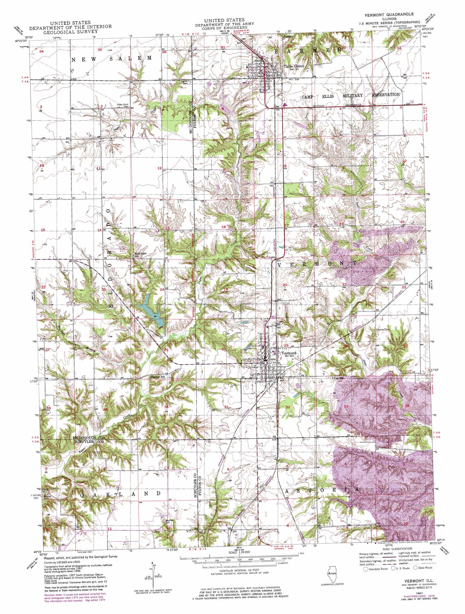
USGS Topo Quad 40090c4 - 1:24,000 scale
| Topo Map Name: | Vermont |
| USGS Topo Quad ID: | 40090c4 |
| Print Size: | ca. 21 1/4" wide x 27" high |
| Southeast Coordinates: | 40.25° N latitude / 90.375° W longitude |
| Map Center Coordinates: | 40.3125° N latitude / 90.4375° W longitude |
| U.S. State: | IL |
| Filename: | o40090c4.jpg |
| Download Map JPG Image: | Vermont topo map 1:24,000 scale |
| Map Type: | Topographic |
| Topo Series: | 7.5´ |
| Map Scale: | 1:24,000 |
| Source of Map Images: | United States Geological Survey (USGS) |
| Alternate Map Versions: |
Vermont IL 1947, updated 1979 Download PDF Buy paper map Vermont IL 1948 Download PDF Buy paper map Vermont IL 2012 Download PDF Buy paper map Vermont IL 2015 Download PDF Buy paper map |
1:24,000 Topo Quads surrounding Vermont
Good Hope |
Bushnell West |
Bushnell East |
Blyton |
Fiatt |
Macomb |
Bardolph |
Adair |
Smithfield |
Lewiston |
Doddsville |
Industry |
Vermont |
Ipava |
Duncan Mills |
Erwin |
Rushville North |
Ray |
Astoria |
Bath |
Ripley |
Rushville South |
Beardstown |
Clear Lake |
Chandlerville |
> Back to 40090a1 at 1:100,000 scale
> Back to 40090a1 at 1:250,000 scale
> Back to U.S. Topo Maps home
Vermont topo map: Gazetteer
Vermont: Dams
Diversion Drainage Dam elevation 185m 606′Freshwater Lake Dam elevation 179m 587′
Heller Lake Dam elevation 199m 652′
Vermont New Lake Dam elevation 178m 583′
Vermont: Parks
Table Grove Village Square elevation 223m 731′Vermont: Populated Places
Table Grove elevation 221m 725′Vermont elevation 211m 692′
Vermont: Reservoirs
Diversion Drainage Lake elevation 185m 606′Freshwater Lake elevation 179m 587′
Heller Lake elevation 199m 652′
Vermont New Lake elevation 178m 583′
Vermont: Streams
Wolfden Branch elevation 169m 554′Vermont digital topo map on disk
Buy this Vermont topo map showing relief, roads, GPS coordinates and other geographical features, as a high-resolution digital map file on DVD: