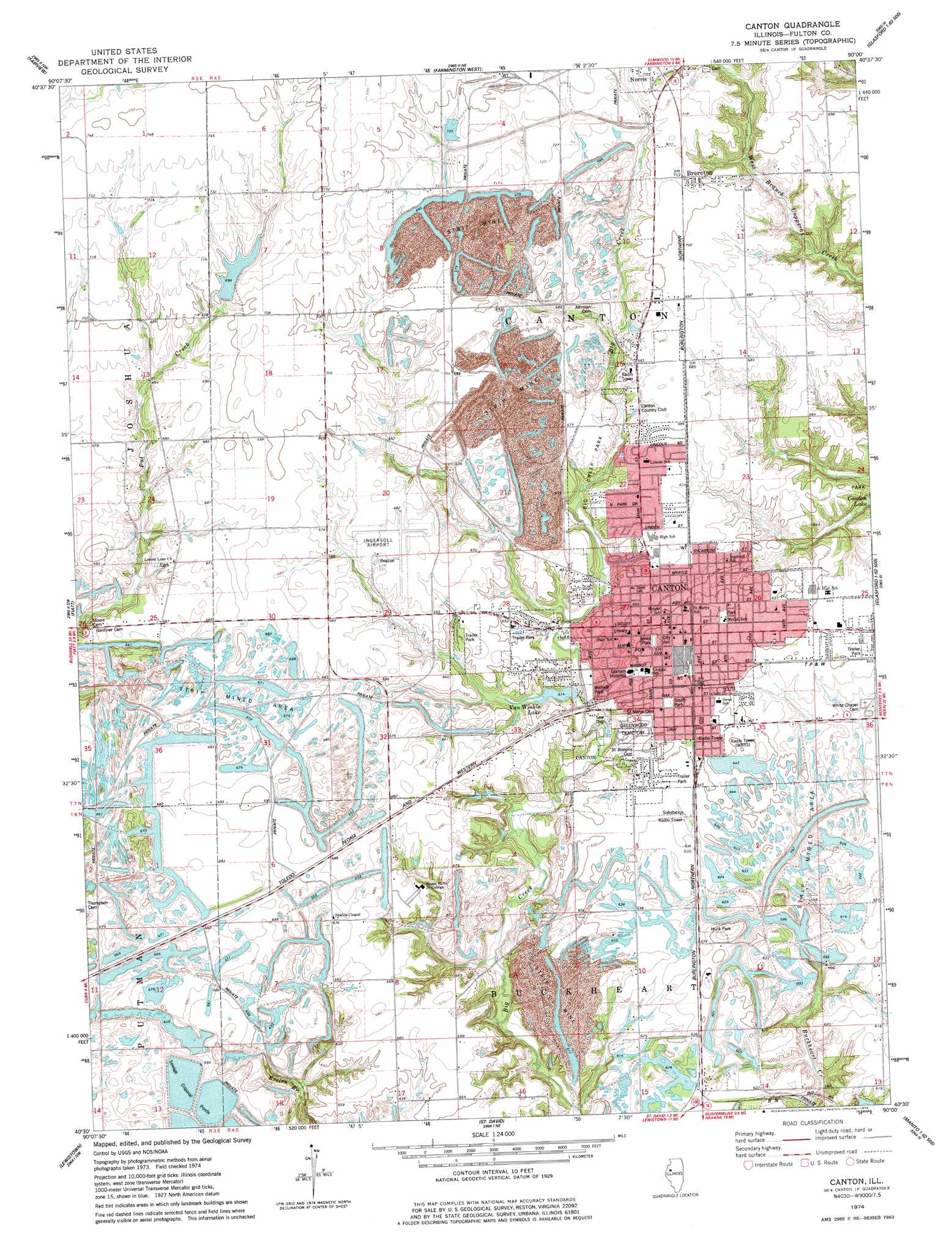
Canton Topo Map Illinois
To zoom in, hover over the map of Canton
USGS Topo Quad 40090e1 - 1:24,000 scale
| Topo Map Name: | Canton |
| USGS Topo Quad ID: | 40090e1 |
| Print Size: | ca. 21 1/4" wide x 27" high |
| Southeast Coordinates: | 40.5° N latitude / 90° W longitude |
| Map Center Coordinates: | 40.5625° N latitude / 90.0625° W longitude |
| U.S. State: | IL |
| Filename: | o40090e1.jpg |
| Download Map JPG Image: | Canton topo map 1:24,000 scale |
| Map Type: | Topographic |
| Topo Series: | 7.5´ |
| Map Scale: | 1:24,000 |
| Source of Map Images: | United States Geological Survey (USGS) |
| Alternate Map Versions: |
Canton IL 1974, updated 1978 Download PDF Buy paper map Canton IL 1995, updated 1996 Download PDF Buy paper map Canton IL 2012 Download PDF Buy paper map Canton IL 2015 Download PDF Buy paper map |
1:24,000 Topo Quads surrounding Canton
De Long |
Maquon |
Yates City |
Elmwood |
Oak Hill |
London Mills |
Fairview |
Farmington West |
Farmington East |
Hanna City |
Blyton |
Fiatt |
Canton |
Banner |
Glasford |
Smithfield |
Lewiston |
Saint David |
Duck Island |
Manito |
Ipava |
Duncan Mills |
Havana |
Topeka |
Forest City |
> Back to 40090e1 at 1:100,000 scale
> Back to 40090a1 at 1:250,000 scale
> Back to U.S. Topo Maps home
Canton topo map: Gazetteer
Canton: Airports
Ingersoll Airport elevation 206m 675′Canton: Dams
MSDGC Dam Number 3 elevation 191m 626′Van Winkle Lake Dam elevation 185m 606′
Wolf Pond Dam elevation 225m 738′
Canton: Mines
Canton Mine elevation 195m 639′Eagle Mine elevation 209m 685′
Simmons Mine elevation 207m 679′
Canton: Parks
Anderson Park elevation 199m 652′Big Creek Park elevation 203m 666′
Dean Park elevation 199m 652′
Hulit Park elevation 205m 672′
Jones Park elevation 201m 659′
Kellogg Park elevation 201m 659′
Lakeland Park elevation 205m 672′
McCall Park elevation 201m 659′
Memorial Stadium elevation 200m 656′
South Park elevation 201m 659′
Wallace Park elevation 185m 606′
Canton: Populated Places
Brereton elevation 215m 705′Canton elevation 197m 646′
Civer (historical) elevation 207m 679′
East Lawndale elevation 196m 643′
Fulton Center (historical) elevation 205m 672′
Prospect Heights Addition elevation 199m 652′
Village Square elevation 196m 643′
Westview Acres elevation 199m 652′
Canton: Post Offices
Canton Post Office elevation 199m 652′Canton: Reservoirs
Bond Lake elevation 201m 659′Fitch Lake elevation 202m 662′
Rainbow Lake elevation 207m 679′
Strode Lake elevation 205m 672′
Van Winkle Lake elevation 185m 606′
Veterans Lake elevation 205m 672′
Wolf Pond elevation 225m 738′
Canton digital topo map on disk
Buy this Canton topo map showing relief, roads, GPS coordinates and other geographical features, as a high-resolution digital map file on DVD: