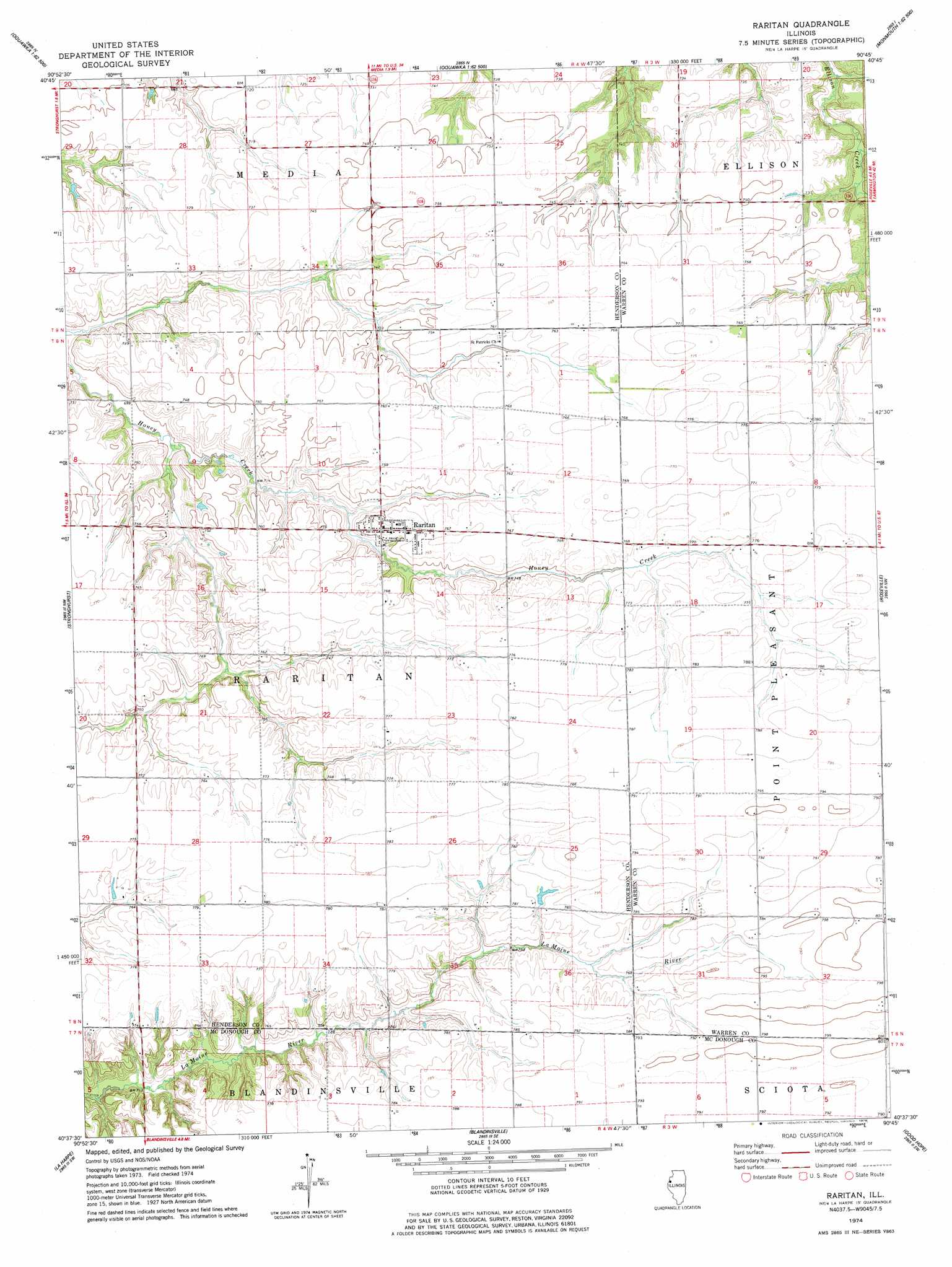
Raritan Topo Map Illinois
To zoom in, hover over the map of Raritan
USGS Topo Quad 40090f7 - 1:24,000 scale
| Topo Map Name: | Raritan |
| USGS Topo Quad ID: | 40090f7 |
| Print Size: | ca. 21 1/4" wide x 27" high |
| Southeast Coordinates: | 40.625° N latitude / 90.75° W longitude |
| Map Center Coordinates: | 40.6875° N latitude / 90.8125° W longitude |
| U.S. State: | IL |
| Filename: | o40090f7.jpg |
| Download Map JPG Image: | Raritan topo map 1:24,000 scale |
| Map Type: | Topographic |
| Topo Series: | 7.5´ |
| Map Scale: | 1:24,000 |
| Source of Map Images: | United States Geological Survey (USGS) |
| Alternate Map Versions: |
Raritan IL 1974, updated 1978 Download PDF Buy paper map Raritan IL 2012 Download PDF Buy paper map Raritan IL 2015 Download PDF Buy paper map |
1:24,000 Topo Quads surrounding Raritan
Kingston |
Oquawka |
Rozetta |
Monmouth |
Cameron |
Burlington |
Gladstone |
Kirkwood West |
Kirkwood East |
Berwick |
Lomax |
Stronghurst |
Raritan |
Roseville |
Greenbush |
Burnside |
La Harpe |
Blandinsville |
Good Hope |
Bushnell West |
Carthage East |
Fountain Green |
Colchester |
Macomb |
Bardolph |
> Back to 40090e1 at 1:100,000 scale
> Back to 40090a1 at 1:250,000 scale
> Back to U.S. Topo Maps home
Raritan topo map: Gazetteer
Raritan: Populated Places
Raritan elevation 232m 761′Raritan: Streams
Horse Branch elevation 223m 731′Raritan digital topo map on disk
Buy this Raritan topo map showing relief, roads, GPS coordinates and other geographical features, as a high-resolution digital map file on DVD: