Appleton Topo Map Illinois
To zoom in, hover over the map of Appleton
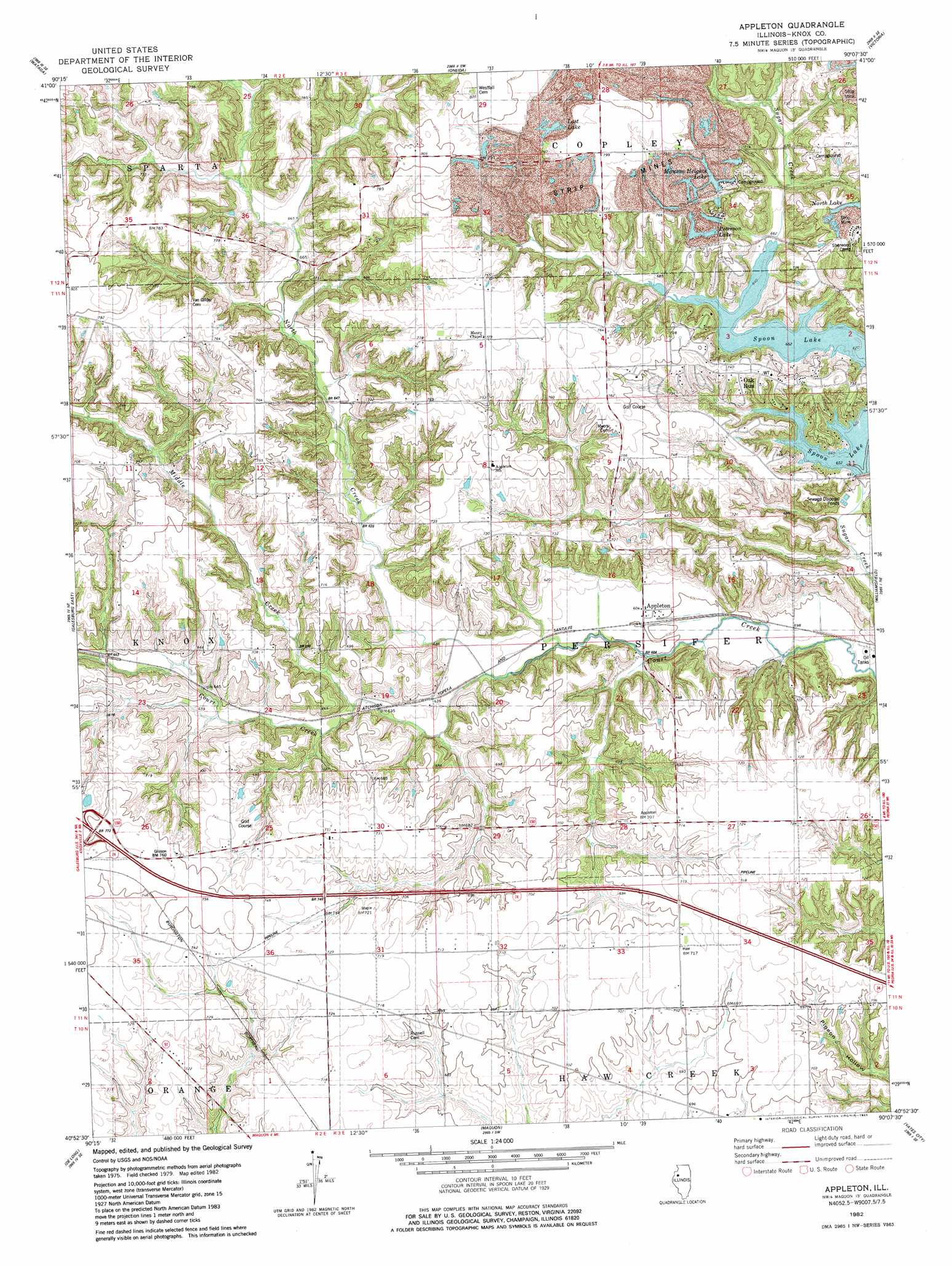
USGS Topo Quad 40090h2 - 1:24,000 scale
| Topo Map Name: | Appleton |
| USGS Topo Quad ID: | 40090h2 |
| Print Size: | ca. 21 1/4" wide x 27" high |
| Southeast Coordinates: | 40.875° N latitude / 90.125° W longitude |
| Map Center Coordinates: | 40.9375° N latitude / 90.1875° W longitude |
| U.S. State: | IL |
| Filename: | o40090h2.jpg |
| Download Map JPG Image: | Appleton topo map 1:24,000 scale |
| Map Type: | Topographic |
| Topo Series: | 7.5´ |
| Map Scale: | 1:24,000 |
| Source of Map Images: | United States Geological Survey (USGS) |
| Alternate Map Versions: |
Appleton IL 1982, updated 1983 Download PDF Buy paper map Appleton IL 1998, updated 2001 Download PDF Buy paper map Appleton IL 2012 Download PDF Buy paper map Appleton IL 2015 Download PDF Buy paper map |
1:24,000 Topo Quads surrounding Appleton
New Windsor |
Woodhull |
Nekoma |
Galva |
Kewanee South |
North Henderson |
Wataga |
Oneida |
Victoria |
Lafayette |
Galesburg West |
Galesburg East |
Appleton |
Williamsfield |
Laura |
Abingdon |
De Long |
Maquon |
Yates City |
Elmwood |
Avon |
London Mills |
Fairview |
Farmington West |
Farmington East |
> Back to 40090e1 at 1:100,000 scale
> Back to 40090a1 at 1:250,000 scale
> Back to U.S. Topo Maps home
Appleton topo map: Gazetteer
Appleton: Crossings
Interchange 54 elevation 230m 754′Appleton: Dams
Bruington Lake Dam elevation 231m 757′Appleton: Mines
Knoxville Mine elevation 214m 702′Thermal Mine elevation 218m 715′
Appleton: Populated Places
Appleton elevation 184m 603′Oak Run elevation 225m 738′
Appleton: Reservoirs
Bruington Lake elevation 231m 757′Manson Heights Lake elevation 229m 751′
Peterson Lake elevation 226m 741′
Appleton: Streams
Middle Creek elevation 194m 636′North Creek elevation 186m 610′
Appleton digital topo map on disk
Buy this Appleton topo map showing relief, roads, GPS coordinates and other geographical features, as a high-resolution digital map file on DVD: