Monmouth Topo Map Illinois
To zoom in, hover over the map of Monmouth
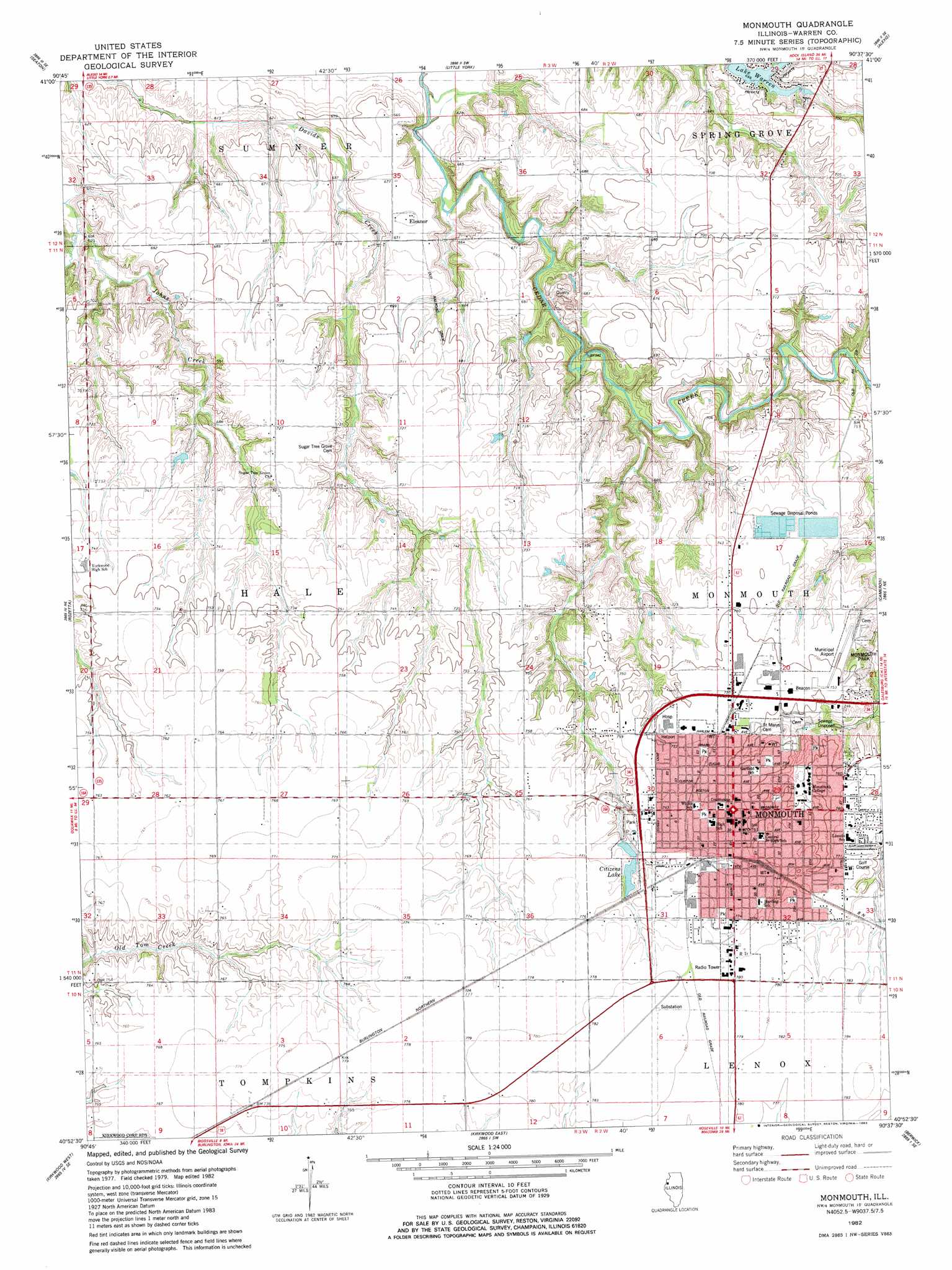
USGS Topo Quad 40090h6 - 1:24,000 scale
| Topo Map Name: | Monmouth |
| USGS Topo Quad ID: | 40090h6 |
| Print Size: | ca. 21 1/4" wide x 27" high |
| Southeast Coordinates: | 40.875° N latitude / 90.625° W longitude |
| Map Center Coordinates: | 40.9375° N latitude / 90.6875° W longitude |
| U.S. State: | IL |
| Filename: | o40090h6.jpg |
| Download Map JPG Image: | Monmouth topo map 1:24,000 scale |
| Map Type: | Topographic |
| Topo Series: | 7.5´ |
| Map Scale: | 1:24,000 |
| Source of Map Images: | United States Geological Survey (USGS) |
| Alternate Map Versions: |
Monmouth IL 1982, updated 1983 Download PDF Buy paper map Monmouth IL 1998, updated 2000 Download PDF Buy paper map Monmouth IL 2012 Download PDF Buy paper map Monmouth IL 2015 Download PDF Buy paper map |
1:24,000 Topo Quads surrounding Monmouth
Joy |
Aledo West |
Aledo East |
Viola |
New Windsor |
Keithsburg |
Seaton |
Little York |
Alexis |
North Henderson |
Oquawka |
Rozetta |
Monmouth |
Cameron |
Galesburg West |
Gladstone |
Kirkwood West |
Kirkwood East |
Berwick |
Abingdon |
Stronghurst |
Raritan |
Roseville |
Greenbush |
Avon |
> Back to 40090e1 at 1:100,000 scale
> Back to 40090a1 at 1:250,000 scale
> Back to U.S. Topo Maps home
Monmouth topo map: Gazetteer
Monmouth: Airports
Community Memorial Hospital Heliport elevation 231m 757′Gillen Airport elevation 232m 761′
Monmouth Municipal Airport elevation 228m 748′
Monmouth: Dams
Citizens Lake Dam elevation 230m 754′Monmouth: Mines
Monmouth Quarry elevation 197m 646′Monmouth: Parks
Buster White Park elevation 235m 770′Diffenbaugh-Harmon Park elevation 232m 761′
Garwood Park elevation 225m 738′
Monmouth Park elevation 210m 688′
North Park elevation 230m 754′
Public Square elevation 232m 761′
Siper Diffenbaugh Park elevation 236m 774′
Warfield Park elevation 234m 767′
West Park elevation 232m 761′
Monmouth: Populated Places
Denny (historical) elevation 201m 659′Eleanor elevation 207m 679′
Monmouth elevation 232m 761′
Monmouth: Post Offices
Monmouth Post Office elevation 231m 757′Monmouth: Reservoirs
Citizens Lake elevation 230m 754′Monmouth: Streams
Talbot Creek elevation 197m 646′Monmouth digital topo map on disk
Buy this Monmouth topo map showing relief, roads, GPS coordinates and other geographical features, as a high-resolution digital map file on DVD: