Bowen Topo Map Illinois
To zoom in, hover over the map of Bowen
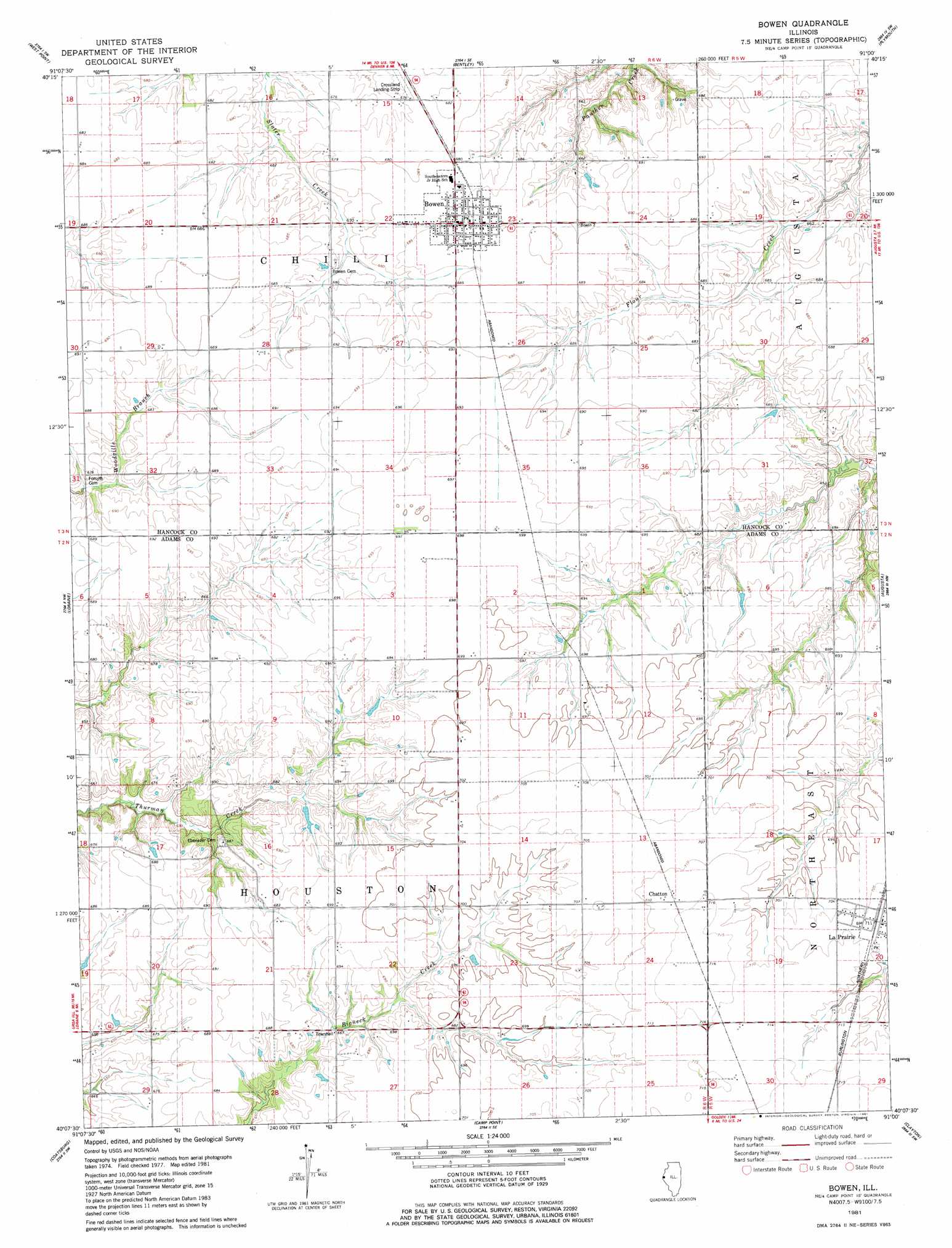
USGS Topo Quad 40091b1 - 1:24,000 scale
| Topo Map Name: | Bowen |
| USGS Topo Quad ID: | 40091b1 |
| Print Size: | ca. 21 1/4" wide x 27" high |
| Southeast Coordinates: | 40.125° N latitude / 91° W longitude |
| Map Center Coordinates: | 40.1875° N latitude / 91.0625° W longitude |
| U.S. State: | IL |
| Filename: | o40091b1.jpg |
| Download Map JPG Image: | Bowen topo map 1:24,000 scale |
| Map Type: | Topographic |
| Topo Series: | 7.5´ |
| Map Scale: | 1:24,000 |
| Source of Map Images: | United States Geological Survey (USGS) |
| Alternate Map Versions: |
Bowen IL 1981, updated 1981 Download PDF Buy paper map Bowen IL 2012 Download PDF Buy paper map Bowen IL 2015 Download PDF Buy paper map |
1:24,000 Topo Quads surrounding Bowen
Hamilton |
Carthage West |
Carthage East |
Fountain Green |
Colchester |
Sutter |
West Point |
Bentley |
Plymouth |
Fandon |
Tioga |
Loraine |
Bowen |
Augusta |
Camden |
Mendon |
Coatsburg |
Camp Point |
Clayton |
Lake Mount Sterling |
Quincy East |
Columbus |
Liberty |
Kellerville |
Mount Sterling |
> Back to 40091a1 at 1:100,000 scale
> Back to 40090a1 at 1:250,000 scale
> Back to U.S. Topo Maps home
Bowen topo map: Gazetteer
Bowen: Airports
Baker Airport elevation 216m 708′Bowen: Dams
Eilers Lake Dam elevation 213m 698′Bowen: Populated Places
Bowen elevation 210m 688′Chatton elevation 217m 711′
La Prairie elevation 216m 708′
Bowen: Post Offices
Chatton Post Office (historical) elevation 214m 702′Pitman Post Office (historical) elevation 216m 708′
Bowen: Reservoirs
Eilers Lake elevation 213m 698′Bowen digital topo map on disk
Buy this Bowen topo map showing relief, roads, GPS coordinates and other geographical features, as a high-resolution digital map file on DVD: