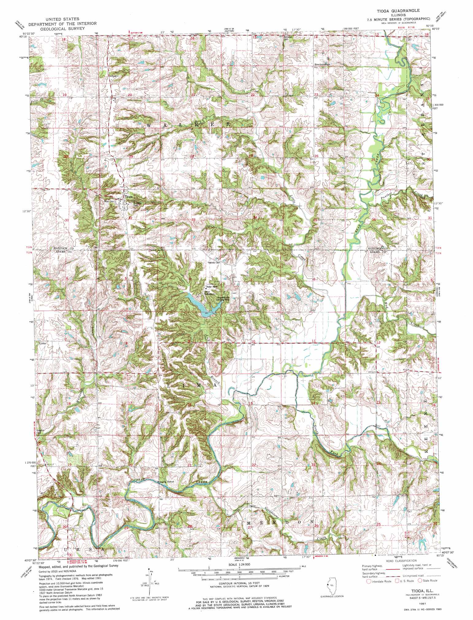
Tioga Topo Map Illinois
To zoom in, hover over the map of Tioga
USGS Topo Quad 40091b3 - 1:24,000 scale
| Topo Map Name: | Tioga |
| USGS Topo Quad ID: | 40091b3 |
| Print Size: | ca. 21 1/4" wide x 27" high |
| Southeast Coordinates: | 40.125° N latitude / 91.25° W longitude |
| Map Center Coordinates: | 40.1875° N latitude / 91.3125° W longitude |
| U.S. State: | IL |
| Filename: | o40091b3.jpg |
| Download Map JPG Image: | Tioga topo map 1:24,000 scale |
| Map Type: | Topographic |
| Topo Series: | 7.5´ |
| Map Scale: | 1:24,000 |
| Source of Map Images: | United States Geological Survey (USGS) |
| Alternate Map Versions: |
Tioga IL 1981, updated 1981 Download PDF Buy paper map Tioga IL 2012 Download PDF Buy paper map Tioga IL 2015 Download PDF Buy paper map |
1:24,000 Topo Quads surrounding Tioga
Wayland |
Keokuk |
Hamilton |
Carthage West |
Carthage East |
Kahoka Se |
Warsaw |
Sutter |
West Point |
Bentley |
Canton |
Lima |
Tioga |
Loraine |
Bowen |
La Grange |
Long Island |
Mendon |
Coatsburg |
Camp Point |
Maywood |
Quincy West |
Quincy East |
Columbus |
Liberty |
> Back to 40091a1 at 1:100,000 scale
> Back to 40090a1 at 1:250,000 scale
> Back to U.S. Topo Maps home
Tioga topo map: Gazetteer
Tioga: Airports
Hagemeister Landing Strip elevation 202m 662′Tioga: Dams
Camp Saukenauk Lake Dam elevation 189m 620′Tioga: Populated Places
Breckenridge elevation 201m 659′Tioga elevation 227m 744′
Tioga: Post Offices
Tioga Post Office (historical) elevation 227m 744′Tioga: Reservoirs
Camp Saukenauk Lake elevation 189m 620′Tioga: Streams
Grindstone Creek elevation 158m 518′Lick Branch elevation 160m 524′
Little Creek elevation 162m 531′
Mud Creek elevation 165m 541′
Panther Creek elevation 165m 541′
South Fork Bear Creek elevation 157m 515′
Tioga digital topo map on disk
Buy this Tioga topo map showing relief, roads, GPS coordinates and other geographical features, as a high-resolution digital map file on DVD: