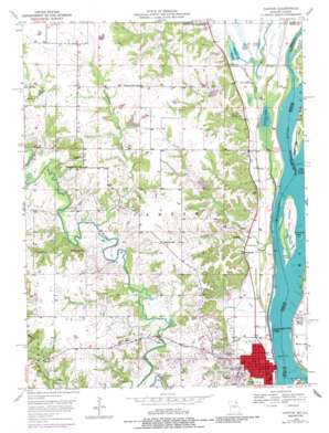
Canton Topo Map Missouri
To zoom in, hover over the map of Canton
USGS Topo Quad 40091b5 - 1:24,000 scale
| Topo Map Name: | Canton |
| USGS Topo Quad ID: | 40091b5 |
| Print Size: | ca. 21 1/4" wide x 27" high |
| Southeast Coordinates: | 40.125° N latitude / 91.5° W longitude |
| Map Center Coordinates: | 40.1875° N latitude / 91.5625° W longitude |
| U.S. States: | MO, IL |
| Filename: | o40091b5.jpg |
| Download Map JPG Image: | Canton topo map 1:24,000 scale |
| Map Type: | Topographic |
| Topo Series: | 7.5´ |
| Map Scale: | 1:24,000 |
| Source of Map Images: | United States Geological Survey (USGS) |
| Alternate Map Versions: |
Canton MO 1950, updated 1967 Download PDF Buy paper map Canton MO 1950, updated 1977 Download PDF Buy paper map Canton MO 1950, updated 1986 Download PDF Buy paper map Canton MO 1951 Download PDF Buy paper map Canton MO 2012 Download PDF Buy paper map Canton MO 2015 Download PDF Buy paper map |
1:24,000 Topo Quads surrounding Canton
> Back to 40091a1 at 1:100,000 scale
> Back to 40090a1 at 1:250,000 scale
> Back to U.S. Topo Maps home
Canton topo map: Gazetteer
Canton: Airports
The Adwell Corporation Airport elevation 146m 479′Canton: Crossings
Canton Ferry elevation 146m 479′Canton: Dams
Baxter Lake Dam elevation 168m 551′Buck Doe Run Creek Watershed Dam Number 43 elevation 173m 567′
Buck-Doe Run Creeks Watershed Lake Number 39 Dam elevation 170m 557′
Buck-Doe Run Creeks Watershed Number 5 Dam elevation 174m 570′
Buck-Doe Run Creeks Watershed Structure Number 6 Dam elevation 175m 574′
Buck-Doe Run Watershed Structure Number 25 Dam elevation 179m 587′
Buck-Doe Run Watershed Structure Number 27a Dam elevation 184m 603′
Buck-Doe Run Watershed Structure Number 27b Dam elevation 191m 626′
Buck-Doe Run Watershed Structure Number 3 Dam elevation 168m 551′
Buck-Doe Run Watershed Structure Number 35 Dam elevation 159m 521′
Buck-Doe Run Watershed Structure Number 38 Dam elevation 172m 564′
Buck-Doe Run Watershed Structure Number 42 Dam elevation 165m 541′
Clark Lake Dam elevation 172m 564′
Lewis County Number 36 Dam elevation 178m 583′
Lewis County Number 37 Dam elevation 186m 610′
Lock and Dam Number 20 elevation 148m 485′
Lock and Dam Number Twenty elevation 146m 479′
Marks Lake Dam elevation 183m 600′
Uhlmeyer Lake Dam elevation 175m 574′
Willer Lake Dam elevation 195m 639′
Willer Lake Section 20 Dam elevation 194m 636′
Willer Lake Section 32 Dam elevation 183m 600′
Canton: Islands
Brownsville Island elevation 146m 479′Hardy Bar Island elevation 149m 488′
Tully Island elevation 147m 482′
White Island elevation 147m 482′
Canton: Lakes
Baxter Ponds elevation 146m 479′Long Pond elevation 146m 479′
O'Farre Lake elevation 146m 479′
Round Pond elevation 147m 482′
Canton: Populated Places
Laura elevation 203m 666′Meyer elevation 148m 485′
Santuzza elevation 183m 600′
Tully elevation 148m 485′
Canton: Reservoirs
Baxter Lake elevation 168m 551′Bruns Lake elevation 175m 574′
Buck-Doe Run Creeks Watershed Lake Number 39 elevation 170m 557′
Buck-Doe Run Watershed Lake Number 25 elevation 179m 587′
Clark Lake elevation 172m 564′
Higbee Lake elevation 168m 551′
Lloyd Lake North elevation 165m 541′
Lloyd Lake South elevation 173m 567′
Long Lake elevation 172m 564′
Marks Lake elevation 183m 600′
McCullough South Dam elevation 174m 570′
Schlotter Lake elevation 159m 521′
Uhlmeyer Lake elevation 175m 574′
Willer Lake elevation 195m 639′
Willer Lake Section 20 elevation 194m 636′
Willer Lake Section 32 elevation 183m 600′
Canton: Streams
Artesian Branch elevation 148m 485′Buck Run elevation 146m 479′
Crooked Creek elevation 165m 541′
Canton: Summits
College Hill elevation 184m 603′Canton digital topo map on disk
Buy this Canton topo map showing relief, roads, GPS coordinates and other geographical features, as a high-resolution digital map file on DVD:


