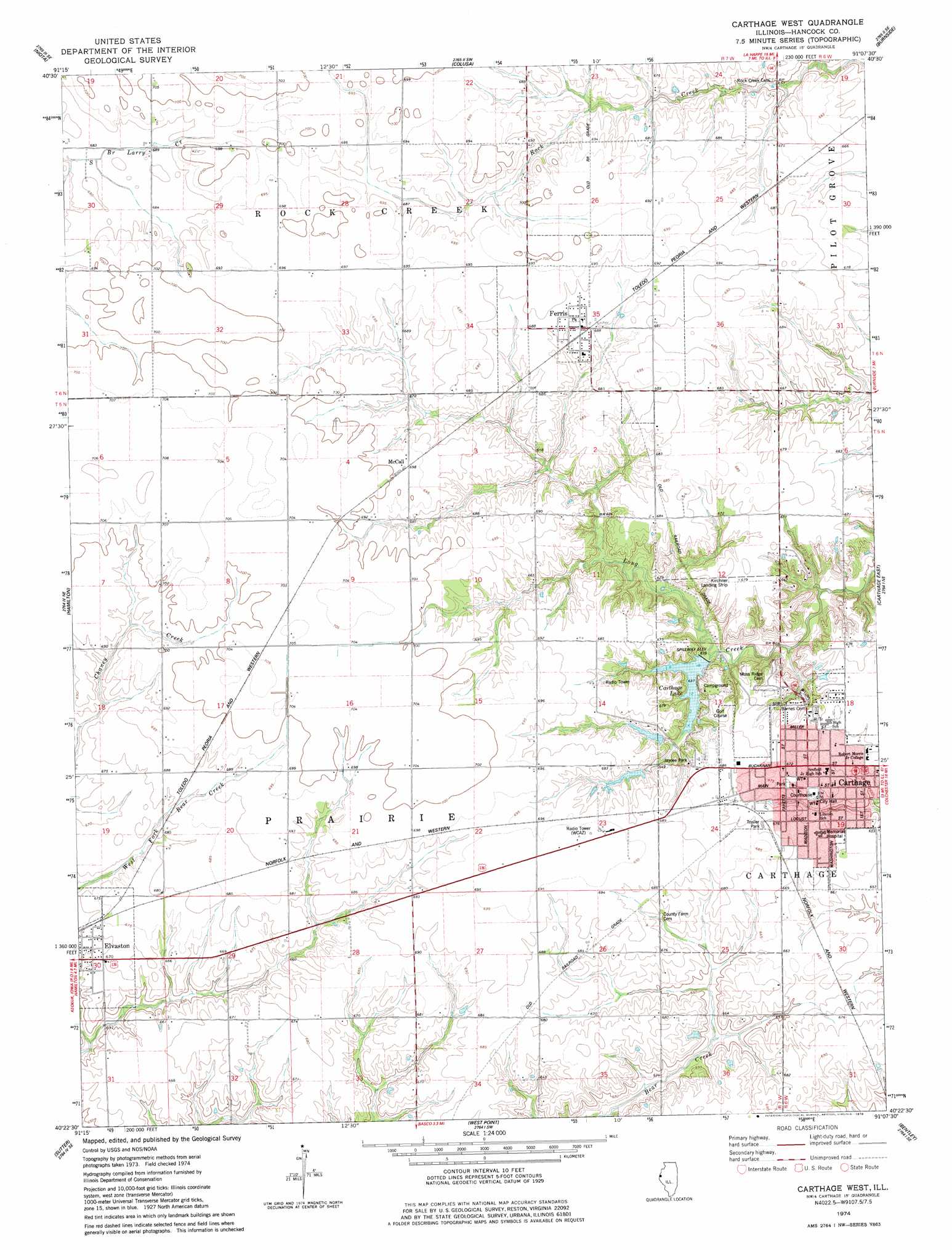
Carthage West Topo Map Illinois
To zoom in, hover over the map of Carthage West
USGS Topo Quad 40091d2 - 1:24,000 scale
| Topo Map Name: | Carthage West |
| USGS Topo Quad ID: | 40091d2 |
| Print Size: | ca. 21 1/4" wide x 27" high |
| Southeast Coordinates: | 40.375° N latitude / 91.125° W longitude |
| Map Center Coordinates: | 40.4375° N latitude / 91.1875° W longitude |
| U.S. State: | IL |
| Filename: | o40091d2.jpg |
| Download Map JPG Image: | Carthage West topo map 1:24,000 scale |
| Map Type: | Topographic |
| Topo Series: | 7.5´ |
| Map Scale: | 1:24,000 |
| Source of Map Images: | United States Geological Survey (USGS) |
| Alternate Map Versions: |
Carthage West IL 1974, updated 1978 Download PDF Buy paper map Carthage West IL 2012 Download PDF Buy paper map Carthage West IL 2015 Download PDF Buy paper map |
1:24,000 Topo Quads surrounding Carthage West
West Point |
Fort Madison |
Dallas City |
Lomax |
Stronghurst |
Nauvoo |
Niota |
Colusa |
Burnside |
La Harpe |
Keokuk |
Hamilton |
Carthage West |
Carthage East |
Fountain Green |
Warsaw |
Sutter |
West Point |
Bentley |
Plymouth |
Lima |
Tioga |
Loraine |
Bowen |
Augusta |
> Back to 40091a1 at 1:100,000 scale
> Back to 40090a1 at 1:250,000 scale
> Back to U.S. Topo Maps home
Carthage West topo map: Gazetteer
Carthage West: Airports
Hanks Hangar Airport elevation 210m 688′Kirchner Airport elevation 207m 679′
Martins Airport elevation 210m 688′
Memorial Hospital Heliport elevation 204m 669′
Schilson Field elevation 214m 702′
Carthage West: Dams
Carthage Lake Number 2 Dam elevation 191m 626′Carthage West: Parks
Carthage Courthouse Square Historic District elevation 204m 669′Jaycee Park elevation 208m 682′
Carthage West: Populated Places
Carthage elevation 204m 669′Elvaston elevation 201m 659′
Ferris elevation 208m 682′
McCall elevation 212m 695′
Carthage West: Reservoirs
Carthage Lake elevation 191m 626′Carthage West digital topo map on disk
Buy this Carthage West topo map showing relief, roads, GPS coordinates and other geographical features, as a high-resolution digital map file on DVD: