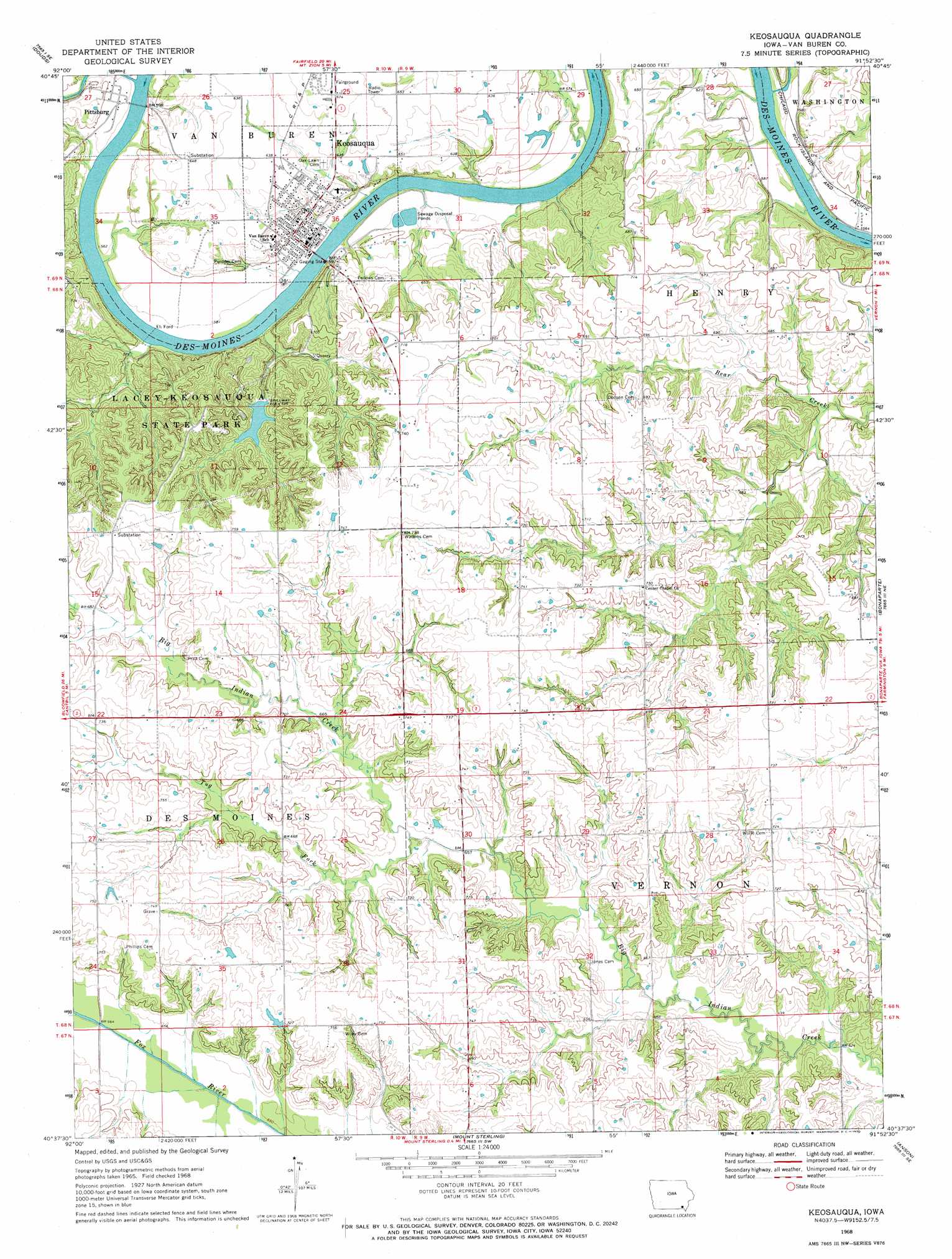
Keosauqua Topo Map Iowa
To zoom in, hover over the map of Keosauqua
USGS Topo Quad 40091f8 - 1:24,000 scale
| Topo Map Name: | Keosauqua |
| USGS Topo Quad ID: | 40091f8 |
| Print Size: | ca. 21 1/4" wide x 27" high |
| Southeast Coordinates: | 40.625° N latitude / 91.875° W longitude |
| Map Center Coordinates: | 40.6875° N latitude / 91.9375° W longitude |
| U.S. State: | IA |
| Filename: | o40091f8.jpg |
| Download Map JPG Image: | Keosauqua topo map 1:24,000 scale |
| Map Type: | Topographic |
| Topo Series: | 7.5´ |
| Map Scale: | 1:24,000 |
| Source of Map Images: | United States Geological Survey (USGS) |
| Alternate Map Versions: |
Keosauqua IA 1968, updated 1970 Download PDF Buy paper map Keosauqua IA 2010 Download PDF Buy paper map Keosauqua IA 2013 Download PDF Buy paper map Keosauqua IA 2015 Download PDF Buy paper map |
1:24,000 Topo Quads surrounding Keosauqua
Eldon |
Libertyville |
Fairfield South |
Lockridge West |
Lockridge East |
Selma |
Douds |
Mount Zion |
Stockport |
Hillsboro |
Milton |
Cantril |
Keosauqua |
Bonaparte |
Farmington |
Brock |
Azen |
Mount Sterling |
Anson |
Croton |
Memphis |
Arbela |
Wyaconda |
Medill |
Kahoka |
> Back to 40091e1 at 1:100,000 scale
> Back to 40090a1 at 1:250,000 scale
> Back to U.S. Topo Maps home
Keosauqua topo map: Gazetteer
Keosauqua: Airports
Keosauqua Municipal Airport elevation 173m 567′Keosauqua: Parks
Lacey-Keosauqua State Park elevation 222m 728′Old Military Road Historical Marker elevation 224m 734′
Peacock Ball Park elevation 178m 583′
Keosauqua: Populated Places
Keosauqua elevation 178m 583′Pittsburg elevation 179m 587′
Pleasant Hill (historical) elevation 191m 626′
Keosauqua: Post Offices
Keosauqua Post Office elevation 180m 590′Pittsburg Post Office (historical) elevation 179m 587′
Pleasant Hill Post Office (historical) elevation 191m 626′
Keosauqua: Streams
Chequest Creek elevation 173m 567′Coppers Creek elevation 166m 544′
Duckworth Creek elevation 182m 597′
Elys Creek elevation 171m 561′
Town Branch elevation 173m 567′
Tug Fork Big Indian Creek elevation 195m 639′
Valley Branch elevation 198m 649′
Keosauqua digital topo map on disk
Buy this Keosauqua topo map showing relief, roads, GPS coordinates and other geographical features, as a high-resolution digital map file on DVD: