Lowell Topo Map Iowa
To zoom in, hover over the map of Lowell
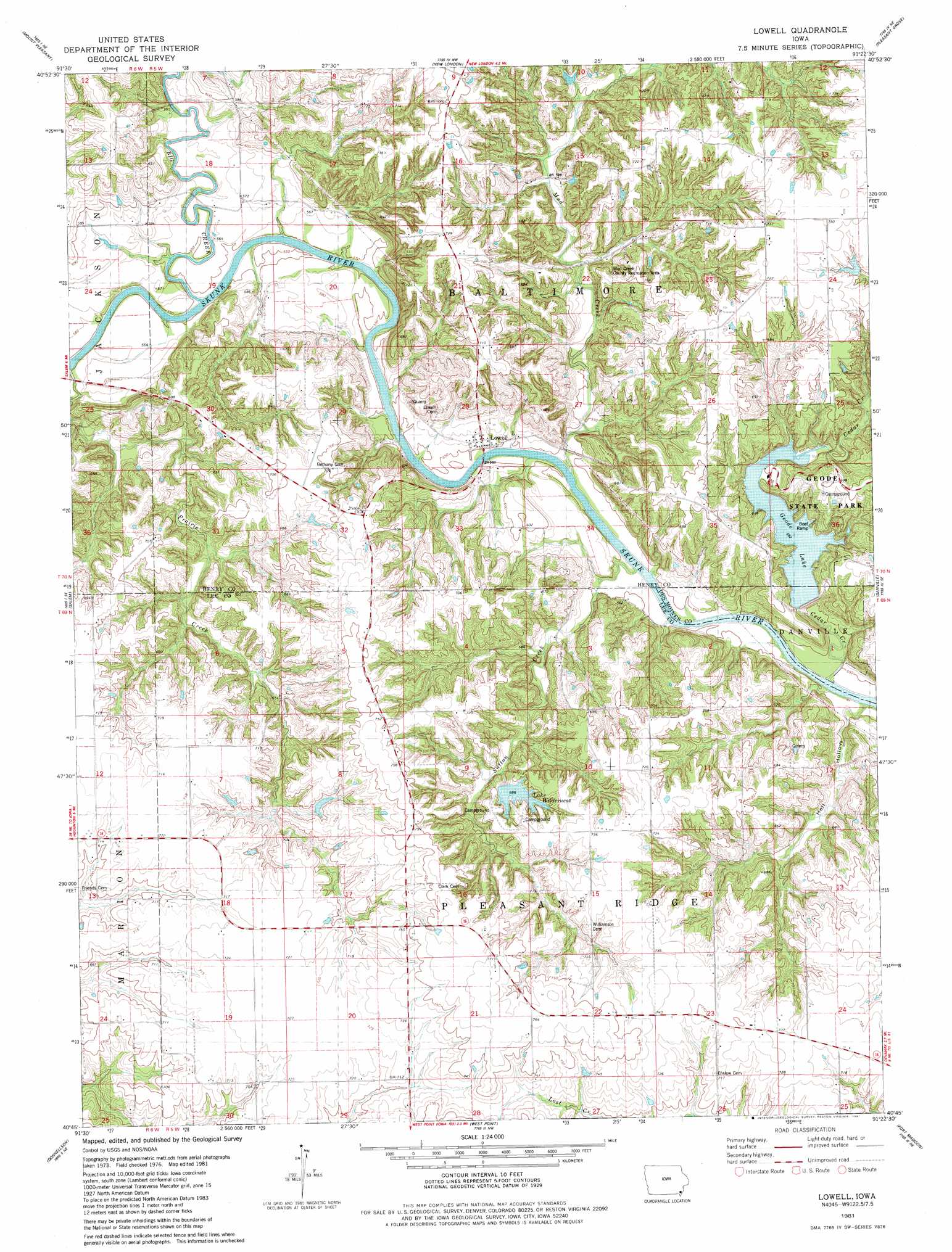
USGS Topo Quad 40091g4 - 1:24,000 scale
| Topo Map Name: | Lowell |
| USGS Topo Quad ID: | 40091g4 |
| Print Size: | ca. 21 1/4" wide x 27" high |
| Southeast Coordinates: | 40.75° N latitude / 91.375° W longitude |
| Map Center Coordinates: | 40.8125° N latitude / 91.4375° W longitude |
| U.S. State: | IA |
| Filename: | o40091g4.jpg |
| Download Map JPG Image: | Lowell topo map 1:24,000 scale |
| Map Type: | Topographic |
| Topo Series: | 7.5´ |
| Map Scale: | 1:24,000 |
| Source of Map Images: | United States Geological Survey (USGS) |
| Alternate Map Versions: |
Lowell IA 1981, updated 1981 Download PDF Buy paper map Lowell IA 2010 Download PDF Buy paper map Lowell IA 2013 Download PDF Buy paper map Lowell IA 2015 Download PDF Buy paper map |
1:24,000 Topo Quads surrounding Lowell
Trenton |
Swedesburg |
Winfield South |
Morning Sun |
Mediapolis |
Lockridge East |
Mount Pleasant |
New London |
Pleasant Grove |
Sperry |
Hillsboro |
Salem |
Lowell |
Danville |
West Burlington |
Farmington |
Donnellson |
West Point |
Fort Madison |
Dallas City |
Croton |
Argyle |
Nauvoo |
Niota |
Colusa |
> Back to 40091e1 at 1:100,000 scale
> Back to 40090a1 at 1:250,000 scale
> Back to U.S. Topo Maps home
Lowell topo map: Gazetteer
Lowell: Lakes
Lake Wilderness elevation 208m 682′Lowell: Parks
Abram Clark Historical Marker elevation 229m 751′First Flour Mill in Iowa Historical Marker elevation 166m 544′
Geode State Park elevation 204m 669′
Lowell City Park elevation 166m 544′
Mud Creek County Recreation Area elevation 182m 597′
Stephenson Park elevation 166m 544′
Lowell: Populated Places
Baltimore (historical) elevation 174m 570′Lowell elevation 181m 593′
Lowell: Post Offices
Beery Post Office (historical) elevation 178m 583′Lowell Post Office (historical) elevation 181m 593′
Pleasant Ridge Post Office (historical) elevation 197m 646′
Lowell: Reservoirs
Geode Lake elevation 182m 597′Lowell: Streams
Big Creek elevation 168m 551′Cedar Creek elevation 194m 636′
Hell Hollow elevation 164m 538′
Mud Creek elevation 165m 541′
Prairie Creek elevation 170m 557′
Lowell digital topo map on disk
Buy this Lowell topo map showing relief, roads, GPS coordinates and other geographical features, as a high-resolution digital map file on DVD: