Pleasant Grove Topo Map Iowa
To zoom in, hover over the map of Pleasant Grove
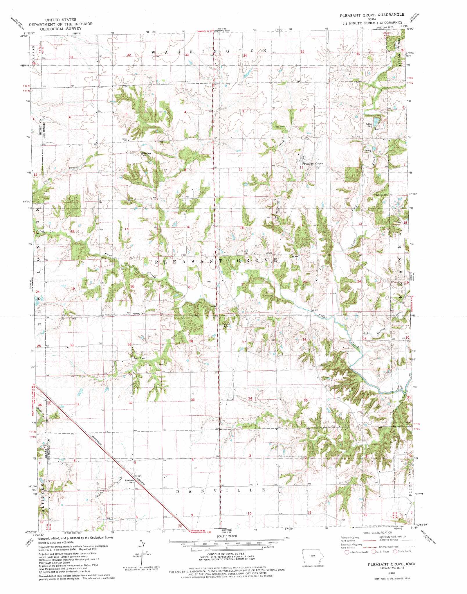
USGS Topo Quad 40091h3 - 1:24,000 scale
| Topo Map Name: | Pleasant Grove |
| USGS Topo Quad ID: | 40091h3 |
| Print Size: | ca. 21 1/4" wide x 27" high |
| Southeast Coordinates: | 40.875° N latitude / 91.25° W longitude |
| Map Center Coordinates: | 40.9375° N latitude / 91.3125° W longitude |
| U.S. State: | IA |
| Filename: | o40091h3.jpg |
| Download Map JPG Image: | Pleasant Grove topo map 1:24,000 scale |
| Map Type: | Topographic |
| Topo Series: | 7.5´ |
| Map Scale: | 1:24,000 |
| Source of Map Images: | United States Geological Survey (USGS) |
| Alternate Map Versions: |
Pleasant Grove IA 1981, updated 1981 Download PDF Buy paper map Pleasant Grove IA 2010 Download PDF Buy paper map Pleasant Grove IA 2013 Download PDF Buy paper map Pleasant Grove IA 2015 Download PDF Buy paper map |
1:24,000 Topo Quads surrounding Pleasant Grove
Crawfordsville |
Winfield North |
Cairo |
Wapello |
Toolesboro |
Swedesburg |
Winfield South |
Morning Sun |
Mediapolis |
Oakville |
Mount Pleasant |
New London |
Pleasant Grove |
Sperry |
Kingston |
Salem |
Lowell |
Danville |
West Burlington |
Burlington |
Donnellson |
West Point |
Fort Madison |
Dallas City |
Lomax |
> Back to 40091e1 at 1:100,000 scale
> Back to 40090a1 at 1:250,000 scale
> Back to U.S. Topo Maps home
Pleasant Grove topo map: Gazetteer
Pleasant Grove: Parks
Stage Coach Depot Historical Marker elevation 222m 728′Pleasant Grove: Populated Places
Pleasant Grove elevation 219m 718′Prairie Grove elevation 220m 721′
Pleasant Grove: Post Offices
Fan Post Office (historical) elevation 218m 715′Pleasantgrove Post Office (historical) elevation 219m 718′
Pleasant Grove: Streams
Big Hollow Creek elevation 186m 610′Cedar Fork Creek elevation 185m 606′
Pleasant Grove digital topo map on disk
Buy this Pleasant Grove topo map showing relief, roads, GPS coordinates and other geographical features, as a high-resolution digital map file on DVD: