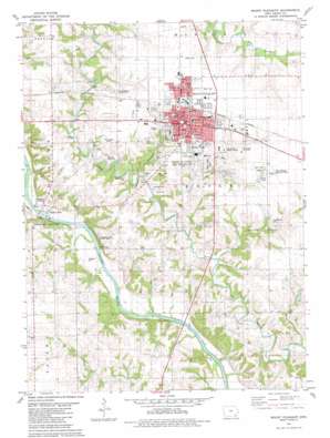
Mount Pleasant Topo Map Iowa
To zoom in, hover over the map of Mount Pleasant
USGS Topo Quad 40091h5 - 1:24,000 scale
| Topo Map Name: | Mount Pleasant |
| USGS Topo Quad ID: | 40091h5 |
| Print Size: | ca. 21 1/4" wide x 27" high |
| Southeast Coordinates: | 40.875° N latitude / 91.5° W longitude |
| Map Center Coordinates: | 40.9375° N latitude / 91.5625° W longitude |
| U.S. State: | IA |
| Filename: | o40091h5.jpg |
| Download Map JPG Image: | Mount Pleasant topo map 1:24,000 scale |
| Map Type: | Topographic |
| Topo Series: | 7.5´ |
| Map Scale: | 1:24,000 |
| Source of Map Images: | United States Geological Survey (USGS) |
| Alternate Map Versions: |
Mount Pleasant IA 1981, updated 1981 Download PDF Buy paper map Mount Pleasant IA 2010 Download PDF Buy paper map Mount Pleasant IA 2013 Download PDF Buy paper map Mount Pleasant IA 2015 Download PDF Buy paper map |
1:24,000 Topo Quads surrounding Mount Pleasant
> Back to 40091e1 at 1:100,000 scale
> Back to 40090a1 at 1:250,000 scale
> Back to U.S. Topo Maps home
Mount Pleasant topo map: Gazetteer
Mount Pleasant: Airports
Medical Heliport elevation 215m 705′Mount Pleasant Municipal Airport elevation 222m 728′
Mount Pleasant: Bridges
Oakland Mills Bridge elevation 173m 567′Mount Pleasant: Lakes
East Lake elevation 211m 692′Mount Pleasant: Parks
Big Creek County Park elevation 198m 649′Camp Harlan Historical Marker elevation 220m 721′
Central Park elevation 223m 731′
Charles Shepherd Historical Marker elevation 216m 708′
Cranes Pond Park elevation 215m 705′
East Lake Park elevation 213m 698′
First College West of the Mississippi Historical Marker elevation 221m 725′
First Courthouse in Iowa Historical Marker elevation 223m 731′
First Home in Mount Pleasant Historical Marker elevation 209m 685′
Harlan Hotel Historical Marker elevation 223m 731′
James A Throop Home Historical Marker elevation 209m 685′
James Harlan State Historical Marker elevation 223m 731′
Little League Ball Park elevation 223m 731′
McMillan Park elevation 221m 725′
Midwest Old Settlers and Threshers Park elevation 218m 715′
Oakland Mills County Park elevation 209m 685′
Pioneer Church School Historical Marker elevation 209m 685′
Saunders Park elevation 209m 685′
Sheaffer Park elevation 220m 721′
Waterworks County Park elevation 173m 567′
Mount Pleasant: Populated Places
Countryside Mobile Home Court elevation 212m 695′Green Valley Mobile Home Court elevation 189m 620′
Mardan Mobile Home Court elevation 215m 705′
Mount Pleasant elevation 218m 715′
Oakland Mills elevation 174m 570′
Westwood elevation 213m 698′
Woodside Mobile Estates elevation 218m 715′
Mount Pleasant: Post Offices
Lahoyt Post Office (historical) elevation 219m 718′Mount Pleasant Post Office elevation 223m 731′
Oakland Mills Post Office (historical) elevation 174m 570′
Rural Post Office (historical) elevation 204m 669′
Mount Pleasant: Streams
Dickey Branch elevation 174m 570′Heather Branch elevation 179m 587′
Saunders Branch elevation 183m 600′
Spearman Branch elevation 181m 593′
Mount Pleasant digital topo map on disk
Buy this Mount Pleasant topo map showing relief, roads, GPS coordinates and other geographical features, as a high-resolution digital map file on DVD:


