La Plata Topo Map Missouri
To zoom in, hover over the map of La Plata
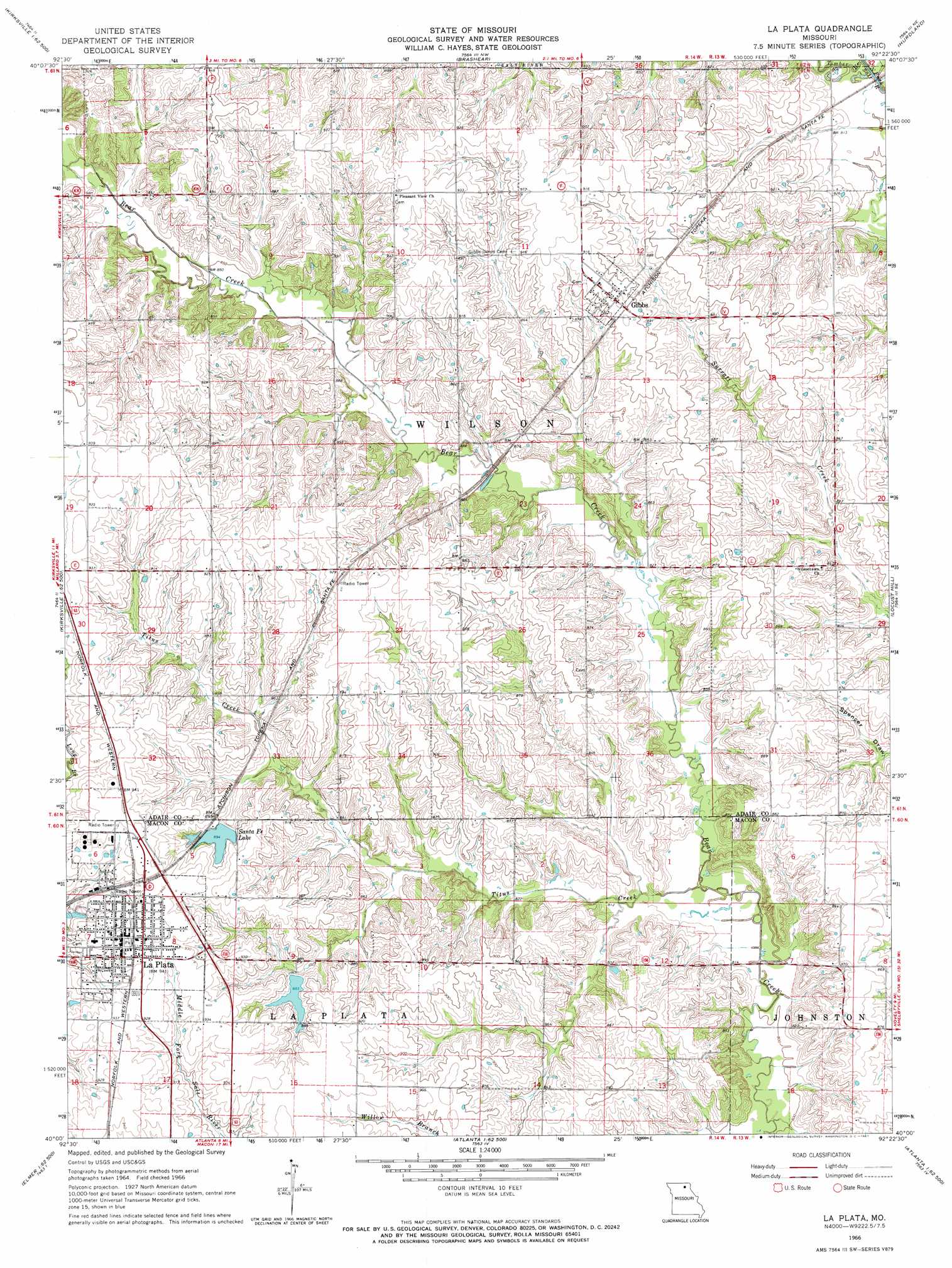
USGS Topo Quad 40092a4 - 1:24,000 scale
| Topo Map Name: | La Plata |
| USGS Topo Quad ID: | 40092a4 |
| Print Size: | ca. 21 1/4" wide x 27" high |
| Southeast Coordinates: | 40° N latitude / 92.375° W longitude |
| Map Center Coordinates: | 40.0625° N latitude / 92.4375° W longitude |
| U.S. State: | MO |
| Filename: | o40092a4.jpg |
| Download Map JPG Image: | La Plata topo map 1:24,000 scale |
| Map Type: | Topographic |
| Topo Series: | 7.5´ |
| Map Scale: | 1:24,000 |
| Source of Map Images: | United States Geological Survey (USGS) |
| Alternate Map Versions: |
La Plata MO 1966, updated 1967 Download PDF Buy paper map La Plata MO 2012 Download PDF Buy paper map La Plata MO 2015 Download PDF Buy paper map |
1:24,000 Topo Quads surrounding La Plata
Connelsville |
Greentop |
Willmathsville |
Bible Grove |
Greensburg |
Novinger |
Kirksville |
Brashear |
Hurdland |
Edina |
Gifford |
Millard |
La Plata |
Locust Hill |
Novelty |
Elmer |
Barnesville |
Atlanta |
Sue City |
Leonard |
New Cambria East |
Bevier North |
Axtell |
Redman |
Hagers Grove |
> Back to 40092a1 at 1:100,000 scale
> Back to 40092a1 at 1:250,000 scale
> Back to U.S. Topo Maps home
La Plata topo map: Gazetteer
La Plata: Dams
Brown Lake Dam elevation 258m 846′Kelley Lake Dam elevation 252m 826′
La Plata City Reservoir East Dam elevation 262m 859′
Laplata Lake Dam elevation 269m 882′
Santa Fe Lake Dam elevation 264m 866′
Thomas Lake Dam elevation 271m 889′
West Lake Dam elevation 270m 885′
Wood Lake Dam elevation 279m 915′
La Plata: Populated Places
Gibbs elevation 278m 912′La Plata elevation 285m 935′
Wilson elevation 260m 853′
La Plata: Reservoirs
Laplata Lake elevation 269m 882′Santa Fe Lake elevation 264m 866′
La Plata: Streams
Timber Branch elevation 241m 790′Titus Creek elevation 244m 800′
La Plata digital topo map on disk
Buy this La Plata topo map showing relief, roads, GPS coordinates and other geographical features, as a high-resolution digital map file on DVD: