Greensburg Topo Map Missouri
To zoom in, hover over the map of Greensburg
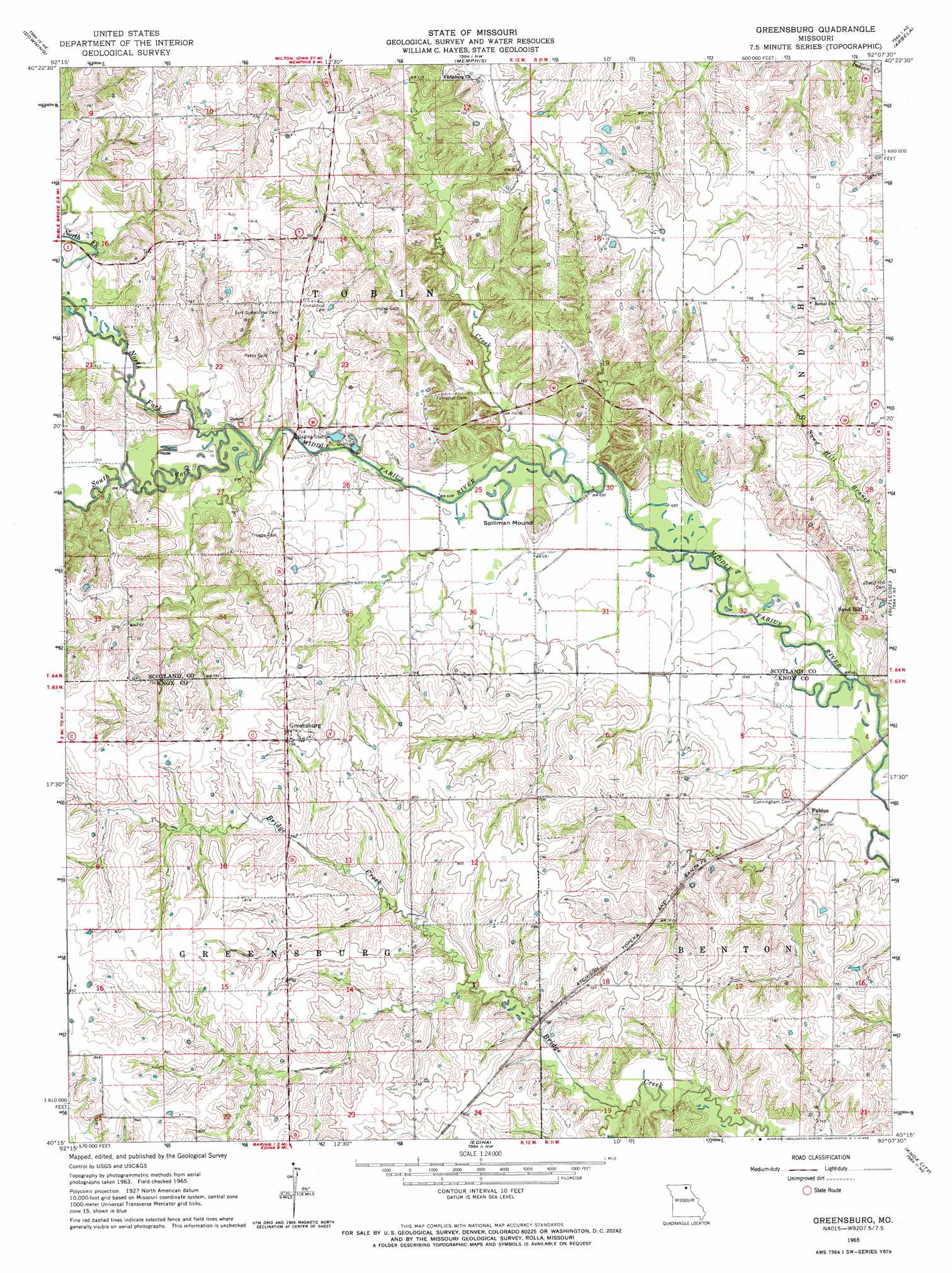
USGS Topo Quad 40092c2 - 1:24,000 scale
| Topo Map Name: | Greensburg |
| USGS Topo Quad ID: | 40092c2 |
| Print Size: | ca. 21 1/4" wide x 27" high |
| Southeast Coordinates: | 40.25° N latitude / 92.125° W longitude |
| Map Center Coordinates: | 40.3125° N latitude / 92.1875° W longitude |
| U.S. State: | MO |
| Filename: | o40092c2.jpg |
| Download Map JPG Image: | Greensburg topo map 1:24,000 scale |
| Map Type: | Topographic |
| Topo Series: | 7.5´ |
| Map Scale: | 1:24,000 |
| Source of Map Images: | United States Geological Survey (USGS) |
| Alternate Map Versions: |
Greensburg MO 1965, updated 1966 Download PDF Buy paper map Greensburg MO 2012 Download PDF Buy paper map Greensburg MO 2015 Download PDF Buy paper map |
1:24,000 Topo Quads surrounding Greensburg
Bunker Hill |
Kilwinning |
Brock |
Azen |
Mount Sterling |
Downing Nw |
Downing |
Memphis |
Arbela |
Wyaconda |
Willmathsville |
Bible Grove |
Greensburg |
Rutledge |
Colony |
Brashear |
Hurdland |
Edina |
Knox City |
Deer Ridge |
La Plata |
Locust Hill |
Novelty |
Edina Se |
La Belle |
> Back to 40092a1 at 1:100,000 scale
> Back to 40092a1 at 1:250,000 scale
> Back to U.S. Topo Maps home
Greensburg topo map: Gazetteer
Greensburg: Airports
Dromey Airport elevation 239m 784′Greensburg: Dams
Sever Lake North Dam elevation 224m 734′Greensburg: Populated Places
Edinburg elevation 248m 813′Fabius elevation 207m 679′
Greensburg elevation 241m 790′
Pleasant Retreat elevation 243m 797′
Sand Hill elevation 240m 787′
Greensburg: Post Offices
Pleasant Ridge Post Office elevation 243m 797′Ruskin Post Office elevation 241m 790′
Greensburg: Reservoirs
Sever Lake North elevation 224m 734′Greensburg: Streams
North Fork Middle Fabius River elevation 210m 688′South Fork Middle Fabius River elevation 210m 688′
Tobin Creek elevation 210m 688′
Greensburg: Summits
Spillman Mound elevation 222m 728′Greensburg digital topo map on disk
Buy this Greensburg topo map showing relief, roads, GPS coordinates and other geographical features, as a high-resolution digital map file on DVD: