Bible Grove Topo Map Missouri
To zoom in, hover over the map of Bible Grove
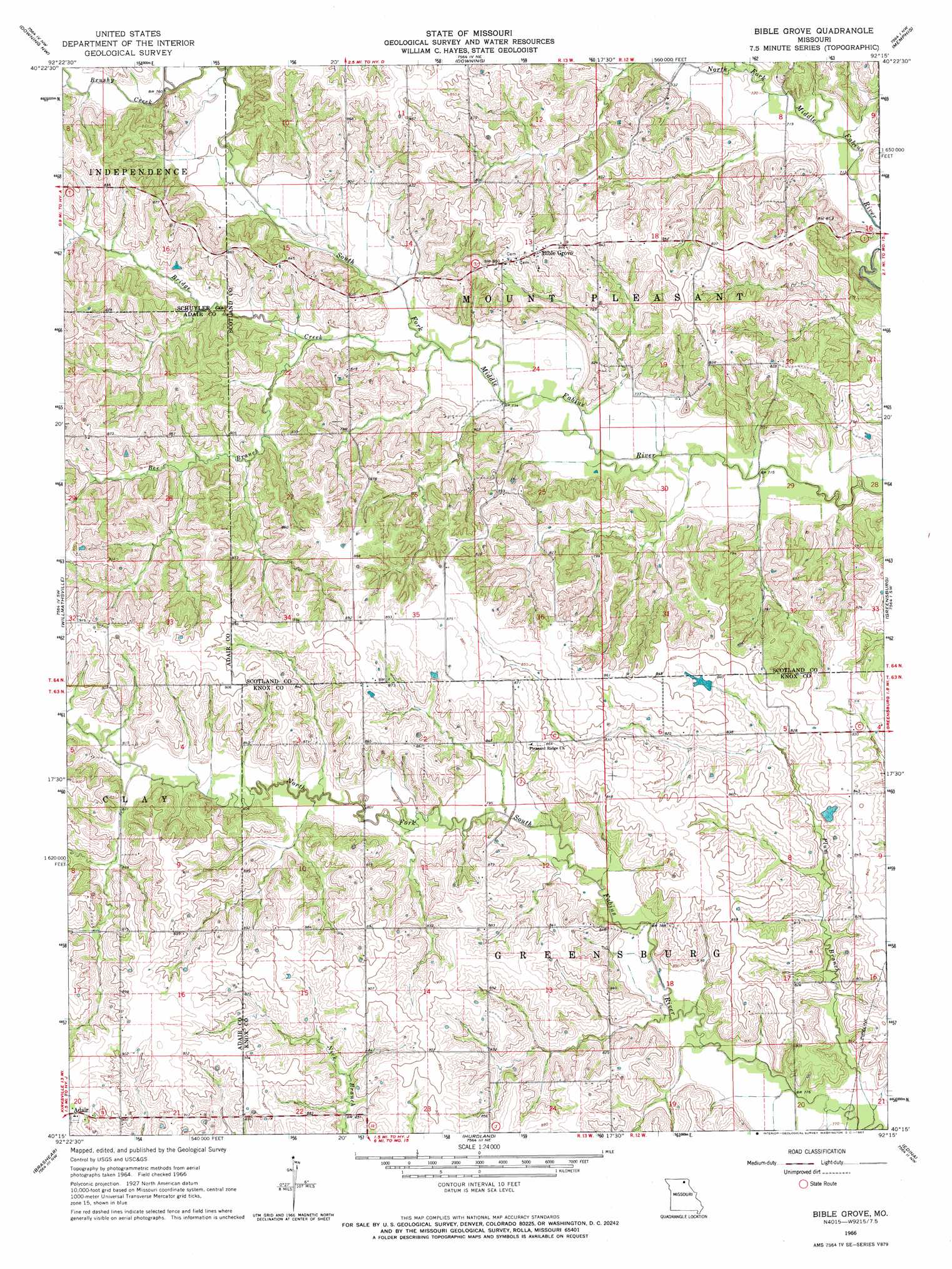
USGS Topo Quad 40092c3 - 1:24,000 scale
| Topo Map Name: | Bible Grove |
| USGS Topo Quad ID: | 40092c3 |
| Print Size: | ca. 21 1/4" wide x 27" high |
| Southeast Coordinates: | 40.25° N latitude / 92.25° W longitude |
| Map Center Coordinates: | 40.3125° N latitude / 92.3125° W longitude |
| U.S. State: | MO |
| Filename: | o40092c3.jpg |
| Download Map JPG Image: | Bible Grove topo map 1:24,000 scale |
| Map Type: | Topographic |
| Topo Series: | 7.5´ |
| Map Scale: | 1:24,000 |
| Source of Map Images: | United States Geological Survey (USGS) |
| Alternate Map Versions: |
Bible Grove MO 1966, updated 1967 Download PDF Buy paper map Bible Grove MO 2012 Download PDF Buy paper map Bible Grove MO 2015 Download PDF Buy paper map |
1:24,000 Topo Quads surrounding Bible Grove
Lancaster |
Bunker Hill |
Kilwinning |
Brock |
Azen |
Queen City |
Downing Nw |
Downing |
Memphis |
Arbela |
Greentop |
Willmathsville |
Bible Grove |
Greensburg |
Rutledge |
Kirksville |
Brashear |
Hurdland |
Edina |
Knox City |
Millard |
La Plata |
Locust Hill |
Novelty |
Edina Se |
> Back to 40092a1 at 1:100,000 scale
> Back to 40092a1 at 1:250,000 scale
> Back to U.S. Topo Maps home
Bible Grove topo map: Gazetteer
Bible Grove: Dams
Gaylen Hill Dam elevation 276m 905′Swearingen Lake Dam elevation 223m 731′
Walter R Tompson Dam elevation 252m 826′
Bible Grove: Populated Places
Bible Grove elevation 261m 856′Hazelville (historical) elevation 264m 866′
Bible Grove: Streams
Bee Branch elevation 226m 741′Bridge Creek elevation 222m 728′
Brushy Creek elevation 229m 751′
Meadow Brook elevation 243m 797′
Plum Branch elevation 232m 761′
Bible Grove digital topo map on disk
Buy this Bible Grove topo map showing relief, roads, GPS coordinates and other geographical features, as a high-resolution digital map file on DVD: