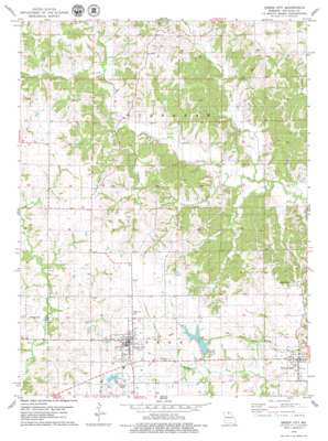
Green City Topo Map Missouri
To zoom in, hover over the map of Green City
USGS Topo Quad 40092c8 - 1:24,000 scale
| Topo Map Name: | Green City |
| USGS Topo Quad ID: | 40092c8 |
| Print Size: | ca. 21 1/4" wide x 27" high |
| Southeast Coordinates: | 40.25° N latitude / 92.875° W longitude |
| Map Center Coordinates: | 40.3125° N latitude / 92.9375° W longitude |
| U.S. State: | MO |
| Filename: | o40092c8.jpg |
| Download Map JPG Image: | Green City topo map 1:24,000 scale |
| Map Type: | Topographic |
| Topo Series: | 7.5´ |
| Map Scale: | 1:24,000 |
| Source of Map Images: | United States Geological Survey (USGS) |
| Alternate Map Versions: |
Green City SW MO 1974, updated 1976 Download PDF Buy paper map Green City MO 2012 Download PDF Buy paper map Green City MO 2015 Download PDF Buy paper map |
1:24,000 Topo Quads surrounding Green City
> Back to 40092a1 at 1:100,000 scale
> Back to 40092a1 at 1:250,000 scale
> Back to U.S. Topo Maps home
Green City topo map: Gazetteer
Green City: Airports
Widmark Airport elevation 311m 1020′Green City: Dams
Green City Section 16 Dam elevation 305m 1000′Green City Section 18 Dam elevation 303m 994′
Green City: Populated Places
Brown (historical) elevation 318m 1043′Green Castle elevation 318m 1043′
Green City elevation 323m 1059′
Pennville elevation 318m 1043′
Green City: Post Offices
Greencastle Post Office elevation 318m 1043′Green City: Reservoirs
Green City Large Reservoir elevation 303m 994′Green City: Streams
Bookout Branch elevation 261m 856′North Spring Creek elevation 256m 839′
Spears Branch elevation 273m 895′
Green City digital topo map on disk
Buy this Green City topo map showing relief, roads, GPS coordinates and other geographical features, as a high-resolution digital map file on DVD:


