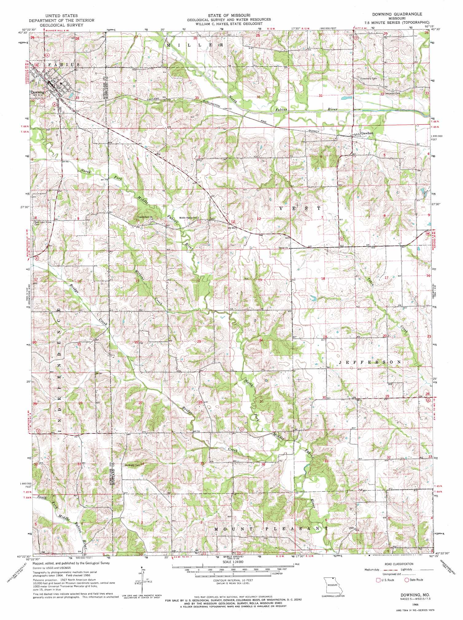
Downing Topo Map Missouri
To zoom in, hover over the map of Downing
USGS Topo Quad 40092d3 - 1:24,000 scale
| Topo Map Name: | Downing |
| USGS Topo Quad ID: | 40092d3 |
| Print Size: | ca. 21 1/4" wide x 27" high |
| Southeast Coordinates: | 40.375° N latitude / 92.25° W longitude |
| Map Center Coordinates: | 40.4375° N latitude / 92.3125° W longitude |
| U.S. State: | MO |
| Filename: | o40092d3.jpg |
| Download Map JPG Image: | Downing topo map 1:24,000 scale |
| Map Type: | Topographic |
| Topo Series: | 7.5´ |
| Map Scale: | 1:24,000 |
| Source of Map Images: | United States Geological Survey (USGS) |
| Alternate Map Versions: |
Downing MO 1966, updated 1967 Download PDF Buy paper map Downing MO 2012 Download PDF Buy paper map Downing MO 2015 Download PDF Buy paper map |
1:24,000 Topo Quads surrounding Downing
West Grove |
Bloomfield South |
Pulaski |
Milton |
Cantril |
Lancaster |
Bunker Hill |
Kilwinning |
Brock |
Azen |
Queen City |
Downing Nw |
Downing |
Memphis |
Arbela |
Greentop |
Willmathsville |
Bible Grove |
Greensburg |
Rutledge |
Kirksville |
Brashear |
Hurdland |
Edina |
Knox City |
> Back to 40092a1 at 1:100,000 scale
> Back to 40092a1 at 1:250,000 scale
> Back to U.S. Topo Maps home
Downing topo map: Gazetteer
Downing: Dams
Jack Blessing Lake Dam elevation 242m 793′Jake Blessing Lake Section 12 Dam elevation 238m 780′
Jake Blessing Lake Section 8 Dam elevation 236m 774′
Rowland-Klopfenstein Lake Dam elevation 260m 853′
Downing: Populated Places
Crawford elevation 223m 731′Downing elevation 266m 872′
Energy elevation 270m 885′
Middle Fabius elevation 245m 803′
Pronax (historical) elevation 258m 846′
Unity elevation 248m 813′
Downing: Post Offices
Unity Post Office elevation 248m 813′Downing: Reservoirs
Rowland-Klopfenstein Lake elevation 260m 853′Downing: Streams
Bridge Creek elevation 222m 728′Wildcat Creek elevation 230m 754′
Downing digital topo map on disk
Buy this Downing topo map showing relief, roads, GPS coordinates and other geographical features, as a high-resolution digital map file on DVD: