Livonia Topo Map Missouri
To zoom in, hover over the map of Livonia
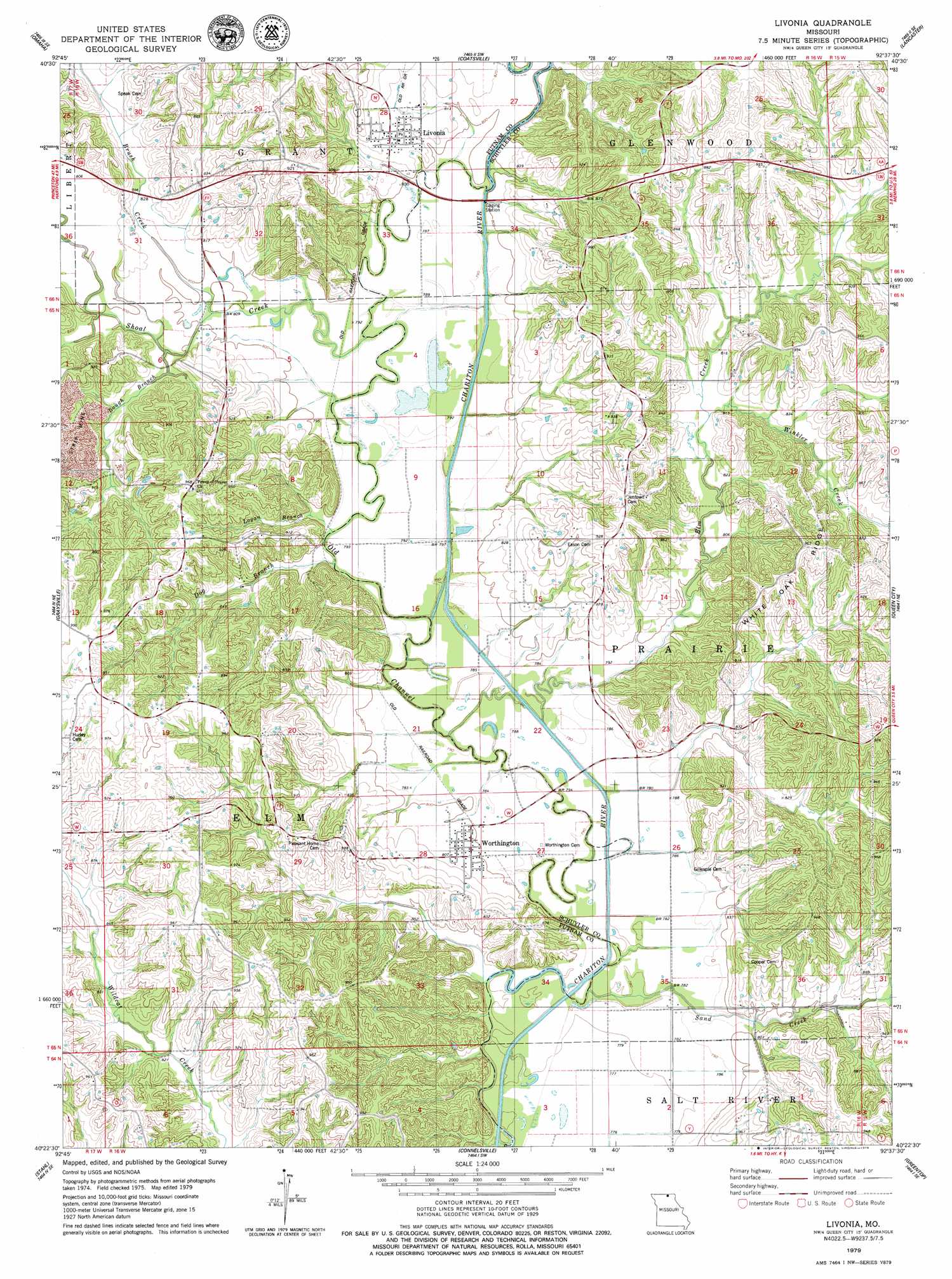
USGS Topo Quad 40092d6 - 1:24,000 scale
| Topo Map Name: | Livonia |
| USGS Topo Quad ID: | 40092d6 |
| Print Size: | ca. 21 1/4" wide x 27" high |
| Southeast Coordinates: | 40.375° N latitude / 92.625° W longitude |
| Map Center Coordinates: | 40.4375° N latitude / 92.6875° W longitude |
| U.S. State: | MO |
| Filename: | o40092d6.jpg |
| Download Map JPG Image: | Livonia topo map 1:24,000 scale |
| Map Type: | Topographic |
| Topo Series: | 7.5´ |
| Map Scale: | 1:24,000 |
| Source of Map Images: | United States Geological Survey (USGS) |
| Alternate Map Versions: |
Queen City NW MO 1974, updated 1976 Download PDF Buy paper map Livonia MO 1979, updated 1979 Download PDF Buy paper map Livonia MO 2012 Download PDF Buy paper map Livonia MO 2015 Download PDF Buy paper map |
1:24,000 Topo Quads surrounding Livonia
Centerville West |
Centerville East |
Moulton |
West Grove |
Bloomfield South |
Mendota |
Omaha |
Coatsville |
Lancaster |
Bunker Hill |
Unionville East |
Graysville |
Livonia |
Queen City |
Downing Nw |
Green City |
Stahl |
Connelsville |
Greentop |
Willmathsville |
Mystic |
Pure Air |
Novinger |
Kirksville |
Brashear |
> Back to 40092a1 at 1:100,000 scale
> Back to 40092a1 at 1:250,000 scale
> Back to U.S. Topo Maps home
Livonia topo map: Gazetteer
Livonia: Lakes
Tan Lake (historical) elevation 240m 787′Livonia: Populated Places
Lickskillet elevation 241m 790′Livonia elevation 254m 833′
Worthington elevation 247m 810′
Livonia: Ridges
White Oak Ridge elevation 291m 954′Livonia: Streams
Baugh Branch elevation 244m 800′Brush Creek elevation 243m 797′
Dog Branch elevation 240m 787′
Elm Creek elevation 235m 770′
Logan Branch elevation 240m 787′
Sand Creek elevation 238m 780′
Shoal Creek elevation 241m 790′
Winkler Creek elevation 248m 813′
Livonia digital topo map on disk
Buy this Livonia topo map showing relief, roads, GPS coordinates and other geographical features, as a high-resolution digital map file on DVD: