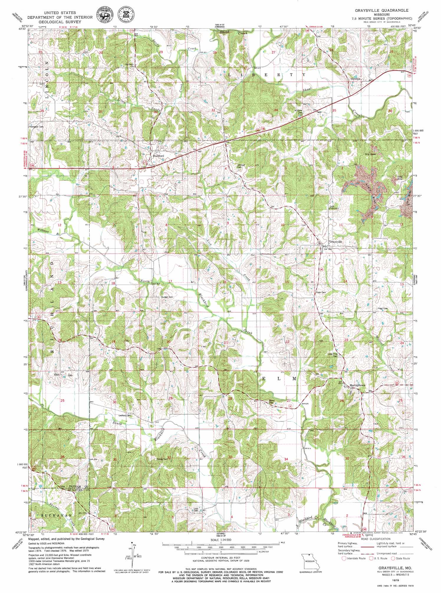
Graysville Topo Map Missouri
To zoom in, hover over the map of Graysville
USGS Topo Quad 40092d7 - 1:24,000 scale
| Topo Map Name: | Graysville |
| USGS Topo Quad ID: | 40092d7 |
| Print Size: | ca. 21 1/4" wide x 27" high |
| Southeast Coordinates: | 40.375° N latitude / 92.75° W longitude |
| Map Center Coordinates: | 40.4375° N latitude / 92.8125° W longitude |
| U.S. State: | MO |
| Filename: | o40092d7.jpg |
| Download Map JPG Image: | Graysville topo map 1:24,000 scale |
| Map Type: | Topographic |
| Topo Series: | 7.5´ |
| Map Scale: | 1:24,000 |
| Source of Map Images: | United States Geological Survey (USGS) |
| Alternate Map Versions: |
Green City NE MO 1974, updated 1976 Download PDF Buy paper map Graysville MO 1979, updated 1979 Download PDF Buy paper map Graysville MO 2012 Download PDF Buy paper map Graysville MO 2015 Download PDF Buy paper map |
1:24,000 Topo Quads surrounding Graysville
Seymour East |
Centerville West |
Centerville East |
Moulton |
West Grove |
Lake Thunderhead |
Mendota |
Omaha |
Coatsville |
Lancaster |
Unionville West |
Unionville East |
Graysville |
Livonia |
Queen City |
Pollock |
Green City |
Stahl |
Connelsville |
Greentop |
Milan East |
Mystic |
Pure Air |
Novinger |
Kirksville |
> Back to 40092a1 at 1:100,000 scale
> Back to 40092a1 at 1:250,000 scale
> Back to U.S. Topo Maps home
Graysville topo map: Gazetteer
Graysville: Populated Places
Elko elevation 283m 928′Glendale elevation 250m 820′
Graysville elevation 304m 997′
Hartford elevation 300m 984′
Martinstown elevation 300m 984′
Graysville: Streams
Lick Creek elevation 250m 820′Little Sandy Creek elevation 253m 830′
North Blackbird Creek elevation 244m 800′
Sandy Creek elevation 253m 830′
South Blackbird Creek elevation 244m 800′
Williams Branch elevation 256m 839′
Graysville digital topo map on disk
Buy this Graysville topo map showing relief, roads, GPS coordinates and other geographical features, as a high-resolution digital map file on DVD: