Libertyville Topo Map Iowa
To zoom in, hover over the map of Libertyville
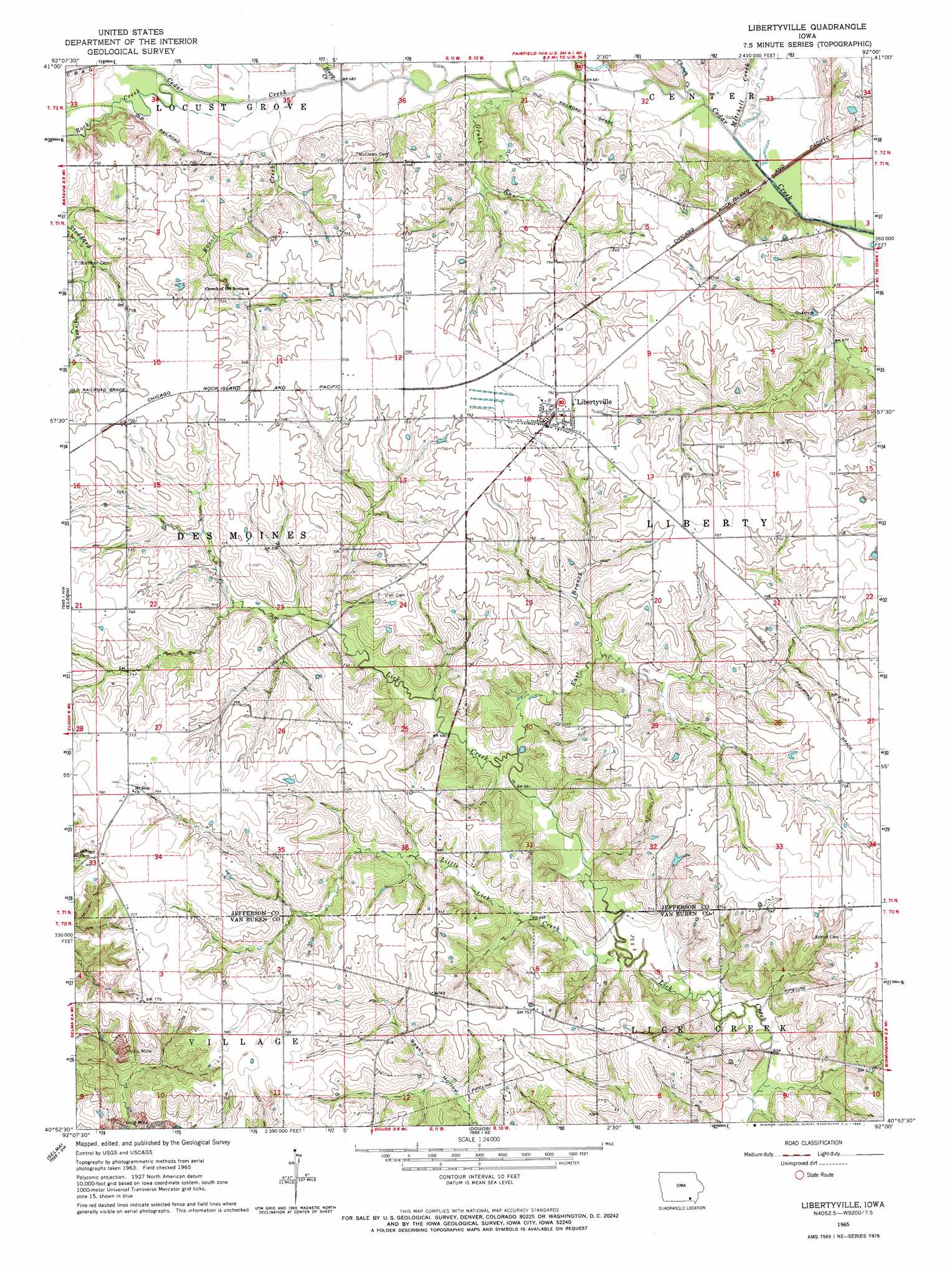
USGS Topo Quad 40092h1 - 1:24,000 scale
| Topo Map Name: | Libertyville |
| USGS Topo Quad ID: | 40092h1 |
| Print Size: | ca. 21 1/4" wide x 27" high |
| Southeast Coordinates: | 40.875° N latitude / 92° W longitude |
| Map Center Coordinates: | 40.9375° N latitude / 92.0625° W longitude |
| U.S. State: | IA |
| Filename: | o40092h1.jpg |
| Download Map JPG Image: | Libertyville topo map 1:24,000 scale |
| Map Type: | Topographic |
| Topo Series: | 7.5´ |
| Map Scale: | 1:24,000 |
| Source of Map Images: | United States Geological Survey (USGS) |
| Alternate Map Versions: |
Libertyville IA 1965, updated 1966 Download PDF Buy paper map Libertyville IA 2010 Download PDF Buy paper map Libertyville IA 2013 Download PDF Buy paper map Libertyville IA 2015 Download PDF Buy paper map |
1:24,000 Topo Quads surrounding Libertyville
Hedrick |
Pekin |
Ollie |
Richland |
Brighton |
Farson |
Abingdon |
Brookville |
Fairfield North |
Salina |
Agency |
Eldon |
Libertyville |
Fairfield South |
Lockridge West |
Floris |
Selma |
Douds |
Mount Zion |
Stockport |
Pulaski |
Milton |
Cantril |
Keosauqua |
Bonaparte |
> Back to 40092e1 at 1:100,000 scale
> Back to 40092a1 at 1:250,000 scale
> Back to U.S. Topo Maps home
Libertyville topo map: Gazetteer
Libertyville: Parks
Cedar Creek Timber Recreation Area elevation 220m 721′Dragoon Trail Historical Marker elevation 231m 757′
Libertyville: Populated Places
Ellmaker elevation 226m 741′Libertyville elevation 231m 757′
Whitefield (historical) elevation 206m 675′
Libertyville: Post Offices
Krum Post Office (historical) elevation 227m 744′Libertyville Post Office elevation 232m 761′
Whitfield Post Office (historical) elevation 227m 744′
Libertyville: Streams
Bonell Creek elevation 203m 666′Church Creek elevation 201m 659′
East Branch Lick Creek elevation 201m 659′
Grubb Run elevation 201m 659′
Hupp Creek elevation 202m 662′
Little Lick Creek elevation 197m 646′
Mitchell Creek elevation 201m 659′
Rock Creek elevation 204m 669′
Libertyville digital topo map on disk
Buy this Libertyville topo map showing relief, roads, GPS coordinates and other geographical features, as a high-resolution digital map file on DVD: