Lindley Topo Map Missouri
To zoom in, hover over the map of Lindley
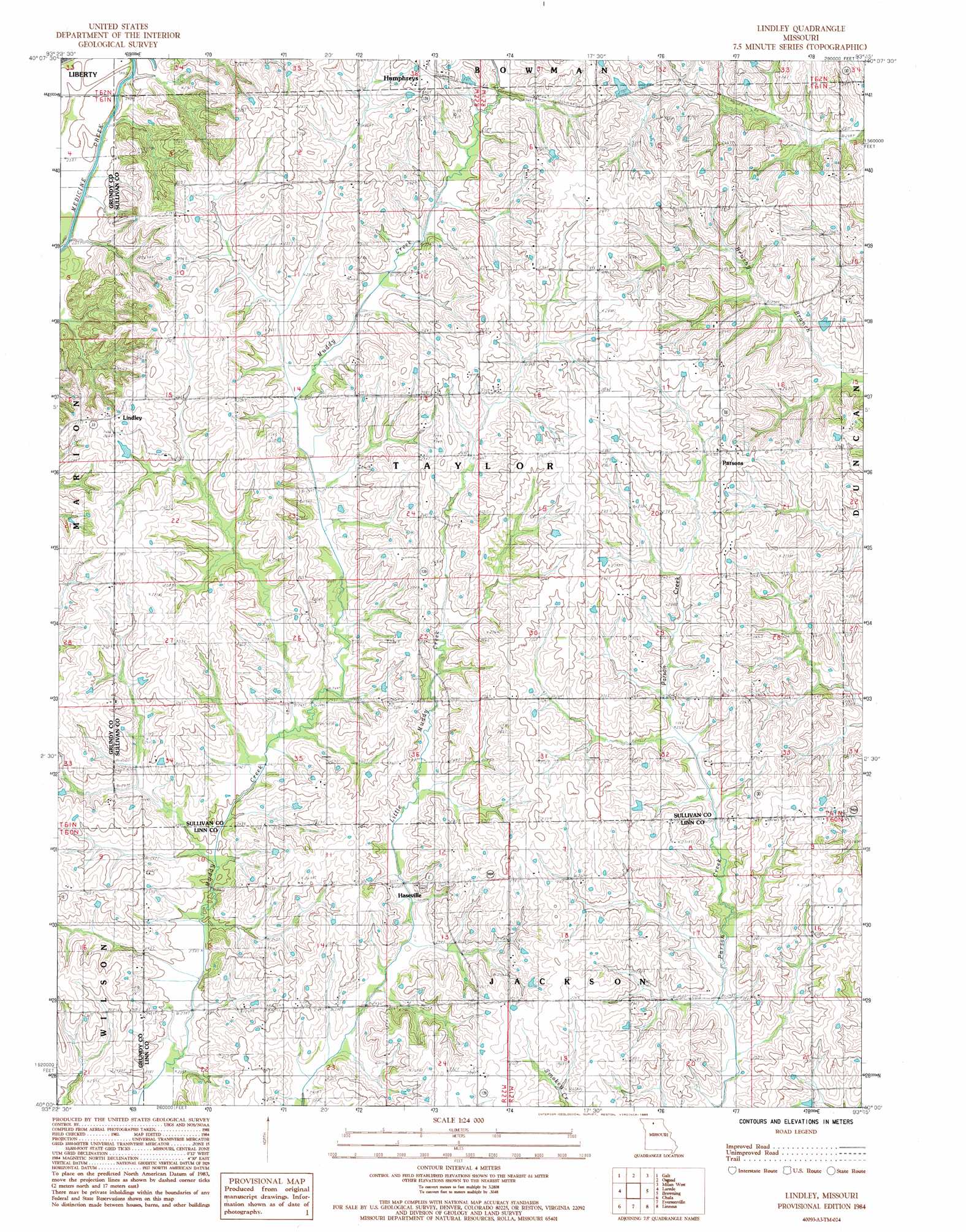
USGS Topo Quad 40093a3 - 1:24,000 scale
| Topo Map Name: | Lindley |
| USGS Topo Quad ID: | 40093a3 |
| Print Size: | ca. 21 1/4" wide x 27" high |
| Southeast Coordinates: | 40° N latitude / 93.25° W longitude |
| Map Center Coordinates: | 40.0625° N latitude / 93.3125° W longitude |
| U.S. State: | MO |
| Filename: | o40093a3.jpg |
| Download Map JPG Image: | Lindley topo map 1:24,000 scale |
| Map Type: | Topographic |
| Topo Series: | 7.5´ |
| Map Scale: | 1:24,000 |
| Source of Map Images: | United States Geological Survey (USGS) |
| Alternate Map Versions: |
Lindley MO 1984, updated 1985 Download PDF Buy paper map Lindley MO 2012 Download PDF Buy paper map Lindley MO 2014 Download PDF Buy paper map |
1:24,000 Topo Quads surrounding Lindley
Mill Grove |
Half Rock |
Harris |
Pollock Sw |
Pollock |
Spickard |
Galt |
Osgood |
Milan West |
Milan East |
Trenton East |
Laredo |
Lindley |
Browning |
Milan Se |
Farmersville |
Chula |
Eversonville |
Linneus |
Shelby |
Chillicothe |
Wheeling |
Meadville |
Laclede |
Brookfield |
> Back to 40093a1 at 1:100,000 scale
> Back to 40092a1 at 1:250,000 scale
> Back to U.S. Topo Maps home
Lindley topo map: Gazetteer
Lindley: Dams
Baker Lake Dam elevation 277m 908′Strong and Stewart Lake Dam elevation 273m 895′
Lindley: Populated Places
Haseville elevation 248m 813′Lindley elevation 274m 898′
Parsons elevation 280m 918′
Lindley: Reservoirs
Baker Lake elevation 277m 908′Strong and Stewart Lake elevation 273m 895′
Lindley digital topo map on disk
Buy this Lindley topo map showing relief, roads, GPS coordinates and other geographical features, as a high-resolution digital map file on DVD: